- Elevation
- 426 m
- above sea level
- Local time
- UTC+01:00
- Europe/Rome · UTC+01:00
- Airports
- CAG Cagliari Elmas Airport14 km
- AHO Alghero-Fertilia Airport166 km
About Su Concali
Su Concali is a mountain. Location: Uta, Province of Cagliari. Elevation: 426 m. The best months to visit are May–October. The nearest airport is Cagliari Elmas Airport (14 km). Nearby sights include Cuccureddus and Mont'Arbu.
Climate of Su Concali
Best months for sightseeingBest months for sightseeing: May–October.
This month · November
Outside the best season
Day 16° · Night 7° · Rain 77 mm
- Hottest month
- August (day 29°)
- Coldest month
- January (night 4°)
- Wettest month
- November (77 mm)
- Driest month
- July (5 mm)
Bars: average monthly low and high temperature. Below: precipitation. Monthly averages for 1970–2000 at about 18 km resolution, adjusted for elevation. Highlighted months are mild and relatively dry. Source: WorldClim 2.1 (CC BY 4.0).
Show values as a table
| Month | Jan | Feb | Mar | Apr | May | Jun | Jul | Aug | Sep | Oct | Nov | Dec |
|---|---|---|---|---|---|---|---|---|---|---|---|---|
| Average high (°C) | 11° | 12° | 14° | 16° | 21° | 25° | 29° | 29° | 25° | 21° | 16° | 12° |
| Average low (°C) | 4° | 4° | 5° | 7° | 11° | 14° | 17° | 18° | 15° | 12° | 7° | 5° |
| Precipitation (mm) | 54 | 62 | 54 | 51 | 30 | 16 | 5 | 10 | 38 | 63 | 77 | 63 |
Other places to visit in this season: May June July August September October
How to get to Su Concali
The nearest airport is Cagliari Elmas Airport (CAG), 14 km to the east as the crow flies.
Airports
- Cagliari Elmas Airport (CAG) Cagliari 14 kmeast
- Alghero-Fertilia Airport (AHO) Alghero 166 kmnorth
- Olbia Costa Smeralda Airport (OLB) Olbia (SS) 195 kmnorth
Straight-line distances; road distances are longer. Airport data: OurAirports.
Day trips from Su Concali
Within 100 km: 5 historic and cultural sites, 69 natural sites, 100 lakes, rivers and coasts.
0–25 km27 places
- Poetto Beach 22 kmE
- Monte Pauliara Mountain 10 kmSE
- Spiaggia di Calamosca Beach 22 kmE
- Monte is Caravius Mountain 10 kmSW
25–60 km110 places
- Spiaggia di Funtanazza Beach 59 kmNW
- Spiaggia della Marina di Arbus Beach 57 kmNW
- Spiaggia di Cala Domestica Beach 49 kmW
- Portu Cauli Beach 44 kmW
60–100 km37 places
- Abarossa Dog Beach Beach 75 kmNW
- Capo San Marco Natural site 83 kmNW
- Spiaggia di Torre dei Corsari Beach 66 kmNW
- Monte Tusorgia Mountain 97 kmN
Straight-line distances.
Nearest towns and villages
-
Capoterra Municipality, Province of Cagliari6.9 km SE
-
Capoterra Town, Capoterra7 km SE
-
 Macchiareddu Village, Uta6.9 km E
-
Sa Perda Su Gattu Village, Capoterra7.4 km SE
-
 Poggio dei Pini Village, Capoterra9 km SE
-
Uta Town, Uta10 km NE
Nearby attractions & nature
Everything nearby-
Cuccureddus Mountain, Uta5.1 km E
-
Mont'Arbu Mountain, Capoterra5.6 km SE
-
Monte Santa Barbara Mountain, Capoterra7.9 km SE
-
Monte Turruneri Mountain, Capoterra8.8 km S
-
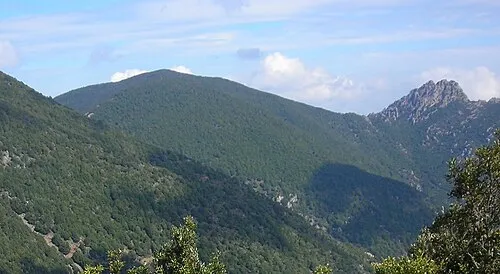 Monte is Caravius Mountain, Nuxis9.9 km SW
-
Monte is Pauceris Mannu Mountain, Capoterra9.8 km S
-
Monte Pauliara Mountain, Capoterra10 km SE
-
Punta Tiriaxeddu Mountain, Capoterra12 km S
Sources & licences
Data last updated: · 2 independent sources