
- Population
- 252
- 252
- Elevation
- 7 m
- above sea level
- Local time
- UTC+01:00
- Europe/Rome · UTC+01:00
- Airports
- OLB Olbia Costa Smeralda Airport55 km
- AHO Alghero-Fertilia Airport127 km
About Sos Alinos
Sos Alinos is a village. Location: Orosei, Province of Nuoro. Population: 252. Elevation: 7 m. The best months to visit are May–June, September–October. The nearest airport is Olbia Costa Smeralda Airport (55 km). Nearby sights include Spiaggia di Cala Liberotto and Marina di Orosei.
Photos of Sos Alinos
-

Earth Science and Remote Sensing Unit , Lyndon B. Johnson Space Center · Public domain -

Wikimedia Commons · CC BY-SA 4.0 -

Wikimedia Commons · CC BY-SA 4.0 -
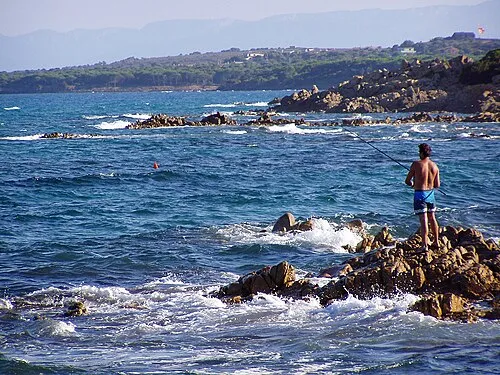
Spiaggia di Cala Liberotto Marek Ślusarczyk · CC BY 3.0


Climate of Sos Alinos
Best months for sightseeingBest months for sightseeing: May–June, September–October.
This month · November
Outside the best season
Day 17° · Night 11° · Rain 56 mm
- Hottest month
- August (day 30°)
- Coldest month
- January (night 8°)
- Wettest month
- December (70 mm)
- Driest month
- July (5 mm)
Bars: average monthly low and high temperature. Below: precipitation. Monthly averages for 1970–2000 at about 18 km resolution, adjusted for elevation. Highlighted months are mild and relatively dry. Source: WorldClim 2.1 (CC BY 4.0).
Show values as a table
| Month | Jan | Feb | Mar | Apr | May | Jun | Jul | Aug | Sep | Oct | Nov | Dec |
|---|---|---|---|---|---|---|---|---|---|---|---|---|
| Average high (°C) | 14° | 14° | 15° | 18° | 22° | 26° | 30° | 30° | 27° | 22° | 17° | 14° |
| Average low (°C) | 8° | 8° | 9° | 10° | 14° | 18° | 21° | 21° | 19° | 15° | 11° | 9° |
| Precipitation (mm) | 41 | 46 | 43 | 37 | 27 | 16 | 5 | 14 | 34 | 56 | 56 | 70 |
Other places to visit in this season: May June September October
How to get to Sos Alinos
The nearest airport is Olbia Costa Smeralda Airport (OLB), 55 km to the north as the crow flies.
Airports
- Olbia Costa Smeralda Airport (OLB) Olbia (SS) 55 kmnorth
- Alghero-Fertilia Airport (AHO) Alghero 127 kmwest
- Figari Sud-Corse Airport (FSC) Figari 131 kmnorthwest
Straight-line distances; road distances are longer. Airport data: OurAirports.
Day trips from Sos Alinos
Within 100 km: 1 historic or cultural site, 61 natural sites, 120 lakes, rivers and coasts.
0–25 km16 places
- Spiaggia di Su Barone Beach 12 kmSW
- Marina di Orosei Beach 8 kmSW
- Cala Fuili Beach 23 kmSW
- Spiaggia di Ziu Martine Beach 23 kmSW
25–60 km43 places
- Spiaggia di Salina Manna Beach 45 kmN
- Spiaggia di Punta Est Beach 45 kmN
- Spiaggia dell'Isola Piana Beach 51 kmN
- Spiaggia di Porto Istana Beach 52 kmN
60–100 km123 places
- Monte Orria Mountain 91 kmNW
- Monte Istolargiu Mountain 96 kmNW
- Monte Eri Mountain 99 kmNW
- Monte Cuccaro Mountain 92 kmNW
Straight-line distances.
Nearby attractions & nature
Everything nearby-
Spiaggia di Cala Liberotto Beach, Orosei2.4 km S
-
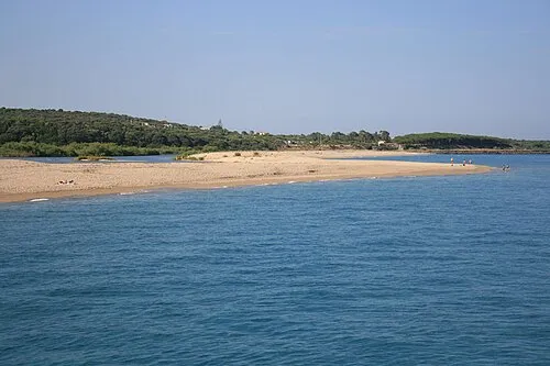 Marina di Orosei Beach, Orosei8.2 km SW
-
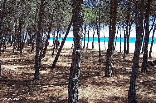 Spiaggia di Su Barone Beach, Orosei12 km SW
-
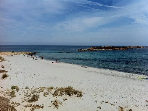 Spiaggia di Capo Comino Beach, Siniscola12 km N
-
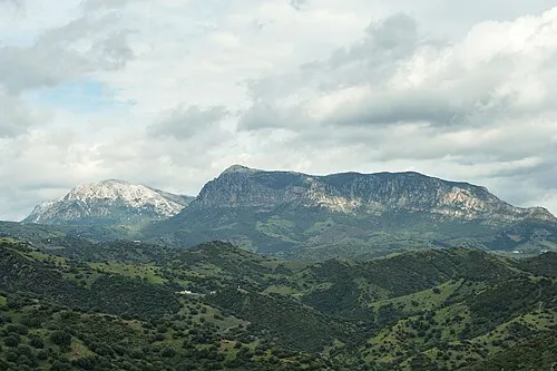 Monte Albo Mountain, Lodè19 km NW
-
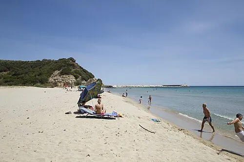 Cala Osalla di Dorgali Beach, Dorgali14 km SW
Sources & licences
Data last updated: · 2 independent sources