Alà dei Sardi
Located in Province of Sassari, Sardinia Coordinates: 40°39′00″ N 9°19′40″ E
- Population
- 1,856
- 1.9K
- Elevation
- 663 m
- above sea level
- Local time
- UTC+01:00
- Europe/Rome · UTC+01:00
- Places inside
- 1
- listed under Alà dei Sardi
- Airports
- OLB Olbia Costa Smeralda Airport32 km
- AHO Alghero-Fertilia Airport88 km
About Alà dei Sardi
Alà dei Sardi is a municipality. Location: Province of Sassari, Sardinia. Population: 1,856. Elevation: 663 m. The best months to visit are June–September. The nearest airport is Olbia Costa Smeralda Airport (32 km). Nearby sights include Monte sa Mesa and Monte Olia.
Photos of Alà dei Sardi
-
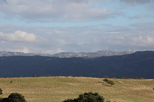
Monte sa Mesa Gianni Careddu · CC BY-SA 4.0

Climate of Alà dei Sardi
Best months for sightseeingBest months for sightseeing: June–September.
This month · November
A wet month
Day 13° · Night 8° · Rain 109 mm
- Hottest month
- July (day 27°)
- Coldest month
- January (night 4°)
- Wettest month
- December (114 mm)
- Driest month
- July (10 mm)
Bars: average monthly low and high temperature. Below: precipitation. Monthly averages for 1970–2000 at about 18 km resolution, adjusted for elevation. Highlighted months are mild and relatively dry. Source: WorldClim 2.1 (CC BY 4.0).
Show values as a table
| Month | Jan | Feb | Mar | Apr | May | Jun | Jul | Aug | Sep | Oct | Nov | Dec |
|---|---|---|---|---|---|---|---|---|---|---|---|---|
| Average high (°C) | 9° | 9° | 11° | 14° | 18° | 23° | 27° | 26° | 23° | 18° | 13° | 10° |
| Average low (°C) | 4° | 4° | 5° | 7° | 11° | 14° | 17° | 17° | 15° | 12° | 8° | 5° |
| Precipitation (mm) | 84 | 88 | 77 | 66 | 47 | 31 | 10 | 19 | 41 | 86 | 109 | 114 |
Other places to visit in this season: June July August September
How to get to Alà dei Sardi
The nearest airport is Olbia Costa Smeralda Airport (OLB), 32 km to the northeast as the crow flies. The nearest large city is Nice, 379 km to the northwest.
Airports
- Olbia Costa Smeralda Airport (OLB) Olbia (SS) 32 kmnortheast
- Alghero-Fertilia Airport (AHO) Alghero 88 kmwest
- Figari Sud-Corse Airport (FSC) Figari 97 kmnorth
Nearby large cities
- Nice Population: 342.7K 379 kmnorthwest
- Toulon Population: 168.7K 394 kmnorthwest
Straight-line distances; road distances are longer. Airport data: OurAirports.
Day trips from Alà dei Sardi
Within 100 km: 19 historic and cultural sites, 182 natural sites, 159 lakes, rivers and coasts.
0–25 km4 places
- Punta Rosello Mountain 15 kmSE
- Monte Olia Mountain 11 kmN
- Monte sa Mesa Mountain 8 kmW
- Punta Comoretta Mountain 21 kmS
25–60 km115 places
- Cala Bitta Beach 54 kmN
- Spiaggia di Cala Luna Beach 54 kmSE
- Playa del príncipe Beach 53 kmN
- Spiaggia del Grande Pevero Beach 55 kmN
60–100 km241 places
- Plage de Roccapina Beach 100 kmN
- Plage de Figari Beach 94 kmN
- Plage de Pargan Beach 85 kmN
- Plage de Santa Giulia Beach 98 kmN
Straight-line distances.
Places in Alà dei Sardi
1 placeBar: population relative to the most populous place in this list.
Nearby attractions & nature
Everything nearby-
Monte sa Mesa Mountain, Buddusò8 km W
-
Monte Olia Mountain, Monti11 km N
-
Punta Rosello Mountain, Onanì15 km SE
-
Punta Comoretta Mountain, Bitti21 km S
Sources & licences
Data last updated: