- Population
- 15
- 15
- Elevation
- 1,316 m
- above sea level
- Local time
- UTC+01:00
- Europe/Rome · UTC+01:00
- Airports
- BZO Bolzano Airport11 km
- INN Innsbruck Airport94 km
About Platten
Platten is a village. Location: Deutschnofen, South Tyrol. Population: 15. Elevation: 1,316 m. The best months to visit are June–August. The nearest airport is Bolzano Airport (11 km). Nearby sights include Monte Soprachiesa and Monte Largo.
Climate of Platten
Best months for sightseeingBest months for sightseeing: June–August.
This month · November
A cold month
Day 5° · Night -2° · Rain 46 mm
- Hottest month
- July (day 21°)
- Coldest month
- January (night -5°)
- Wettest month
- July (84 mm)
- Driest month
- February (24 mm)
Bars: average monthly low and high temperature. Below: precipitation. Monthly averages for 1970–2000 at about 18 km resolution, adjusted for elevation. Highlighted months are mild and relatively dry. Source: WorldClim 2.1 (CC BY 4.0).
Show values as a table
| Month | Jan | Feb | Mar | Apr | May | Jun | Jul | Aug | Sep | Oct | Nov | Dec |
|---|---|---|---|---|---|---|---|---|---|---|---|---|
| Average high (°C) | 1° | 3° | 6° | 10° | 15° | 18° | 21° | 21° | 17° | 11° | 5° | 2° |
| Average low (°C) | -5° | -5° | -3° | 0° | 5° | 9° | 11° | 11° | 8° | 3° | -2° | -5° |
| Precipitation (mm) | 26 | 24 | 30 | 42 | 64 | 82 | 84 | 81 | 67 | 68 | 46 | 29 |
How to get to Platten
The nearest airport is Bolzano Airport (BZO), 11 km to the northwest as the crow flies. For international flights: Innsbruck Airport (INN) (94 km). The nearest large city is Innsbruck, 94 km to the north.
Airports
- Bolzano Airport (BZO) Bolzano (BZ) 11 kmnorthwest
- Innsbruck Airport (INN) Innsbruck 94 kmnorth
- Treviso Airport (TSF) Treviso (TV) 103 kmsoutheast
Nearby large cities
- Innsbruck Population: 132.5K 94 kmnorth
- Munich Population: 1.5M 191 kmnorth
- Salzburg Population: 157.2K 195 kmnortheast
- Klagenfurt Population: 100.3K 219 kmeast
- Augsburg Population: 301.1K 221 kmnorth
Straight-line distances; road distances are longer. Airport data: OurAirports.
Day trips from Platten
Within 100 km: 40 historic and cultural sites, 3,007 natural sites, 132 lakes, rivers and coasts.
0–25 km148 places
- Croda Nera Mountain 25 kmE
- Monte Pez Mountain 14 kmNE
- Castel Mountain 22 kmS
- Catena di Lagorai Mountain 22 kmSE
25–60 km798 places
- Piz Gralba Mountain 28 kmNE
- Piz Miara Mountain 28 kmNE
- Vorderer Seelenkogl Mountain 56 kmNW
- Guardia Alta Mountain 59 kmNW
60–100 km2,233 places
- Spadalone Mountain 65 kmSW
- Dosso Rotondo Mountain 79 kmSW
- Lai da Juata Lake 89 kmW
- Lai da Costainas Lake 78 kmW
Straight-line distances.
Nearby attractions & nature
Everything nearby-
Monte Soprachiesa Mountain, Deutschnofen2.6 km W
-
Monte Largo Mountain, Deutschnofen7 km W
-
Corno d'Ega Mountain, Deutschnofen9 km SE
-
Monte Francesco Mountain, Deutschnofen8.5 km W
-
Cima del Forcellone Mountain, Deutschnofen8.9 km SE
-
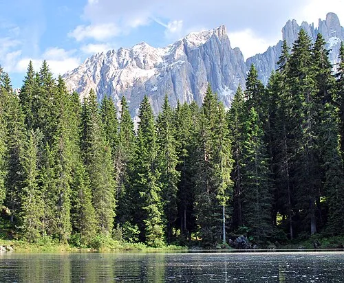 Latemar Spitze Mountain, Predazzo9.7 km SE
Other cities and towns in Deutschnofen
-
 Pietralba Village, Deutschnofen4.7 km SW
-
Stadtl Village, Deutschnofen4.2 km SE
-
 Obereggen Village, Deutschnofen6.1 km SE
-
 Monte San Pietro Village, Deutschnofen6.1 km SW
-
San Floriano Village, Deutschnofen5.6 km SE
-
Novale Village, Deutschnofen4.4 km SE
Sources & licences
Data last updated: · 2 independent sources