Pfitsch
Located in South Tyrol, Trentino-Alto Adige Coordinates: 46°57′00″ N 11°33′00″ E
- Population
- 3,093
- 3.1K
- Elevation
- 1,428 m
- above sea level
- Local time
- UTC+01:00
- Europe/Rome · UTC+01:00
- Places inside
- 31
- listed under Pfitsch
- Airports
- INN Innsbruck Airport38 km
- BZO Bolzano Airport57 km
About Pfitsch
Pfitsch is a municipality. Location: South Tyrol, Trentino-Alto Adige. Population: 3,093. Elevation: 1,428 m. The best months to visit are July–August. The nearest airport is Innsbruck Airport (38 km). Nearby sights include Val di Vizze and Cima della Stanga.
Photos of Pfitsch
-

Vennatal Simon Legner · CC BY-SA 4.0 -
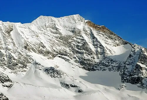
Croda Alta Svíčková · CC BY-SA 3.0 -
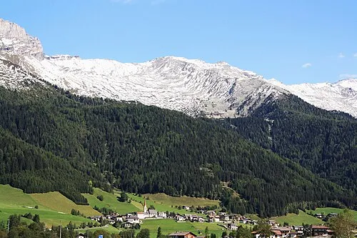
Wildseespitze Piergiuliano Chesi · CC BY 3.0 -
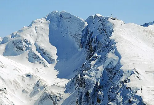
Hühnerspiel Svíčková · CC BY-SA 3.0 -
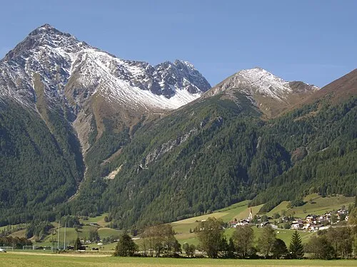
Rollspitze Piergiuliano Chesi · CC BY 3.0


Climate of Pfitsch
Best months for sightseeingBest months for sightseeing: July–August.
This month · November
A cold month
Day 5° · Night -1° · Rain 78 mm
- Hottest month
- July (day 19°)
- Coldest month
- February (night -5°)
- Wettest month
- July (133 mm)
- Driest month
- February (49 mm)
Bars: average monthly low and high temperature. Below: precipitation. Monthly averages for 1970–2000 at about 18 km resolution, adjusted for elevation. Highlighted months are mild and relatively dry. Source: WorldClim 2.1 (CC BY 4.0).
Show values as a table
| Month | Jan | Feb | Mar | Apr | May | Jun | Jul | Aug | Sep | Oct | Nov | Dec |
|---|---|---|---|---|---|---|---|---|---|---|---|---|
| Average high (°C) | 1° | 2° | 4° | 7° | 12° | 16° | 19° | 18° | 15° | 11° | 5° | 2° |
| Average low (°C) | -5° | -5° | -3° | 0° | 5° | 8° | 10° | 10° | 7° | 4° | -1° | -3° |
| Precipitation (mm) | 52 | 49 | 67 | 78 | 98 | 125 | 133 | 122 | 92 | 79 | 78 | 57 |
How to get to Pfitsch
The nearest airport is Innsbruck Airport (INN), 38 km to the northwest as the crow flies. The nearest large city is Innsbruck, 37 km to the north.
Airports
- Innsbruck Airport (INN) Innsbruck 38 kmnorthwest
- Bolzano Airport (BZO) Bolzano (BZ) 57 kmsouth
- Salzburg Airport (SZG) Salzburg 144 kmnortheast
Nearby large cities
- Innsbruck Population: 132.5K 37 kmnorth
- Munich Population: 1.5M 132 kmnorth
- Salzburg Population: 157.2K 147 kmnortheast
- Augsburg Population: 301.1K 165 kmnorth
- Ulm Population: 120.5K 199 kmnorthwest
Straight-line distances; road distances are longer. Airport data: OurAirports.
Day trips from Pfitsch
Within 100 km: 144 historic and cultural sites, 4,771 natural sites, 834 lakes, rivers and coasts.
0–25 km229 places
- Wild See Lake 5 kmN
- Obernberger See Lake 12 kmW
- Juns See Lake 21 kmN
- Brennersee Lake 8 kmNW
25–60 km1,268 places
- Piz Gralba Mountain 51 kmS
- Piz Miara Mountain 51 kmS
- Croda Nera Mountain 60 kmS
- Wildsee Lake 49 kmNW
60–100 km4,252 places
- Bayerisches Oberland Mountain 79 kmN
- Schloss Hirschberg am Haarsee Historic site 99 kmN
- Lai da Juata Lake 98 kmW
- Lai da Costainas Lake 94 kmSW
Straight-line distances.
Places in Pfitsch
31 placesRied
Population: 1.4K

Prati
Population: 965
Stazione
Population: 642
Flaines
Population: 168

San Giacomo
Population: 167

Caminata
Population: 166
- 7 Palù 77
- 8 Riva 47
- 9 Fossa Trues 45
- 10 Smudres 38
- 11 Quinzo 34
- 12 Avenes 31
- 13 Novale 24
- 14 Fosse 23
- 15 Borgone 12
- 16 Piazza 7
- 17 Centrale Idroelettrica 1
Bar: population relative to the most populous place in this list.
Mountains & nature14
- Croda Alta · Mountain
- Felbespitze · Mountain
- Griesscharte · Mountain
- Haupentalerhöhe · Mountain
- Hintere Weissspitze · Mountain
- Hochferner · Mountain
- Kraxentrager · Mountain
- Pockshorn · Mountain
- Rollspitze · Mountain
- Rübespitze · Mountain
- Tollgrube · Mountain
- Torwand · Mountain
- Vordere Weissspitze · Mountain
- Westliche Hochwarth · Mountain
Nearby attractions & nature
Everything nearby-
Val di Vizze Natural site, Trentino-Alto Adige2.2 km NE
-
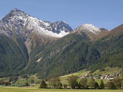 Cima della Stanga Mountain, Brennero/Brenner3.1 km W
-
Schlüsseljoch Mountain, Brennero/Brenner3.1 km NW
-
Hühnerspiel Mountain, Brennero/Brenner3.7 km W
-
Cima Vallaccia Mountain, Brennero/Brenner3.2 km NW
-
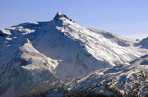 Wolfendorn Mountain, Brennero/Brenner3.9 km N
-
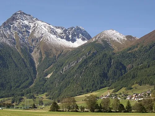 Punta del Tasso Mountain, Brennero/Brenner3.7 km W
-
Wildseespitze Mountain, South Tyrol4.9 km N
Sources & licences
Data last updated: