- Population
- 27,959
- 28K
- Elevation
- 139 m
- above sea level
- Local time
- UTC+01:00
- Europe/Rome · UTC+01:00
- Places inside
- 44
- listed under San Miniato
- Airports
- FLR Florence Airport, Peretola32 km
- PSA Pisa International Airport37 km
About San Miniato
San Miniato is a municipality. Location: Province of Pisa, Tuscany. Population: 27,959. Elevation: 139 m. The best months to visit are May–June, September. The nearest airport is Florence Airport, Peretola (32 km).
Climate of San Miniato
Best months for sightseeingBest months for sightseeing: May–June, September.
This month · November
A wet month
Day 14° · Night 6° · Rain 118 mm
- Hottest month
- July (day 30°)
- Coldest month
- January (night 2°)
- Wettest month
- November (118 mm)
- Driest month
- July (35 mm)
Bars: average monthly low and high temperature. Below: precipitation. Monthly averages for 1970–2000 at about 18 km resolution, adjusted for elevation. Highlighted months are mild and relatively dry. Source: WorldClim 2.1 (CC BY 4.0).
Show values as a table
| Month | Jan | Feb | Mar | Apr | May | Jun | Jul | Aug | Sep | Oct | Nov | Dec |
|---|---|---|---|---|---|---|---|---|---|---|---|---|
| Average high (°C) | 10° | 12° | 14° | 17° | 22° | 26° | 30° | 30° | 25° | 20° | 14° | 11° |
| Average low (°C) | 2° | 2° | 4° | 7° | 11° | 14° | 17° | 17° | 14° | 10° | 6° | 3° |
| Precipitation (mm) | 70 | 63 | 71 | 84 | 65 | 56 | 35 | 58 | 88 | 113 | 118 | 83 |
How to get to San Miniato
The nearest airport is Florence Airport, Peretola (FLR), 32 km to the northeast as the crow flies. The nearest large city is Nice, 289 km to the west.
Airports
- Florence Airport, Peretola (FLR) Firenze (FI) 32 kmnortheast
- Pisa International Airport (PSA) Pisa (PI) 37 kmwest
- Bologna Guglielmo Marconi Airport (BLQ) Bologna 101 kmnorth
Nearby large cities
- Nice Population: 342.7K 289 kmwest
- Rijeka Population: 108K 339 kmnortheast
- Ljubljana Population: 272.2K 391 kmnortheast
Straight-line distances; road distances are longer. Airport data: OurAirports.
Day trips from San Miniato
Within 100 km: 70 historic and cultural sites, 202 natural sites, 36 lakes, rivers and coasts.
0–25 km12 places
- I Fornelli Mountain 16 kmNE
- Colle Belvedere Mountain 22 kmN
- Monte Cupoli Mountain 21 kmN
- Monte Fiore Mountain 19 kmN
25–60 km147 places
- Poggio di Iavello Mountain 37 kmNE
- Cormorano Beach 55 kmSW
- Cala del Leone Beach 47 kmSW
- Spiaggia di Calignaia Beach 47 kmSW
60–100 km149 places
- Poggio Mosconcino Mountain 98 kmS
- Cala Civette Beach 93 kmS
- Ultima Spiaggia Beach 84 kmS
- Mirollino Beach 83 kmS
Straight-line distances.
Places in San Miniato
44 places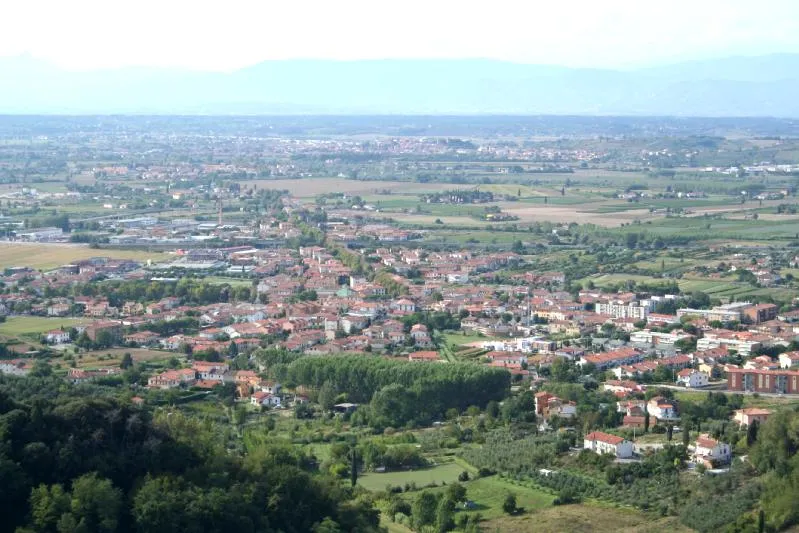
San Miniato Basso
Population: 26.4K
San Miniato
Population: 16.9K

San Donato
Population: 1.8K
La Scala
Population: 1.4K

San Romano
Population: 1.2K

Ponte A Elsa
Population: 1.1K
- 7 Isola 639
- 8 La Serra 510
- 9 Corazzano 360
- 10 Roffia 314
- 11 Stibbio 247
- 12 Balconevisi 244
- 13 La Dogaia 101
- 14 Palagio 79
- 15 Le Tombe 71
- 16 Giovanastra 65
- 17 Fornacino 56
- 18 Sant'Angelo 56
- 19 Poggio A Isola 52
- 20 Cusignano 51
- 21 Fondo Scesa Balconevisi 44
- 22 Parrino 42
- 23 Casotti di Moriolo 40
- 24 Palazzo Torto 38
- 25 Bucciano 36
- 26 Mezzopiano I 35
- 27 Calenzano II 34
- 28 Ontraino 33
- 29 Collebrunacchi 32
- 30 Alberaccio 30
- 31 Case Nuove di Roffia 30
- 32 Mezzopiano II 30
- 33 Bottega Genovini 27
- 34 Gargozzi 26
- 35 Le Colonne 26
- 36 Calpetardo 25
- 37 Montorzo 25
- 38 Palagetto 22
- 39 Calenzano I 18
- 40 Piano di Moriolo 17
- 41 Borghigiana 15
- 42 Moriolo 10
Bar: population relative to the most populous place in this list.
Cities & villages2
- Canneto · Village
- Ponte a Egola · Village
Sources & licences
Data last updated: