Chiarone Scalo
Located in Capalbio, Provincia di Grosseto Coordinates: 42°23′18″ N 11°26′47″ E

- Population
- 18
- 18
- Elevation
- 7 m
- above sea level
- Local time
- UTC+01:00
- Europe/Rome · UTC+01:00
- Airports
- FCO Rome–Fiumicino Leonardo da Vinci International Airport93 km
- EBA Marina di Campo Airport107 km
About Chiarone Scalo
Chiarone Scalo is a village. Location: Capalbio, Provincia di Grosseto. Population: 18. Elevation: 7 m.
Chiarone Scalo is a village in Tuscany, central Italy, administratively a frazione of the comune of Capalbio, province of Grosseto. At the time of the 2001 census its population amounted to 18.
Source: Wikipedia · CC BY-SA 4.0
Photos of Chiarone Scalo
-

LigaDue · CC BY-SA 4.0 -

LigaDue · CC BY-SA 4.0 -

LigaDue · CC BY-SA 4.0


Climate of Chiarone Scalo
Best months for sightseeingBest months for sightseeing: May–June, September–October.
This month · November
Outside the best season
Day 16° · Night 8° · Rain 71 mm
- Hottest month
- July (day 30°)
- Coldest month
- January (night 4°)
- Wettest month
- November (71 mm)
- Driest month
- July (10 mm)
Bars: average monthly low and high temperature. Below: precipitation. Monthly averages for 1970–2000 at about 18 km resolution, adjusted for elevation. Highlighted months are mild and relatively dry. Source: WorldClim 2.1 (CC BY 4.0).
Show values as a table
| Month | Jan | Feb | Mar | Apr | May | Jun | Jul | Aug | Sep | Oct | Nov | Dec |
|---|---|---|---|---|---|---|---|---|---|---|---|---|
| Average high (°C) | 12° | 13° | 15° | 18° | 22° | 27° | 30° | 30° | 26° | 21° | 16° | 13° |
| Average low (°C) | 4° | 4° | 6° | 8° | 12° | 16° | 19° | 19° | 16° | 13° | 8° | 5° |
| Precipitation (mm) | 58 | 47 | 44 | 42 | 36 | 19 | 10 | 28 | 53 | 67 | 71 | 55 |
Other places to visit in this season: May June September October
How to get to Chiarone Scalo
The nearest airport is Rome–Fiumicino Leonardo da Vinci International Airport (FCO), 93 km to the southeast as the crow flies. The nearest large city is Nice, 371 km to the northwest.
Airports
- Rome–Fiumicino Leonardo da Vinci International Airport (FCO) Rome 93 kmsoutheast
- Marina di Campo Airport (EBA) Campo nell'Elba (LI) 107 kmnorthwest
- Ciampino–G. B. Pastine International Airport (CIA) Rome 115 kmsoutheast
Nearby large cities
- Nice Population: 342.7K 371 kmnorthwest
Straight-line distances; road distances are longer. Airport data: OurAirports.
Day trips from Chiarone Scalo
Within 100 km: 93 historic and cultural sites, 107 natural sites, 37 lakes, rivers and coasts.
0–25 km11 places
- Ultima Spiaggia Beach 1 kmS
- Siaggia delle graticciare Beach 2 kmSE
- Riva del Marchese Beach 20 kmW
- La capannuccia Beach 14 kmW
25–60 km149 places
- Poggio Mosconcino Mountain 54 kmNW
- Parco della Rimembranza Natural site 50 kmNW
- Parco di Villa Pizzetti Natural site 50 kmNW
- Parco del fiume Ombrone Silvano Signori Natural site 49 kmNW
60–100 km77 places
- Campo di Mare Beach 67 kmSE
- Cala Civette Beach 75 kmNW
- Ultima Spiaggia Beach 83 kmNW
- Mirollino Beach 87 kmNW
Straight-line distances.
Nearby attractions & nature
Everything nearby-
Ultima Spiaggia Beach, Capalbio1 km S
-
Siaggia delle graticciare Beach, Montalto di Castro2 km SE
-
La capannuccia Beach, Orbetello14 km W
-
Poggio Polveriera Mountain, Monte Argentario21 km W
-
Poggio Mandrioli Mountain, Monte Argentario21 km W
-
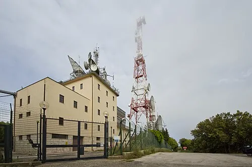 Il Telegrafo Mountain, Monte Argentario23 km W
Other cities and towns in Capalbio
-
Centro C Village, Capalbio2.9 km NW
-
 Borgo Carige Village, Capalbio4.6 km NW
-
Centro G Village, Capalbio2.8 km N
-
Centro D Village, Capalbio2.9 km NW
-
Centro E Village, Capalbio2.5 km NW
-
 Capalbio Scalo Village, Capalbio6.6 km W
Sources & licences
Data last updated: · 2 independent sources