Tatti
Located in Massa Marittima, Provincia di Grosseto Coordinates: 43°01′20″ N 11°01′37″ E

- Population
- 209
- 209
- Elevation
- 412 m
- above sea level
- Local time
- UTC+01:00
- Europe/Rome · UTC+01:00
- Airports
- EBA Marina di Campo Airport71 km
- FLR Florence Airport, Peretola89 km
About Tatti
Tatti is a village. Location: Massa Marittima, Provincia di Grosseto. Population: 209. Elevation: 412 m.
Tatti is a village in Tuscany, central Italy, administratively a frazione of the comune of Massa Marittima, province of Grosseto, in the area of the Colline Metallifere. At the time of the 2001 census its population amounted to 231. Tatti is about 37 km from Grosseto and 20 km from Massa Marittima, and it is a small medieval village (11th century) situated on a hill of Colline Metallifere.
Source: Wikipedia · CC BY-SA 4.0
Photos of Tatti
-

Alienautic · CC BY-SA 3.0 -

Alienautic · CC BY-SA 3.0 -
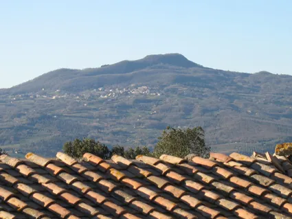
Sassoforte Hermann Salvadori · CC BY-SA 4.0


Climate of Tatti
Best months for sightseeingBest months for sightseeing: June–September.
This month · November
Outside the best season
Day 13° · Night 7° · Rain 86 mm
- Hottest month
- July (day 27°)
- Coldest month
- January (night 3°)
- Wettest month
- November (86 mm)
- Driest month
- July (28 mm)
Bars: average monthly low and high temperature. Below: precipitation. Monthly averages for 1970–2000 at about 18 km resolution, adjusted for elevation. Highlighted months are mild and relatively dry. Source: WorldClim 2.1 (CC BY 4.0).
Show values as a table
| Month | Jan | Feb | Mar | Apr | May | Jun | Jul | Aug | Sep | Oct | Nov | Dec |
|---|---|---|---|---|---|---|---|---|---|---|---|---|
| Average high (°C) | 9° | 9° | 12° | 15° | 20° | 23° | 27° | 26° | 23° | 18° | 13° | 9° |
| Average low (°C) | 3° | 3° | 4° | 7° | 11° | 14° | 17° | 17° | 14° | 11° | 7° | 3° |
| Precipitation (mm) | 59 | 59 | 60 | 61 | 51 | 37 | 28 | 41 | 67 | 77 | 86 | 65 |
Other places to visit in this season: June July August September
How to get to Tatti
The nearest airport is Marina di Campo Airport (EBA), 71 km to the southwest as the crow flies. For international flights: Florence Airport, Peretola (FLR) (89 km). The nearest large city is Nice, 314 km to the west.
Airports
- Marina di Campo Airport (EBA) Campo nell'Elba (LI) 71 kmsouthwest
- Florence Airport, Peretola (FLR) Firenze (FI) 89 kmnorth
- Pisa International Airport (PSA) Pisa (PI) 90 kmnorthwest
Nearby large cities
- Nice Population: 342.7K 314 kmwest
- Rijeka Population: 108K 374 kmnortheast
Straight-line distances; road distances are longer. Airport data: OurAirports.
Day trips from Tatti
Within 100 km: 137 historic and cultural sites, 135 natural sites, 68 lakes, rivers and coasts.
0–25 km11 places
- Poggio Mosconcino Mountain 24 kmS
- Poggio le Soline Mountain 10 kmNE
- Sassoforte Mountain 6 kmE
- Poggio Montecchi Mountain 9 kmN
25–60 km164 places
- Parco della Rimembranza Natural site 30 kmS
- Parco di Villa Pizzetti Natural site 30 kmS
- Parco del fiume Ombrone Silvano Signori Natural site 31 kmS
- Medusa Beach 36 kmS
60–100 km165 places
- Ultima Spiaggia Beach 79 kmSE
- Siaggia delle graticciare Beach 80 kmSE
- Riva del Marchese Beach 72 kmS
- La capannuccia Beach 70 kmS
Straight-line distances.
Nearby attractions & nature
Everything nearby-
Sassoforte Mountain, Roccastrada6.1 km E
-
Poggio Montecchi Mountain, Montieri9.2 km N
-
Poggio le Soline Mountain, Chiusdino9.8 km NE
-
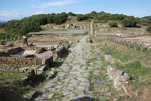 Rovine di Roselle Historic site, Province of Grosseto24 km SE
-
San Benedetto Attraction, Province of Grosseto24 km S
-
Sant'Antonio Abate Attraction, Province of Grosseto21 km S
Other cities and towns in Massa Marittima
-
 Niccioleta Village, Massa Marittima10 km NW
-
Ghirlanda Village, Massa Marittima11 km W
-
 La Pesta Village, Massa Marittima10 km W
-
 Valpiana Village, Massa Marittima15 km W
-
Capanne Village, Massa Marittima9.4 km W
-
Zona Industriale Valpiana Village, Massa Marittima14 km W
Sources & licences
Data last updated: · 2 independent sources