San Niccolò di Celle
Located in Deruta, Province of Perugia Coordinates: 43°01′00″ N 12°23′00″ E

- Population
- 1,086
- 1.1K
- Elevation
- 174 m
- above sea level
- Local time
- UTC+01:00
- Europe/Rome · UTC+01:00
- Airports
- PEG Perugia San Francesco d'Assisi – Umbria International Airport14 km
- AOI Marche Airport104 km
About San Niccolò di Celle
San Niccolò di Celle is a village. Location: Deruta, Province of Perugia. Population: 1,086. Elevation: 174 m.
San Niccolò di Celle is a frazione of the comune of Deruta in the Province of Perugia, Umbria, central Italy. It stands at an elevation of 176 metres above sea level. At the time of the Istat census of 2001 it had 726 inhabitants.
Source: Wikipedia · CC BY-SA 4.0
Photos of San Niccolò di Celle
-

LigaDue · CC BY-SA 4.0 -

Art Anderson · CC BY-SA 3.0 -

Museo del vino Raq · CC BY-SA 3.0


Climate of San Niccolò di Celle
Best months for sightseeingBest months for sightseeing: May–June, September–October.
This month · November
Outside the best season
Day 14° · Night 6° · Rain 88 mm
- Hottest month
- July (day 30°)
- Coldest month
- January (night 2°)
- Wettest month
- November (88 mm)
- Driest month
- July (32 mm)
Bars: average monthly low and high temperature. Below: precipitation. Monthly averages for 1970–2000 at about 18 km resolution, adjusted for elevation. Highlighted months are mild and relatively dry. Source: WorldClim 2.1 (CC BY 4.0).
Show values as a table
| Month | Jan | Feb | Mar | Apr | May | Jun | Jul | Aug | Sep | Oct | Nov | Dec |
|---|---|---|---|---|---|---|---|---|---|---|---|---|
| Average high (°C) | 9° | 11° | 14° | 17° | 23° | 27° | 30° | 30° | 26° | 20° | 14° | 10° |
| Average low (°C) | 2° | 2° | 4° | 7° | 11° | 14° | 17° | 17° | 14° | 10° | 6° | 3° |
| Precipitation (mm) | 45 | 53 | 55 | 62 | 64 | 55 | 32 | 47 | 70 | 81 | 88 | 68 |
Other places to visit in this season: May June September October
How to get to San Niccolò di Celle
The nearest airport is Perugia San Francesco d'Assisi – Umbria International Airport (PEG), 14 km to the northeast as the crow flies. The nearest large city is Rijeka, 305 km to the northeast.
Airports
- Perugia San Francesco d'Assisi – Umbria International Airport (PEG) Perugia (PG) 14 kmnortheast
- Marche Airport (AOI) Falconara Marittima (AN) 104 kmnortheast
- Federico Fellini International Airport (RMI) Rimini (RN) 113 kmnorth
Nearby large cities
- Rijeka Population: 108K 305 kmnortheast
- Split Population: 149.8K 334 kmeast
- Ljubljana Population: 272.2K 377 kmnortheast
Straight-line distances; road distances are longer. Airport data: OurAirports.
Day trips from San Niccolò di Celle
Within 100 km: 29 historic and cultural sites, 264 natural sites, 2 lakes, rivers and coasts.
0–25 km5 places
- Appennino Umbro Mountain 23 kmNE
- Isola Polvese Island 23 kmNW
- Palazzo dei Priori Historic site 11 kmN
- Stadio Renato Curi Landmark 10 kmN
25–60 km60 places
- Monti Volsini Mountain 54 kmSW
- Monte Vergozze Mountain 40 kmSE
- Monte Vagliamenti Mountain 44 kmSE
- Monte Tito Mountain 47 kmE
60–100 km230 places
- Monte del Pantano Mountain 61 kmN
- Valle Cerrese Natural site 78 kmS
- Isola Bisentina Island 62 kmSW
- Monte Guaidone Mountain 73 kmE
Straight-line distances.
Nearby attractions & nature
Everything nearby-
Museo del vino Museum, Torgiano4.2 km E
-
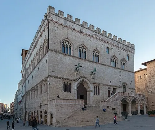 Palazzo dei Priori Historic site, Perugia11 km N
-
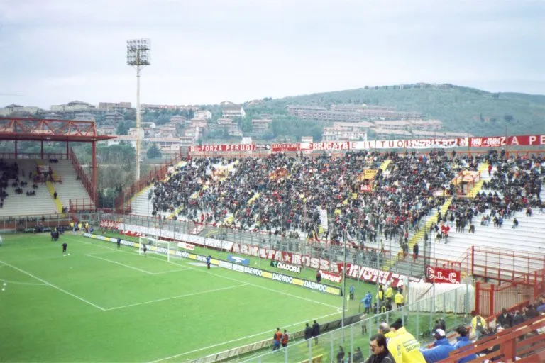 Stadio Renato Curi Landmark, Perugia10 km N
-
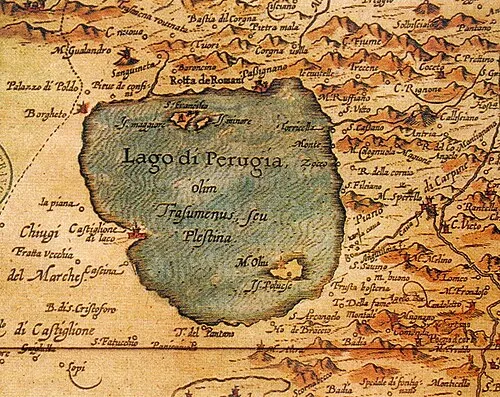 Isola Polvese Island, Castiglione del Lago23 km NW
-
Appennino Umbro Mountain, Umbria23 km NE
Other cities and towns in Deruta
-
 Ponte Nuovo Village, Deruta3.9 km E
-
Fanciullata Village, Deruta3.2 km S
-
Venturello Village, Deruta2.4 km SE
-
Deruta Village, Deruta4.5 km SE
-
 Casalina Village, Deruta7.5 km S
-
Ripabianca Village, Deruta8.7 km S
Sources & licences
Data last updated: · 2 independent sources