Auronzo di Cadore
Located in Province of Belluno, Veneto Coordinates: 46°33′45″ N 12°25′02″ E
- Population
- 3,279
- 3.3K
- Elevation
- 875 m
- above sea level
- Local time
- UTC+01:00
- Europe/Rome · UTC+01:00
- Places inside
- 32
- listed under Auronzo di Cadore
- Airports
- BZO Bolzano Airport85 km
- TSF Treviso Airport103 km
About Auronzo di Cadore
Auronzo di Cadore is a municipality. Location: Province of Belluno, Veneto. Population: 3,279. Elevation: 875 m. The best months to visit are June–September. The nearest airport is Bolzano Airport (85 km). Nearby sights include Val da Rin and Val Baion.
Photos of Auronzo di Cadore
-
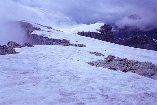
Monte Popera Sandrin Ernesto · CC BY-SA 4.0 -
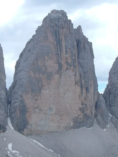
Tre Cime di Lavaredo Grande No machine-readable author provided. Bartcockx~commonswiki assumed · Public domain


Climate of Auronzo di Cadore
Best months for sightseeingBest months for sightseeing: June–September.
This month · November
A cold month
Day 8° · Night 2° · Rain 86 mm
- Hottest month
- July (day 22°)
- Coldest month
- January (night -3°)
- Wettest month
- July (143 mm)
- Driest month
- January (49 mm)
Bars: average monthly low and high temperature. Below: precipitation. Monthly averages for 1970–2000 at about 18 km resolution, adjusted for elevation. Highlighted months are mild and relatively dry. Source: WorldClim 2.1 (CC BY 4.0).
Show values as a table
| Month | Jan | Feb | Mar | Apr | May | Jun | Jul | Aug | Sep | Oct | Nov | Dec |
|---|---|---|---|---|---|---|---|---|---|---|---|---|
| Average high (°C) | 4° | 5° | 8° | 11° | 16° | 20° | 22° | 22° | 19° | 14° | 8° | 5° |
| Average low (°C) | -3° | -2° | 0° | 3° | 8° | 11° | 13° | 13° | 10° | 7° | 2° | -2° |
| Precipitation (mm) | 49 | 50 | 64 | 80 | 111 | 130 | 143 | 133 | 105 | 95 | 86 | 56 |
Other places to visit in this season: June July August September
How to get to Auronzo di Cadore
The nearest airport is Bolzano Airport (BZO), 85 km to the west as the crow flies. For international flights: Treviso Airport (TSF) (103 km). The nearest large city is Innsbruck, 110 km to the northwest.
Airports
- Bolzano Airport (BZO) Bolzano (BZ) 85 kmwest
- Treviso Airport (TSF) Treviso (TV) 103 kmsouth
- Innsbruck Airport (INN) Innsbruck 113 kmnorthwest
Nearby large cities
- Innsbruck Population: 132.5K 110 kmnorthwest
- Klagenfurt Population: 100.3K 145 kmeast
- Salzburg Population: 157.2K 145 kmnorth
- Ljubljana Population: 272.2K 171 kmeast
- Munich Population: 1.5M 186 kmnorth
Straight-line distances; road distances are longer. Airport data: OurAirports.
Day trips from Auronzo di Cadore
Within 100 km: 81 historic and cultural sites, 2,915 natural sites, 423 lakes, rivers and coasts.
0–25 km173 places
- Sille River 25 kmN
- Thurntaler Seen Lake 23 kmN
- Demut Mountain 14 kmN
- Cima Vallona Mountain 14 kmNE
25–60 km1,223 places
- Piz Gralba Mountain 48 kmW
- Piz Miara Mountain 48 kmW
- Croda Nera Mountain 51 kmW
- Vorderer Langtalsee Lake 56 kmNE
60–100 km2,023 places
- Prestreljenik Mountain 84 kmE
- Mangrt Mountain 96 kmE
- Svinjak Mountain 96 kmE
- Matajur Mountain 94 kmSE
Straight-line distances.
Places in Auronzo di Cadore
32 placesBar: population relative to the most populous place in this list.
Mountains & nature29
- Cima Bagni · Mountain
- Cima Cadini di San Lucano · Mountain
- Cima d'Ambata · Mountain
- Cima d'Ambata · Mountain
- Cima dei Camosci · Mountain
- Cima dei Toni · Mountain
- Cima Froppa · Mountain
- Cima Schiavina · Mountain
- Col di Vezza · Mountain
- Col San Angelo · Mountain
- Croda Alta di Sompràde · Mountain
- Croda Banco · Mountain
- Croda da Campo · Mountain
- Croda Da Rin · Mountain
- Croda dell' Arbel · Mountain
- Croda Mescolo · Mountain
- Le Selle · Mountain
- Monte Agudo · Mountain
- Monte Campedelle · Mountain
- Monte Campoduro · Mountain
- Monte Meduce · Mountain
- Monte Piedo · Mountain
- Monte Popera · Mountain
- Monte Rusiana · Mountain
- Pala Meduce · Mountain
- Pale di Menotto · Mountain
- Punta Agnello · Mountain
- Punta Teresa · Mountain
- Tre Cime di Lavaredo Grande · Mountain
Nearby attractions & nature
Everything nearby-
Val da Rin Natural site, Veneto3.1 km W
-
Val Baion Natural site, Veneto5 km SW
-
Valle Marzòn Natural site, Veneto6.4 km NW
-
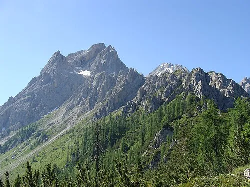 Croda Rossa Mountain, Sesto/Sexten9.2 km N
-
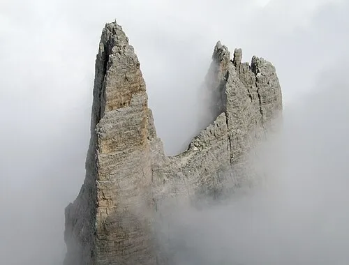 Tre Cime di Lavaredo Piccola Mountain, Trentino-Alto Adige11 km NW
-
Monte Froppa Mountain, Calalzo di Cadore8.8 km SW
-
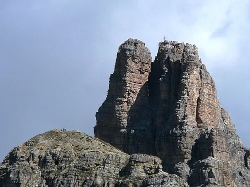 Torre di Toblin Mountain, San Candido/Innichen12 km NW
-
Cima Malpasso Mountain, Santo Stefano di Cadore9.5 km SE
Sources & licences
Data last updated: