- Population
- 1,326
- 1.3K
- Elevation
- 918 m
- above sea level
- Local time
- UTC+01:00
- Europe/Rome · UTC+01:00
- Places inside
- 11
- listed under Tambre
- Airports
- TSF Treviso Airport56 km
- VCE Venice Marco Polo Airport69 km
About Tambre
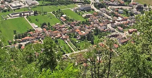
Tambre is a municipality. Location: Province of Belluno, Veneto. Population: 1,326. Elevation: 918 m. The best months to visit are June–August. The nearest airport is Treviso Airport (56 km). Nearby sights include Valle Salatis and Monte Guslon.
Climate of Tambre
Best months for sightseeingBest months for sightseeing: June–August.
This month · November
A cold month
Day 7° · Night 0° · Rain 93 mm
- Hottest month
- July (day 23°)
- Coldest month
- January (night -4°)
- Wettest month
- June (122 mm)
- Driest month
- February (48 mm)
Bars: average monthly low and high temperature. Below: precipitation. Monthly averages for 1970–2000 at about 18 km resolution, adjusted for elevation. Highlighted months are mild and relatively dry. Source: WorldClim 2.1 (CC BY 4.0).
Show values as a table
| Month | Jan | Feb | Mar | Apr | May | Jun | Jul | Aug | Sep | Oct | Nov | Dec |
|---|---|---|---|---|---|---|---|---|---|---|---|---|
| Average high (°C) | 3° | 5° | 8° | 11° | 16° | 20° | 23° | 23° | 19° | 13° | 7° | 4° |
| Average low (°C) | -4° | -4° | -1° | 3° | 8° | 11° | 13° | 13° | 10° | 5° | 0° | -3° |
| Precipitation (mm) | 52 | 48 | 67 | 88 | 112 | 122 | 113 | 110 | 109 | 113 | 93 | 61 |
How to get to Tambre
The nearest airport is Treviso Airport (TSF), 56 km to the south as the crow flies. The nearest large city is Innsbruck, 149 km to the northwest.
Airports
- Treviso Airport (TSF) Treviso (TV) 56 kmsouth
- Venice Marco Polo Airport (VCE) Venezia (VE) 69 kmsouth
- Trieste Airport (TRS) Ronchi dei Legionari/Trieste 88 kmeast
Nearby large cities
- Innsbruck Population: 132.5K 149 kmnorthwest
- Klagenfurt Population: 100.3K 155 kmeast
- Ljubljana Population: 272.2K 162 kmeast
- Rijeka Population: 108K 181 kmsoutheast
- Salzburg Population: 157.2K 192 kmnorth
Straight-line distances; road distances are longer. Airport data: OurAirports.
Day trips from Tambre
Within 100 km: 75 historic and cultural sites, 1,512 natural sites, 133 lakes, rivers and coasts.
0–25 km95 places
- Monte Sambuga Mountain 16 kmSW
- Monte Cor Mountain 18 kmSW
- Monte Cimone Mountain 21 kmSW
- Monte Croce Mountain 18 kmW
25–60 km387 places
- Croda Nera Mountain 60 kmNW
- Cima Vallona Mountain 59 kmN
- Carnia Mountain 40 kmNE
- Nemesis Mountain 55 kmNW
60–100 km1,238 places
- Burano Island 71 kmS
- Sacca Fisola Island 78 kmS
- San Clemente Island 80 kmS
- Prestreljenik Mountain 85 kmE
Straight-line distances.
Places in Tambre
11 places- 1 Tambre 445
- 2 Tambruz 212
- 3 Broz 204
- 4 Borsoi 152
- 5 Valdenogher 145
- 6 Sant'Anna 71
- 7 Lavina 67
- 8 Facchin 9
Bar: population relative to the most populous place in this list.
Mountains & nature3
- Cimon di Palantina · Mountain
- Monte Colombera · Mountain
- Monte Croseraz · Mountain
Nearby attractions & nature
Everything nearby-
Valle Salatis Natural site, Veneto3.2 km NE
-
Monte Guslon Mountain, Chies d'Alpago4.2 km E
-
Monte Castelat Mountain, Chies d'Alpago4.8 km E
-
Monte Cornor Mountain, Chies d'Alpago5.2 km E
-
Monte Costa Mountain, Alpago5.9 km SW
-
Monte Messer Mountain, Chies d'Alpago6.1 km NE
-
Monte Tremol Mountain, Aviano6.1 km E
-
Col Cornier Mountain, Veneto6.2 km SE
Other cities and towns in Province of Belluno
-
Ponte nelle Alpi Municipality, Province of Belluno13 km NW
-
Belluno Municipality, Province of Belluno16 km W
-
Soverzene Municipality, Province of Belluno12 km NW
-
Longarone Municipality, Province of Belluno18 km NW
-
Limana Municipality, Province of Belluno18 km W
-
 Ponte nelle Alpi-Polpet Town, Ponte nelle Alpi13 km NW
Sources & licences
Data last updated: