- Population
- 5,201
- 5.2K
- Elevation
- 459 m
- above sea level
- Local time
- UTC+01:00
- Europe/Rome · UTC+01:00
- Places inside
- 22
- listed under Longarone
- Airports
- TSF Treviso Airport69 km
- BZO Bolzano Airport78 km
About Longarone
Longarone is a municipality. Location: Province of Belluno, Veneto. Population: 5,201. Elevation: 459 m. The best months to visit are May–September. The nearest airport is Treviso Airport (69 km). Nearby sights include Cima La Serra and Valle Zemola.
Climate of Longarone
Best months for sightseeingBest months for sightseeing: May–September.
This month · November
A cold month
Day 10° · Night 3° · Rain 80 mm
- Hottest month
- July (day 26°)
- Coldest month
- January (night -1°)
- Wettest month
- June (117 mm)
- Driest month
- January (44 mm)
Bars: average monthly low and high temperature. Below: precipitation. Monthly averages for 1970–2000 at about 18 km resolution, adjusted for elevation. Highlighted months are mild and relatively dry. Source: WorldClim 2.1 (CC BY 4.0).
Show values as a table
| Month | Jan | Feb | Mar | Apr | May | Jun | Jul | Aug | Sep | Oct | Nov | Dec |
|---|---|---|---|---|---|---|---|---|---|---|---|---|
| Average high (°C) | 6° | 8° | 11° | 15° | 20° | 23° | 26° | 26° | 22° | 17° | 10° | 7° |
| Average low (°C) | -1° | 0° | 3° | 6° | 11° | 14° | 16° | 16° | 13° | 9° | 3° | 0° |
| Precipitation (mm) | 44 | 44 | 57 | 75 | 103 | 117 | 117 | 112 | 100 | 100 | 80 | 50 |
Other places to visit in this season: May June July August September
How to get to Longarone
The nearest airport is Treviso Airport (TSF), 69 km to the south as the crow flies. The nearest large city is Innsbruck, 131 km to the northwest.
Airports
- Treviso Airport (TSF) Treviso (TV) 69 kmsouth
- Bolzano Airport (BZO) Bolzano (BZ) 78 kmwest
- Venice Marco Polo Airport (VCE) Venezia (VE) 85 kmsouth
Nearby large cities
- Innsbruck Population: 132.5K 131 kmnorthwest
- Klagenfurt Population: 100.3K 159 kmeast
- Ljubljana Population: 272.2K 172 kmeast
- Salzburg Population: 157.2K 180 kmnorth
- Rijeka Population: 108K 196 kmsoutheast
Straight-line distances; road distances are longer. Airport data: OurAirports.
Day trips from Longarone
Within 100 km: 73 historic and cultural sites, 2,189 natural sites, 222 lakes, rivers and coasts.
0–25 km141 places
- Monte Sambuga Mountain 24 kmS
- Monte Croce Mountain 23 kmS
- Monte Guslon Mountain 19 kmSE
- Monte Sestier Mountain 19 kmSE
25–60 km598 places
- Sille River 58 kmN
- Piz Gralba Mountain 48 kmNW
- Piz Miara Mountain 48 kmNW
- Croda Nera Mountain 44 kmNW
60–100 km1,745 places
- Burano Island 87 kmS
- Sacca Fisola Island 93 kmS
- San Clemente Island 95 kmS
- Prestreljenik Mountain 91 kmE
Straight-line distances.
Places in Longarone
22 places- 1 Longarone 2.2K
- 2 Castellavazzo 580
- 3 Codissago 533
- 4 Igne 527
- 5 Fortogna 518
- 6 Provagna 280
- 7 Podenzoi 265
- 8 Olantreghe 199
- 9 Dogna 163
- 10 Soffranco 80
- 11 Desedan 77
- 12 Faè 68
- 13 Pascoli 39
- 14 Muda-Maè 26
- 15 Villanova 19
- 16 Zona Industriale 3
Bar: population relative to the most populous place in this list.
Mountains & nature6
- Cima dell'Albero · Mountain
- Cima di Pramper · Mountain
- Cima Mora · Mountain
- Monte Beccola · Mountain
- Monte Cimon · Mountain
- Monte Megna · Mountain
Nearby attractions & nature
Everything nearby-
Cima La Serra Mountain, Friuli Venezia Giulia5.7 km NW
-
Valle Zemola Natural site, Friuli Venezia Giulia6.2 km NE
-
Val Grisol Natural site, Veneto6.4 km W
-
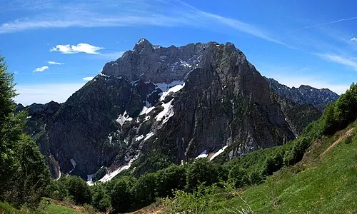 Col Nudo Mountain, Friuli Venezia Giulia8.8 km SE
-
Monte Citta Mountain, Ospitale di Cadore7.1 km NE
-
Monte Certen Mountain, Erto e Casso7.4 km E
-
Coll Mai Mountain, Soverzene7.4 km SE
-
Cime Rocchetta Mountain, Val di Zoldo7.5 km N
Other cities and towns in Province of Belluno
-
Ponte nelle Alpi Municipality, Province of Belluno9.5 km S
-
Belluno Municipality, Province of Belluno15 km SW
-
Chies d'Alpago Municipality, Province of Belluno12 km SE
-
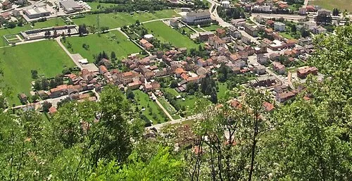 Ponte nelle Alpi-Polpet Town, Ponte nelle Alpi8.9 km S
-
Alpago Municipality, Province of Belluno16 km S
-
Val di Zoldo Municipality, Province of Belluno15 km NW
Sources & licences
Data last updated: