Rosa
Located in Monastier di Treviso, Province of Treviso Coordinates: 45°41′00″ N 12°26′27″ E
- Population
- 23
- 23
- Elevation
- 3 m
- above sea level
- Local time
- UTC+01:00
- Europe/Rome · UTC+01:00
- Airports
- TSF Treviso Airport20 km
- VCE Venice Marco Polo Airport21 km
About Rosa
Rosa is a village. Location: Monastier di Treviso, Province of Treviso. Population: 23. Elevation: 3 m. The best months to visit are May–June, September. The nearest airport is Treviso Airport (20 km). Nearby sights include Stadio Omobono Tenni and Palazzo dei Trecento.
Climate of Rosa
Best months for sightseeingBest months for sightseeing: May–June, September.
This month · November
Outside the best season
Day 12° · Night 4° · Rain 82 mm
- Hottest month
- July (day 29°)
- Coldest month
- January (night -1°)
- Wettest month
- June (98 mm)
- Driest month
- February (46 mm)
Bars: average monthly low and high temperature. Below: precipitation. Monthly averages for 1970–2000 at about 18 km resolution, adjusted for elevation. Highlighted months are mild and relatively dry. Source: WorldClim 2.1 (CC BY 4.0).
Show values as a table
| Month | Jan | Feb | Mar | Apr | May | Jun | Jul | Aug | Sep | Oct | Nov | Dec |
|---|---|---|---|---|---|---|---|---|---|---|---|---|
| Average high (°C) | 7° | 9° | 14° | 17° | 23° | 26° | 29° | 28° | 24° | 18° | 12° | 8° |
| Average low (°C) | -1° | 0° | 4° | 7° | 12° | 16° | 18° | 18° | 14° | 9° | 4° | 0° |
| Precipitation (mm) | 57 | 46 | 62 | 79 | 88 | 98 | 72 | 77 | 84 | 92 | 82 | 62 |
How to get to Rosa
The nearest airport is Treviso Airport (TSF), 20 km to the west as the crow flies. The nearest large city is Rijeka, 161 km to the east.
Airports
- Treviso Airport (TSF) Treviso (TV) 20 kmwest
- Venice Marco Polo Airport (VCE) Venezia (VE) 21 kmsouth
- Trieste Airport (TRS) Ronchi dei Legionari/Trieste 81 kmeast
Nearby large cities
- Rijeka Population: 108K 161 kmeast
- Ljubljana Population: 272.2K 165 kmeast
- Klagenfurt Population: 100.3K 178 kmnortheast
- Innsbruck Population: 132.5K 193 kmnorthwest
- Salzburg Population: 157.2K 240 kmnorth
Straight-line distances; road distances are longer. Airport data: OurAirports.
Day trips from Rosa
Within 100 km: 52 historic and cultural sites, 639 natural sites, 37 lakes, rivers and coasts.
0–25 km5 places
- Burano Island 22 kmS
- San Giacomo in Paludo Island 24 kmS
- La Cura Island 20 kmS
- Palazzo dei Trecento Historic site 15 kmW
25–60 km147 places
- Sacca Fisola Island 30 kmS
- San Clemente Island 31 kmS
- Spiaggia di Caorle Beach 35 kmE
- Spiaggia di Levante Beach 36 kmE
60–100 km576 places
- Markovec Mountain 100 kmE
- Solkan Bridge Landmark 100 kmE
- Dragonja River 92 kmE
- Croda Nera Mountain 98 kmNW
Straight-line distances.
Nearby attractions & nature
Everything nearby-
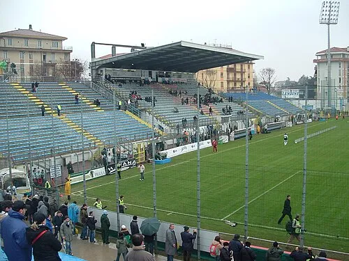 Stadio Omobono Tenni Landmark, Treviso14 km W
-
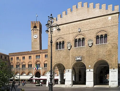 Palazzo dei Trecento Historic site, Treviso15 km W
-
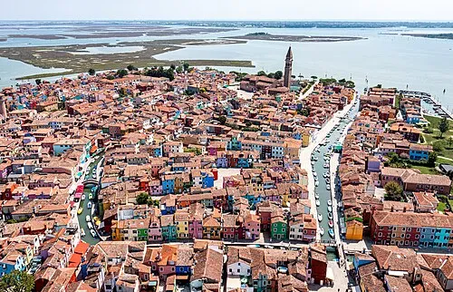 Burano Island, Venice22 km S
-
La Cura Island, Venice20 km S
-
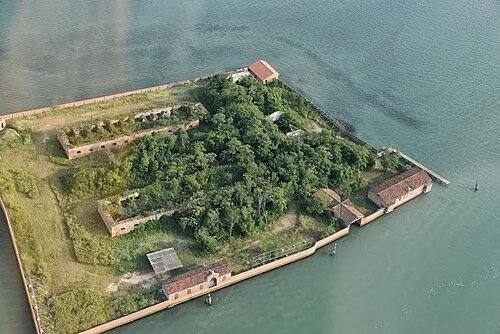 San Giacomo in Paludo Island, Venice24 km S
Sources & licences
Data last updated: · 2 independent sources