- Population
- 39,172
- 39.2K
- Elevation
- 20 m
- above sea level
- Local time
- UTC+09:00
- Asia/Tokyo · UTC+09:00
- Places inside
- 1
- listed under Kōda-chō
- Airports
- NGO Chubu Centrair International Airport33 km
- NKM Nagoya Airport / JASDF Komaki Air Base50 km
About Kōda-chō
Kōda-chō is a municipality. Location: Nukata-gun, Aichi. Population: 39,172. Elevation: 20 m.
Kōta (幸田町, Kōta-chō) is a town located in Nukata District, Aichi Prefecture, in the Tōkai region of Japan. As of 1 October 2019, the town had an estimated population of 42,200 in 16,198 households, and a population density of 744 persons per km2. The total area of the town was 56.72 square kilometres (21.90 sq mi). Part of the town was called Kōda until 1954. It should not be confused with a district in the nearby city of Tahara, in the same prefecture, also called Koda (Koda-chō)
Source: Wikipedia · CC BY-SA 4.0
Places bordering Kōda-chō
- Okazaki
- Nishio
- Gamagōri
Population of Kōda-chō over time
| 2010 | 37,930 | |
|---|---|---|
| 2015 | 39,549 | |
| 2021 | 42,523 |
Censuses and official estimates; source: Wikidata.
Climate of Kōda-chō
Best months for sightseeingBest months for sightseeing: May–June, October.
This month · November
A wet month
Day 17° · Night 8° · Rain 101 mm
Better nearby cities in November
- Fujinomiya · 138 km east18°
- Fuji · 143 km east20°
- Kofu · 156 km northeast17°
- Hottest month
- August (day 31°)
- Coldest month
- January (night 1°)
- Wettest month
- June (265 mm)
- Driest month
- December (58 mm)
Bars: average monthly low and high temperature. Below: precipitation. Monthly averages for 1970–2000 at about 18 km resolution, adjusted for elevation. Highlighted months are mild and relatively dry. Source: WorldClim 2.1 (CC BY 4.0).
Show values as a table
| Month | Jan | Feb | Mar | Apr | May | Jun | Jul | Aug | Sep | Oct | Nov | Dec |
|---|---|---|---|---|---|---|---|---|---|---|---|---|
| Average high (°C) | 9° | 10° | 13° | 19° | 23° | 26° | 29° | 31° | 27° | 22° | 17° | 12° |
| Average low (°C) | 1° | 1° | 4° | 10° | 14° | 19° | 22° | 23° | 20° | 14° | 8° | 3° |
| Precipitation (mm) | 60 | 81 | 135 | 194 | 200 | 265 | 250 | 229 | 256 | 168 | 101 | 58 |
How to get to Kōda-chō
The nearest airport is Chubu Centrair International Airport (NGO), 33 km to the west as the crow flies. The nearest large city is Nishio, 11 km to the west.
Airports
- Chubu Centrair International Airport (NGO) Tokoname 33 kmwest
- Nagoya Airport / JASDF Komaki Air Base (NKM) Nagoya 50 kmnorthwest
- Mount Fuji Shizuoka Airport (FSZ) Makinohara / Shimada 94 kmeast
Nearby large cities
- Nishio Population: 170K 11 kmwest
- Okazaki Population: 384.7K 11 kmnorth
- Anjo Population: 188.7K 14 kmnorthwest
- Handa Population: 117.9K 22 kmwest
- Toyokawa Population: 184.7K 22 kmeast
Straight-line distances; road distances are longer. Airport data: OurAirports.
Places in Kōda-chō
1 placeBar: population relative to the most populous place in this list.
Nearby attractions & nature
Everything nearby-
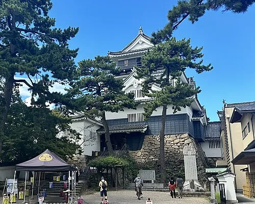 Okazaki castle Historic site, Okazaki-shi12 km N
-
 Mikawa-wan Natural site, Japan13 km SW
-
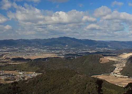 Hongū-zan Mountain, Toyokawa-shi24 km E
-
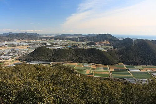 Atsumi Peninsula Natural site, Aichi22 km S
-
Himakajima Island, Japan22 km SW
-
Mikawa-wan Natural site, Japan17 km S
-
Toyo River River, Japan18 km SE
-
Yahagi River River, Japan18 km W
Sources & licences
Data last updated: · 2 independent sources