- Population
- 58,710
- 58.7K
- Elevation
- 11 m
- above sea level
- Local time
- UTC+09:00
- Asia/Tokyo · UTC+09:00
- Airports
- NGO Chubu Centrair International Airport5 km
- NKM Nagoya Airport / JASDF Komaki Air Base42 km
About Tokoname
Tokoname is a city. Location: Tokoname-shi, Aichi. Population: 58,710. Elevation: 11 m.
Tokoname (常滑市, Tokoname-shi) is a city in Aichi Prefecture, Japan. As of 1 October 2019, the city had an estimated population of 57,872 in 24,872 households, and a population density of 1,035 persons per km2. The total area of the city is 55.90 square kilometres (21.58 sq mi). The city is notable as one of the Six Ancient Kilns of Japan.
Source: Wikipedia · CC BY-SA 4.0
Travel notes for Tokoname
From Wikivoyage
Tokoname City (常滑市) is a city in southern Aichi Prefecture. Located to the south of Nagoya, the city is the home of Chubu Centrair International Airport, which serves Nagoya and the whole Chubu region.
Understand+
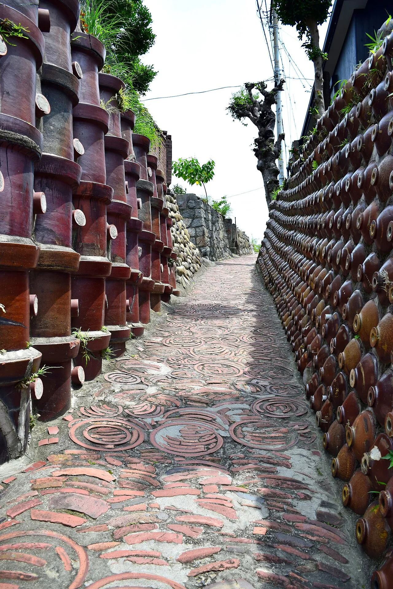
Tokoname is located on the western coast of the Chita Peninsula, facing Ise Bay. The city has been famous for its pottery of Tokoname-Yaki (常滑焼), which is one of the oldest ceramic kiln industries among six cities in Japan (六古窯, rokkoyō).
After the establishment of Chubu Centrair International Airport in 2005, the city's transportation has been improved to serve the airport and other cities well. It has some large shopping malls and tourist sites. You can have some fun and kill some time before going to the Chubu airport.
Tourist information site:
The local tourist association provides a multilingual guide site. If you wonder, the cat at the top-left corner is maneki-neko (招き猫), a figurine that serves as a mascot for attracting customers in stores throughout Japan. You will see this cute little thing in almost every store in Japan. Most maneki-neko in Japan are made in Tokoname, so it has become the city's mascot. In fact, you can see some maneki-neko that are really big.
Tokoname City government website
Get in+
As the city hosts Chubu Centrair International Airport, one of the most important airports in Japan, it is very easy to access the city by any means.
By plane:
Everyone arriving at 1 Chubu Centrair International Airport (中部国際空港 セントレア). (NGO IATA) will arrive Tokoname if they aren't going to transfer or using ferries. The fastest option to/from the airport is the airport line of Meitetsu - You can stop at either Rinku Tokoname (りんくう常滑) or Tokoname (常滑) station.
By train:
As mentioned above, stop at either 2 Rinku Tokoname Station (りんくう常滑). or 3 Tokoname Station (常滑駅). of the Meitetsu airport line. It's just that Rinku Tokoname is closer to the city's large shopping malls while Tokoname station is closer to the downtown. If you are from Nagoya by Shinkansen, ride the line from Meitetsu Nagoya Station (名鉄名古屋). You cost JPY 980 and around 30~50 minutes, depending on the train you ride.
By car:
If you are from the airport side because you rent a car from the airport (except for Budget, which will explain below), the Rinku Interchange (りんくうインターチェンジ) is the obvious choice for arriving city. If you are from the Nagoya end, take Chitahanto Road (知多半島道路, E87), go Chitaodan Road (知多横断道路, E87) through the Handa-chuo junction (半田中央ジャンクション), and leave at Rinku Interchange. While Tokoname Interchange (常滑インターチェンジ) sounds like the place you want to leave, it is a little further from downtown than Rinku Interchange.
If you are using national routes, take the National Route 155/247 from the north/south end. For those from the east end, take Aichi Prefectural Road Route 265.
Source: Wikivoyage · CC BY-SA 4.0 · abridged
Places bordering Tokoname
- Mihama Chō
- Chita
- Handa
- Agui Chō
- Taketoyo
Twin towns and sister cities of Tokoname
- Marugame· Japan
- Okazaki· Japan
- Seto· Japan
Source: Wikidata. Only places with a page on this site are shown.
Population of Tokoname over time
| 2010 | 54,858 | |
|---|---|---|
| 2015 | 56,547 | |
| 2021 | 57,507 |
Censuses and official estimates; source: Wikidata.
Climate of Tokoname
Best months for sightseeingBest months for sightseeing: May–June, October.
This month · November
Outside the best season
Day 17° · Night 8° · Rain 97 mm
Better nearby cities in November
- Fujinomiya · 165 km east18°
- Fuji · 170 km east20°
- Kofu · 179 km northeast17°
- Hottest month
- August (day 31°)
- Coldest month
- January (night 1°)
- Wettest month
- June (259 mm)
- Driest month
- December (49 mm)
Bars: average monthly low and high temperature. Below: precipitation. Monthly averages for 1970–2000 at about 18 km resolution, adjusted for elevation. Highlighted months are mild and relatively dry. Source: WorldClim 2.1 (CC BY 4.0).
Show values as a table
| Month | Jan | Feb | Mar | Apr | May | Jun | Jul | Aug | Sep | Oct | Nov | Dec |
|---|---|---|---|---|---|---|---|---|---|---|---|---|
| Average high (°C) | 9° | 10° | 13° | 19° | 23° | 26° | 30° | 31° | 27° | 22° | 17° | 12° |
| Average low (°C) | 1° | 1° | 4° | 9° | 14° | 18° | 22° | 23° | 20° | 14° | 8° | 3° |
| Precipitation (mm) | 53 | 76 | 126 | 179 | 185 | 259 | 243 | 193 | 248 | 159 | 97 | 49 |
How to get to Tokoname
The nearest airport is Chubu Centrair International Airport (NGO), 5 km to the southwest as the crow flies. The nearest large city is Handa, 8 km to the east.
Airports
- Chubu Centrair International Airport (NGO) Tokoname 5 kmsouthwest
- Nagoya Airport / JASDF Komaki Air Base (NKM) Nagoya 42 kmnorth
- Mount Fuji Shizuoka Airport (FSZ) Makinohara / Shimada 123 kmeast
Nearby large cities
- Handa Population: 117.9K 8 kmeast
- Tōkai Population: 113.8K 16 kmnorth
- Kariya Population: 153.8K 16 kmnortheast
- Nishio Population: 170K 18 kmeast
- Anjo Population: 188.7K 23 kmeast
Straight-line distances; road distances are longer. Airport data: OurAirports.
Day trips from Tokoname
Within 100 km: 19 historic and cultural sites, 22 natural sites, 29 lakes, rivers and coasts.
0–25 km12 places
- Himakajima Island 24 kmSE
- Chita-hantō Natural site 6 kmSE
- Nikkō River River 22 kmN
- Hori River River 24 kmN
25–60 km23 places
- Tōshi-jima Island 40 kmS
- Sakate-jima Island 44 kmS
- Kami-jima Island 39 kmS
- Shino-jima Island 27 kmSE
60–100 km35 places
- Kashiko Island Island 64 kmS
- Mount Miwa Mountain 98 kmSW
- Mount Kunimi Mountain 93 kmSW
- Mount Azami Mountain 92 kmSW
Straight-line distances.
Tokoname and similar cities
Side by side with cities of similar size in the same country: population, elevation and climate.
| Measure | Tokoname | Hanyū | Ishikari | Koga |
|---|---|---|---|---|
| Population | 58.7K | 58.7K | 58.8K | 58.8K |
| Elevation | 11 m | 18 m | 0 m | 10 m |
| Summer day (hottest month) | 31° | 30° | 25° | 30° |
| Winter night (coldest month) | 1° | -2° | -9° | 3° |
| Annual rainfall | 1,867 mm | 1,265 mm | 1,210 mm | 1,679 mm |
| Best months | May–Jun, Oct | May–Jun, Oct | Jun–Sep | May–Jun, Oct |
| Distance | — | 282 km | 1,006 km | 601 km |
Climate values are 1970–2000 monthly averages; straight-line distance.
Nearby attractions & nature
Everything nearby-
 Chita-hantō Natural site, Japan6.3 km SE
-
Shonai River River, Japan17 km N
-
Kiso River River, Mie19 km NW
-
SCMaglev and Railway Park Museum, Minato-ku18 km N
-
Nagara River River, Japan24 km NW
-
Yahagi River River, Japan13 km SE
-
Ibi River River, Japan22 km NW
-
Nikkō River River, Aichi22 km N
Sources & licences
Data last updated: · 2 independent sources