- Population
- 10,420
- 10.4K
- Elevation
- 167 m
- above sea level
- Local time
- UTC+09:00
- Asia/Tokyo · UTC+09:00
- Places inside
- 1
- listed under Gojōnome Machi
- Airports
- ONJ Odate Noshiro Airport33 km
- AXT Akita Airport35 km
About Gojōnome Machi
Gojōnome Machi is a municipality. Location: Minamiakita-gun, Akita. Population: 10,420. Elevation: 167 m. The best months to visit are June–July, September. The nearest airport is Odate Noshiro Airport (33 km). Nearby sights include Akita Port Tower and Hachirō Lagoon.
Climate of Gojōnome Machi
Best months for sightseeingBest months for sightseeing: June–July, September.
This month · November
A wet month
Day 11° · Night 3° · Rain 144 mm
- Hottest month
- August (day 28°)
- Coldest month
- January (night -4°)
- Wettest month
- July (176 mm)
- Driest month
- March (96 mm)
Bars: average monthly low and high temperature. Below: precipitation. Monthly averages for 1970–2000 at about 18 km resolution, adjusted for elevation. Highlighted months are mild and relatively dry. Source: WorldClim 2.1 (CC BY 4.0).
Show values as a table
| Month | Jan | Feb | Mar | Apr | May | Jun | Jul | Aug | Sep | Oct | Nov | Dec |
|---|---|---|---|---|---|---|---|---|---|---|---|---|
| Average high (°C) | 2° | 2° | 5° | 12° | 18° | 22° | 26° | 28° | 23° | 17° | 11° | 5° |
| Average low (°C) | -4° | -4° | -2° | 4° | 9° | 14° | 19° | 20° | 16° | 9° | 3° | -1° |
| Precipitation (mm) | 126 | 101 | 96 | 106 | 99 | 120 | 176 | 164 | 173 | 139 | 144 | 151 |
How to get to Gojōnome Machi
The nearest airport is Odate Noshiro Airport (ONJ), 33 km to the northeast as the crow flies. The nearest large city is Akita, 24 km to the south.
Airports
- Odate Noshiro Airport (ONJ) Kitaakita 33 kmnortheast
- Akita Airport (AXT) Akita 35 kmsouth
- Iwate Hanamaki Airport (HNA) Hanamaki 97 kmsoutheast
Nearby large cities
- Akita Population: 307.7K 24 kmsouth
- Hirosaki Population: 168.7K 77 kmnorth
- Morioka Population: 290.7K 85 kmeast
- Aomori Population: 298.4K 109 kmnortheast
- Sakata Population: 100.3K 116 kmsouth
Straight-line distances; road distances are longer. Airport data: OurAirports.
Day trips from Gojōnome Machi
Within 100 km: 3 historic and cultural sites, 10 natural sites, 12 lakes, rivers and coasts.
0–25 km2 places
- Akita Port Tower Landmark 23 kmSW
- Hachirō Lagoon Lake 17 kmW
25–60 km8 places
- Oga Quasi National Park Natural site 39 kmW
- Oga Peninsula Natural site 32 kmW
- Yoneshiro River River 37 kmNW
- Omono River River 29 kmSW
60–100 km15 places
- Tobi Shima Island 99 kmSW
- Koyoshi River River 62 kmS
- Hakkōda San Mountain 100 kmNE
- Lake Towada Lake 83 kmNE
Straight-line distances.
Places in Gojōnome Machi
1 place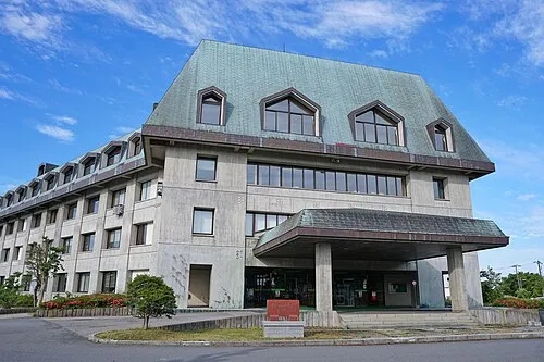
Gojōnome
Population: 9K
Nearby attractions & nature
Everything nearby-
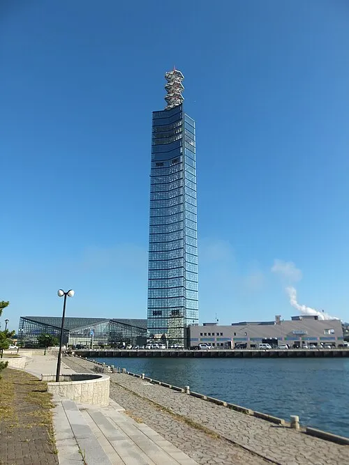 Akita Port Tower Landmark, Akita Shi23 km SW
-
 Hachirō Lagoon Lake, Akita17 km W
Sources & licences
Data last updated: