- Elevation
- 90 m
- above sea level
- Local time
- UTC+09:00
- Asia/Tokyo · UTC+09:00
- Airports
- MYJ Matsuyama Airport39 km
- KCZ Kochi Ryoma Airport64 km
About Komatsu
Komatsu is a village. Location: Saijō Shi, Ehime. Elevation: 90 m.
Komatsu (小松町, Komatsu-chō) was a town located in Shūsō District, Ehime Prefecture, Japan. As of 2003, the town had an estimated population of 9,668 and a density of 126.78 persons per km2. The total area was 76.26 km2. On November 1, 2004, Komatsu, along with the city of Tōyo, and the town of Tanbara (also from Shūsō District), was merged into the expanded city of Saijō and no longer exists as an independent municipality.
Source: Wikipedia · CC BY-SA 4.0
At a glance
- Built
- 1898
Source: Wikidata
Climate of Komatsu
Best months for sightseeingBest months for sightseeing: May–June, October.
This month · November
Outside the best season
Day 17° · Night 8° · Rain 83 mm
Better nearby cities in November
- Kochi · 53 km southeast18°
- Ōita · 158 km southwest18°
- Beppu · 164 km southwest17°
- Hottest month
- August (day 31°)
- Coldest month
- January (night 1°)
- Wettest month
- June (275 mm)
- Driest month
- January (50 mm)
Bars: average monthly low and high temperature. Below: precipitation. Monthly averages for 1970–2000 at about 18 km resolution, adjusted for elevation. Highlighted months are mild and relatively dry. Source: WorldClim 2.1 (CC BY 4.0).
Show values as a table
| Month | Jan | Feb | Mar | Apr | May | Jun | Jul | Aug | Sep | Oct | Nov | Dec |
|---|---|---|---|---|---|---|---|---|---|---|---|---|
| Average high (°C) | 9° | 10° | 13° | 19° | 23° | 26° | 30° | 31° | 27° | 22° | 17° | 12° |
| Average low (°C) | 1° | 1° | 5° | 10° | 15° | 19° | 23° | 24° | 20° | 14° | 8° | 3° |
| Precipitation (mm) | 50 | 73 | 110 | 169 | 179 | 275 | 233 | 125 | 221 | 136 | 83 | 50 |
How to get to Komatsu
The nearest airport is Matsuyama Airport (MYJ), 39 km to the west as the crow flies. The nearest large city is Saijō, 7 km to the northeast.
Airports
- Matsuyama Airport (MYJ) Matsuyama 39 kmwest
- Kochi Ryoma Airport (KCZ) Nankoku 64 kmsoutheast
- Hiroshima Airport (HIJ) Hiroshima 64 kmnorth
Nearby large cities
- Saijō Population: 104.8K 7 kmnortheast
- Niihama Population: 123.1K 19 kmnortheast
- Imabari Population: 171K 23 kmnorthwest
- Matsuyama Population: 511.2K 33 kmwest
- Kochi Population: 332.1K 53 kmsoutheast
Straight-line distances; road distances are longer. Airport data: OurAirports.
Nearby attractions & nature
Everything nearby-
 Mount Ishizuchi Mountain, Saijō Shi13 km S
-
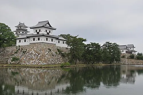 Imabari Castle Historic site, Imabari22 km NW
Sources & licences
Data last updated: · 2 independent sources