- Population
- 73,164
- 73.2K
- Elevation
- 42 m
- above sea level
- Local time
- UTC+09:00
- Asia/Tokyo · UTC+09:00
- Airports
- FUK Fukuoka Airport11 km
- HSG Kyushu Saga International Airport45 km
About Dazaifu
Dazaifu is a city. Location: Dazaifu-shi, Fukuoka. Population: 73,164. Elevation: 42 m. The best months to visit are May–June, October. The nearest airport is Fukuoka Airport (11 km). Nearby sights include Kyūshū Kokuritsu Hakubutsukan and Mount Hōman.
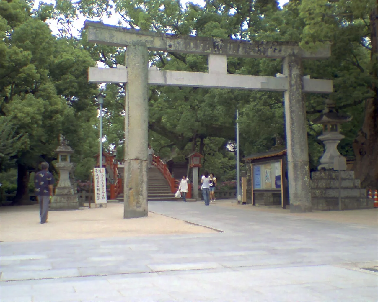
Photos of Dazaifu
-

水車 · CC BY-SA 4.0 -

先従隗始 · CC0 -

先従隗始 · CC0 -

そらみみ · CC BY-SA 4.0 -

そらみみ · CC BY-SA 4.0


Travel notes for Dazaifu
From Wikivoyage
Dazaifu (大宰府) is a city in Fukuoka Prefecture, Kyushu, Japan.
Understand+
Tourist information sites:
The local tourist association has a bilingual guide site.
The city government's site has a Japanese-only tourism section.
Get in+
By train:
Dazaifu is accessible via Futsukaichi (二日市) station on the Nishitetsu Tenjin-Omuta Line.
From Tenjin station in Fukuoka there are at least a dozen trains per hour operating to Futsukaichi. The journey is 12 minutes by Limited Express or 25 minutes by Local train, and costs ¥390.
If you want to head from JR Hakata Station to Dazaifu, the best option is to take a local bus to Nishitetsu Yakuin Station (¥100) and there take Nishitetsu train to Dazaifu (transfer at Nishitetsu Futsukaichi). Some local buses are available from JR Futsukaichi station to Dazaifu too, but they are rather expensive and infrequent.
By bus:
Nishitetsu operates the "Tabito" liner bus connecting three locations in Dazaifu with Fukuoka International Airport and Hakata Bus Terminal, the latter next door to Hakata station. The bus costs ¥700 to connect Dazaifu with Hakata Bus Terminal, or ¥600 to go to the airport (Oct 2025). Estimated time: 40 minutes to the terminal, or 25 to the airport. Cash, IC card, and credit cards with contactless payment are accepted.
By car:
Take the main road number 3 south out of Fukuoka, which passes through Dazaifu. This can be crushingly slow for such a short distance. A better option is to take the toll road south out of Fukuoka (you can access from various points around the city) and get off at the Dazaifu interchange.
Source: Wikivoyage · CC BY-SA 4.0 · abridged
Climate of Dazaifu
Best months for sightseeingBest months for sightseeing: May–June, October.
This month · November
Outside the best season
Day 17° · Night 9° · Rain 78 mm
Better nearby cities in November
- Beppu · 94 km east17°
- Ōita · 105 km east18°
- Nobeoka · 148 km southeast18°
- Hottest month
- August (day 31°)
- Coldest month
- January (night 2°)
- Wettest month
- July (335 mm)
- Driest month
- December (62 mm)
Bars: average monthly low and high temperature. Below: precipitation. Monthly averages for 1970–2000 at about 18 km resolution, adjusted for elevation. Highlighted months are mild and relatively dry. Source: WorldClim 2.1 (CC BY 4.0).
Show values as a table
| Month | Jan | Feb | Mar | Apr | May | Jun | Jul | Aug | Sep | Oct | Nov | Dec |
|---|---|---|---|---|---|---|---|---|---|---|---|---|
| Average high (°C) | 9° | 9° | 13° | 18° | 23° | 26° | 29° | 31° | 27° | 22° | 17° | 11° |
| Average low (°C) | 2° | 2° | 5° | 10° | 14° | 19° | 23° | 24° | 20° | 14° | 9° | 4° |
| Precipitation (mm) | 77 | 85 | 119 | 157 | 170 | 317 | 335 | 179 | 198 | 99 | 78 | 62 |
How to get to Dazaifu
The nearest airport is Fukuoka Airport (FUK), 11 km to the northwest as the crow flies. The nearest large city is Chikushino-shi, 2 km to the southwest.
Airports
- Fukuoka Airport (FUK) Fukuoka 11 kmnorthwest
- Kyushu Saga International Airport (HSG) Saga 45 kmsouthwest
- Kitakyushu Airport (KKJ) Kitakyushu 60 kmnortheast
Nearby large cities
- Chikushino-shi Population: 103.3K 2 kmsouthwest
- Ōnojō Population: 102.1K 5 kmnorthwest
- Kasuga Population: 111K 6 kmwest
- Iizuka Population: 126.4K 20 kmnortheast
- Kurume Population: 303.6K 22 kmsouth
Straight-line distances; road distances are longer. Airport data: OurAirports.
Day trips from Dazaifu
Within 100 km: 20 historic and cultural sites, 22 natural sites, 12 lakes, rivers and coasts.
0–25 km17 places
- Kyūshū Kokuritsu Hakubutsukan Museum 1 kmNE
- Mt. Abura Mountain 15 kmW
- Shōfū-en Natural site 14 kmNW
- Rakusui-en Natural site 13 kmNW
25–60 km12 places
- Hiko Shima Island 59 kmNE
- Chikugo River River 44 kmS
- Wakato Ōhashi Landmark 51 kmNE
- Ganryū-jima Island 60 kmNE
60–100 km25 places
- Iki Island Island 80 kmNW
- Hario Jima Island 83 kmSW
- Okino-shima Island 90 kmNW
- Nishisonoki-hantō Natural site 98 kmSW
Straight-line distances.
Dazaifu and similar cities
Side by side with cities of similar size in the same country: population, elevation and climate.
| Measure | Dazaifu | Yoshikawa | Ishioka | Kasama |
|---|---|---|---|---|
| Population | 73.2K | 73.3K | 73.1K | 73.7K |
| Elevation | 42 m | 4 m | 4 m | 177 m |
| Summer day (hottest month) | 31° | 30° | 29° | 28° |
| Winter night (coldest month) | 2° | -1° | -3° | -4° |
| Annual rainfall | 1,876 mm | 1,327 mm | 1,363 mm | 1,366 mm |
| Best months | May–Jun, Oct | May–Jun, Oct | May–Jun, Sep–Oct | May–Jul, Sep–Oct |
| Distance | — | 893 km | 938 km | 945 km |
Climate values are 1970–2000 monthly averages; straight-line distance.
Nearby attractions & nature
Everything nearby-
Kyūshū Kokuritsu Hakubutsukan Museum, Dazaifu-shi1.5 km NE
-
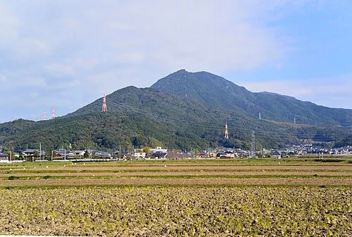 Mount Hōman Mountain, Dazaifu-shi5.2 km NE
-
 Kyushu Historical Museum Museum, Ogōri-shi8.8 km S
-
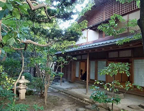 Rakusui-en Natural site, Hakata13 km NW
-
 Tōchō-ji Attraction, Hakata14 km NW
-
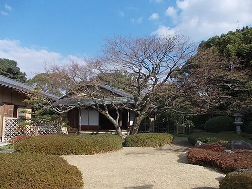 Shōfū-en Natural site, Chūō-ku14 km NW
-
 Shōfuku-ji Attraction, Hakata14 km NW
-
 Mt. Abura Mountain, Minami15 km W
Sources & licences
Data last updated: