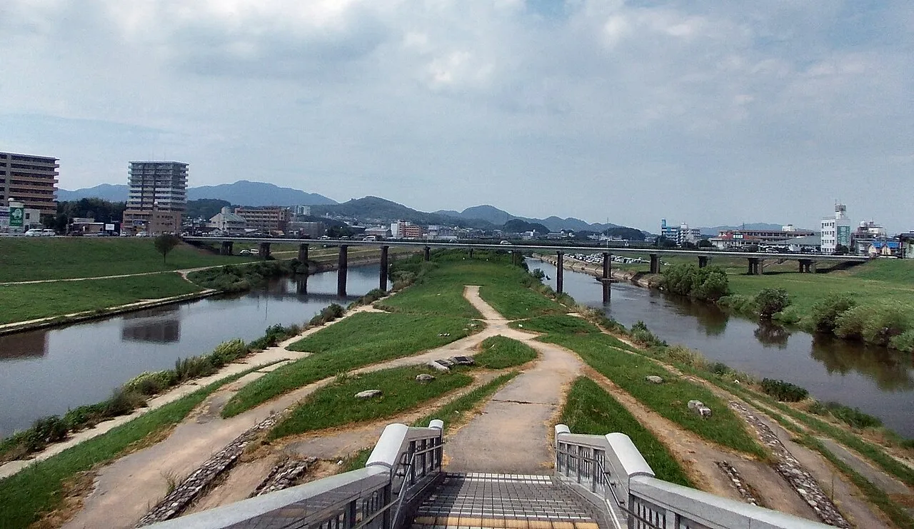
- Population
- 126,364
- 126.4K
- Elevation
- 21 m
- above sea level
- Local time
- UTC+09:00
- Asia/Tokyo · UTC+09:00
- Airports
- FUK Fukuoka Airport23 km
- KKJ Kitakyushu Airport40 km
About Iizuka
Iizuka is a city. Location: Iizuka Shi, Fukuoka. Population: 126,364. Elevation: 21 m.
Iizuka (飯塚市, Iizuka-shi; Japanese pronunciation: [ìí.(d͡)zɨ́.kä́(.ɕì), íí-]) is a city in Fukuoka Prefecture, Japan. As of 29 February 2024, the city had an estimated population of 124,757 in 63833 households, and a population density of 580 persons per km2. The total area of the city is 213.96 km2 (82.61 sq mi).
Source: Wikipedia · CC BY-SA 4.0
Photos of Iizuka
-

そらみみ · CC BY-SA 4.0 -

CompactV2 · CC BY-SA 4.0 -
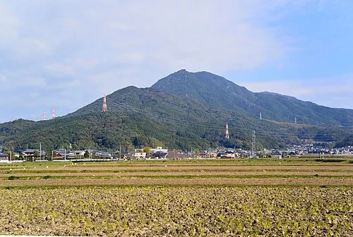
Mount Hōman Miya.m · CC BY-SA 3.0


Travel notes for Iizuka
From Wikivoyage
Fukuoka Prefecture (福岡県 Fukuoka-ken) is the most populous prefecture of Kyushu, Japan with a population of over 5 million.
Understand+
Fukuoka has a very old history and has had close contact with Japan's Asian neighbors, including the site of two Mongolian invasions in the late 13th century that were unsuccessful (due to typhoons, hence the term kamikaze). Its port has been used extensively in Japan's early history and is the entry point for the spread of Buddhism.
Tourist information site:
Visit Fukuoka is the prefecture's official multilingual guide site.
Get in+
By plane:
Fukuoka city's airport (FUK IATA) is the busiest on Kyushu and fields a fair number of international flights too, e.g. to South Korea, China and Taiwan. It also has connections in Japan to fifteen other major Japanese cities. Kitakyushu Airport (KKJ IATA) also has international flight.
By train:
Fukuoka City and Kitakyushu City are both on the shinkansen line that runs to and from Tokyo. The JR train system has several lines running across the prefecture, as well as from the Meinohama subway station in Fukuoka City to Karatsu in Saga.
By bus:
Nishitetsu is a company which provides daily service all over the prefecture as well as up to and down from Tokyo. Willer also offers long distance bus service to major cities in Japan.
By ship:
Fukuoka offers the Camellia Line Ferry and Beetle hydrofoil service to Busan, South Korea.
Source: Wikivoyage · CC BY-SA 4.0 · abridged
Places bordering Iizuka
- Nōgata
- Chikushino-shi
- Tagawa
- Miyawaka Shi
- Kama Shi
- Keisen Machi
- Sasaguri
- Sue Machi
- Umi
- Itoda Machi
- Fukuchi Machi
- Chikuzen-machi
Population of Iizuka over time
| 2010 | 131,492 | |
|---|---|---|
| 2015 | 129,146 | |
| 2020 | 126,136 |
Censuses and official estimates; source: Wikidata.
Climate of Iizuka
Best months for sightseeingBest months for sightseeing: May, October.
This month · November
Outside the best season
Day 17° · Night 8° · Rain 75 mm
Better nearby cities in November
- Beppu · 85 km southeast17°
- Ōita · 96 km southeast18°
- Nobeoka · 148 km southeast18°
- Hottest month
- August (day 31°)
- Coldest month
- January (night 1°)
- Wettest month
- July (315 mm)
- Driest month
- December (58 mm)
Bars: average monthly low and high temperature. Below: precipitation. Monthly averages for 1970–2000 at about 18 km resolution, adjusted for elevation. Highlighted months are mild and relatively dry. Source: WorldClim 2.1 (CC BY 4.0).
Show values as a table
| Month | Jan | Feb | Mar | Apr | May | Jun | Jul | Aug | Sep | Oct | Nov | Dec |
|---|---|---|---|---|---|---|---|---|---|---|---|---|
| Average high (°C) | 9° | 10° | 13° | 19° | 23° | 26° | 30° | 31° | 27° | 22° | 17° | 12° |
| Average low (°C) | 1° | 2° | 4° | 9° | 14° | 18° | 23° | 23° | 19° | 13° | 8° | 3° |
| Precipitation (mm) | 74 | 84 | 113 | 151 | 165 | 302 | 315 | 166 | 191 | 97 | 75 | 58 |
How to get to Iizuka
The nearest airport is Fukuoka Airport (FUK), 23 km to the west as the crow flies. The nearest large city is Chikushino-shi, 22 km to the southwest.
Airports
- Fukuoka Airport (FUK) Fukuoka 23 kmwest
- Kitakyushu Airport (KKJ) Kitakyushu 40 kmnortheast
- Yamaguchi Ube Airport (UBJ) Ube 64 kmnortheast
Nearby large cities
- Chikushino-shi Population: 103.3K 22 kmsouthwest
- Ōnojō Population: 102.1K 22 kmsouthwest
- Kasuga Population: 111K 24 kmsouthwest
- Kurume Population: 303.6K 39 kmsouthwest
- Shimonoseki Population: 265.7K 42 kmnortheast
Straight-line distances; road distances are longer. Airport data: OurAirports.
Day trips from Iizuka
Within 100 km: 20 historic and cultural sites, 17 natural sites, 12 lakes, rivers and coasts.
0–25 km2 places
- Kyūshū Kokuritsu Hakubutsukan Museum 19 kmSW
- Mount Hōman Mountain 15 kmSW
25–60 km26 places
- Hiko Shima Island 39 kmNE
- Kōzan Ji Attraction 48 kmNE
- Kanmon Kyō Landmark 44 kmNE
- Wakato Ōhashi Landmark 32 kmN
60–100 km21 places
- Iki Island Island 91 kmW
- Okino-shima Island 86 kmNW
- Kumamoto castle Historic site 92 kmS
- Shimabara Castle Historic site 99 kmS
Straight-line distances.
Iizuka and similar cities
Side by side with cities of similar size in the same country: population, elevation and climate.
| Measure | Iizuka | Koganei | Tsuruoka | Uruma |
|---|---|---|---|---|
| Population | 126.4K | 126.1K | 125.4K | 125.3K |
| Elevation | 21 m | 80 m | 13 m | 22 m |
| Summer day (hottest month) | 31° | 30° | 29° | 31° |
| Winter night (coldest month) | 1° | -1° | -2° | 14° |
| Annual rainfall | 1,791 mm | 1,461 mm | 1,855 mm | 2,081 mm |
| Best months | May, Oct | May–Jun, Oct | May–Jun, Sep | Nov–May |
| Distance | — | 840 km | 996 km | 850 km |
Climate values are 1970–2000 monthly averages; straight-line distance.
Nearby attractions & nature
Everything nearby-
Mount Hōman Mountain, Dazaifu-shi15 km SW
-
Kyūshū Kokuritsu Hakubutsukan Museum, Dazaifu-shi19 km SW
Sources & licences
Data last updated: · 2 independent sources