Kōriyama
Local name: 郡山市
Located in Kōriyama Shi, Fukushima Coordinates: 37°24′00″ N 140°23′00″ E
- Population
- 327,692
- 327.7K
- Elevation
- 236 m
- above sea level
- Local time
- UTC+09:00
- Asia/Tokyo · UTC+09:00
- Airports
- FKS Fukushima Airport20 km
- SDJ Sendai Airport95 km
About Kōriyama
Kōriyama is a city. Location: Kōriyama Shi, Fukushima. Population: 327,692. Elevation: 236 m.
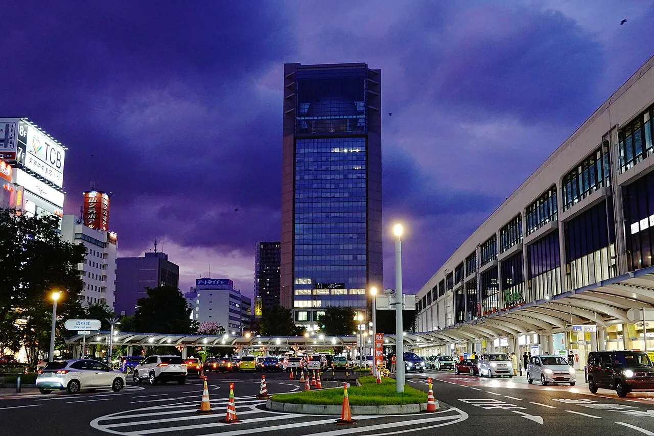
Kōriyama (郡山市, Kōriyama-shi) is a city in Fukushima Prefecture, Japan. As of 1 August 2023, the city had an estimated population of 321,938 people in 141,760 households, and a population density of 425 persons per km2. The total area of the city is 757.20 square kilometers (292.36 sq mi). Kōriyama is designated as a core city and functions as a commercial center for Fukushima Prefecture. Kōriyama is the third largest conurbation in the Tōhoku region.
Source: Wikipedia · CC BY-SA 4.0
Photos of Kōriyama
-

Machiro · CC BY-SA 4.0

Travel notes for Kōriyama
From Wikivoyage
Koriyama (郡山) is a city in Fukushima, Japan.
Understand+
Kōriyama originated as a regional governmental center in the Nara period, when the area was on the frontier of Yamato settlement of the Tohoku region. The surrounding area developed into shōen controlled by various samurai clans in the Heian and Kamakura periods. Nearby centers, such as Nihonmatsu developed into castle towns, Kōriyama remained as a commercial center and thrived as a post town because of its importance as a traffic focal point into the Edo period. As a major military equipment production center, Koriyama was subject to three large-scale air raids during WW2.
Kōriyama city is called the "commercial capital in Fukushima".
Tourist information site:
The local tourist association has a Japanese-only guide site. Its Pamphlet section contains some materials in English.
Get in+
Koriyama is the largest city in Fukushima Prefecture and has good rail, road and bus networks linking it to Tokyo in the south and other parts of Tohoku to the north and west.
The Tohoku Shinkansen is the fastest way to get to and from Tokyo (80 minutes, ¥7970), as well as other major cities in Tohoku, such as Fukushima and Sendai (40 minutes, ¥5240).
The Tohoku Main Line follows a similar route to the Shinkansen, and though cheaper, it is much slower and trains run far less regularly.
The West Ban'etsu Line connects Koriyama with Niigata in the west, travelling via the Mount Bandai region.
There are also buses linking Koriyama with Tokyo and Narita Airport.
Koriyama is situated on the Tohoku Expressway, with interchanges at Koriyama and Koriyama Minami.
The nearest airport, Fukushima Airport, is in Sukagawa city, about 20km to the south. Fukushima Airport has daily flights to Okinawa, Osaka and Sapporo, with less frequent international flights to Seoul and Shanghai.
Source: Wikivoyage · CC BY-SA 4.0 · abridged
Places bordering Kōriyama
- Sukagawa
- Aizu-Wakamatsu
- Nihommatsu
- Tamura
- Motomiya
- Inawashiro
- Ōtama Mura
- Ten’ei Mura
- Hirata Mura
- Miharu Machi
- Ono Machi
Twin towns and sister cities of Kōriyama
- Nara-shi· Japan
- Kurume· Japan
- Tottori-shi· Japan
Source: Wikidata. Only places with a page on this site are shown.
Population of Kōriyama over time
| 2010 | 338,712 | |
|---|---|---|
| 2015 | 335,444 | |
| 2021 | 327,040 |
Censuses and official estimates; source: Wikidata.
Climate of Kōriyama
Best months for sightseeingBest months for sightseeing: May–June, September.
This month · November
Outside the best season
Day 13° · Night 3° · Rain 61 mm
Better nearby cities in November
- Isehara · 242 km southwest18°
- Kofu · 252 km southwest17°
- Odawara · 262 km southwest19°
- Hottest month
- August (day 29°)
- Coldest month
- January (night -3°)
- Wettest month
- September (166 mm)
- Driest month
- January (41 mm)
Bars: average monthly low and high temperature. Below: precipitation. Monthly averages for 1970–2000 at about 18 km resolution, adjusted for elevation. Highlighted months are mild and relatively dry. Source: WorldClim 2.1 (CC BY 4.0).
Show values as a table
| Month | Jan | Feb | Mar | Apr | May | Jun | Jul | Aug | Sep | Oct | Nov | Dec |
|---|---|---|---|---|---|---|---|---|---|---|---|---|
| Average high (°C) | 5° | 5° | 9° | 16° | 21° | 23° | 27° | 29° | 24° | 19° | 13° | 8° |
| Average low (°C) | -3° | -3° | -1° | 5° | 10° | 15° | 19° | 20° | 16° | 9° | 3° | -1° |
| Precipitation (mm) | 41 | 46 | 67 | 89 | 96 | 136 | 151 | 153 | 166 | 122 | 61 | 50 |
How to get to Kōriyama
The nearest airport is Fukushima Airport (FKS), 20 km to the south as the crow flies. For international flights: Sendai Airport (SDJ) (95 km). The nearest large city is Fukushima, 40 km to the north.
Airports
- Fukushima Airport (FKS) Sukagawa 20 kmsouth
- Sendai Airport (SDJ) Natori 95 kmnortheast
- Yamagata Airport (GAJ) Higashine 112 kmnorth
Nearby large cities
- Fukushima Population: 294.2K 40 kmnorth
- Aizu-Wakamatsu Population: 118.2K 40 kmwest
- Iwaki Population: 357.3K 59 kmsoutheast
- Hitachi Population: 174.5K 92 kmsouth
- Yamagata Population: 248.8K 93 kmnorth
Straight-line distances; road distances are longer. Airport data: OurAirports.
Day trips from Kōriyama
Within 100 km: 1 historic or cultural site, 14 natural sites, 5 lakes, rivers and coasts.
25–60 km10 places
- Nekomaga Dake Mountain 39 kmNW
- Takayu-onsen Natural site 40 kmN
- Lake Hibara Lake 44 kmNW
- Mount Azuma-kofuji Mountain 37 kmN
60–100 km10 places
- Abukuma River River 86 kmNE
- Iimori Yama Mountain 61 kmNW
- Iide San Mountain 78 kmNW
- Echigo Sanmyaku Mountain 68 kmNW
Straight-line distances.
Kōriyama and similar cities
Side by side with cities of similar size in the same country: population, elevation and climate.
| Measure | Kōriyama | Kochi | Kita-ku | Maebashi |
|---|---|---|---|---|
| Population | 327.7K | 332.1K | 332.1K | 332.1K |
| Elevation | 236 m | 58 m | 17 m | 107 m |
| Summer day (hottest month) | 29° | 31° | 31° | 31° |
| Winter night (coldest month) | -3° | 2° | 1° | -2° |
| Annual rainfall | 1,178 mm | 2,076 mm | 1,432 mm | 1,337 mm |
| Best months | May–Jun, Sep | Apr–Jun, Oct–Nov | May–Jun, Oct | Apr–May, Oct |
| Distance | — | 754 km | 192 km | 160 km |
Climate values are 1970–2000 monthly averages; straight-line distance.
Sources & licences
Data last updated: · 2 independent sources