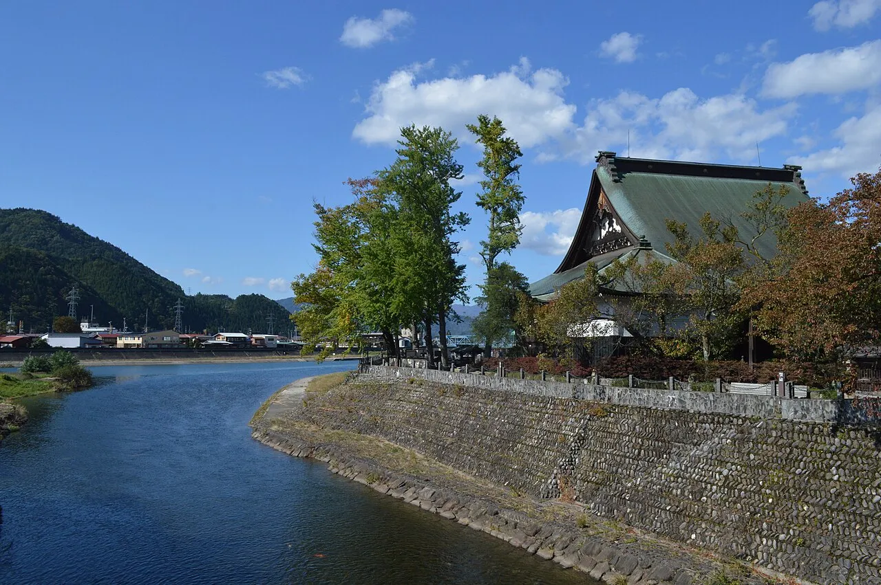
- Population
- 22,538
- 22.5K
- Elevation
- 491 m
- above sea level
- Local time
- UTC+09:00
- Asia/Tokyo · UTC+09:00
- Airports
- TOY Toyama Kitokito Airport46 km
- MMJ Shinshu-Matsumoto Airport67 km
About Furukawa
Furukawa is a town. Location: Hida Shi, Gifu. Population: 22,538. Elevation: 491 m. The best months to visit are May–June, September–October. The nearest airport is Toyama Kitokito Airport (46 km).
Photos of Furukawa
-

Raita Futo from Tokyo, Japan · CC BY 2.0 -

大野 一将 · CC BY-SA 4.0 -

大野 一将 · CC BY-SA 4.0 -

Waackapple · CC BY 4.0 -

Ocdp · CC0


Travel notes for Furukawa
From Wikivoyage
Hida (飛騨) is a city in the northern part of Gifu Prefecture.
Understand+
Known as Furukawa (古川) until its 2004 merger with nearby villages, the town is often likened to a small version of Takayama, with a popular spring festival and a small, well-preserved historical city center.
Tourist Information Site:
Hida Travel is the city's official multilingual guide site.
Get in+
Get off JR Hida Furukawa (飛騨古川) station on JR Takayama line. 15 minutes from Takayama by JR train.
Source: Wikivoyage · CC BY-SA 4.0 · abridged
Climate of Furukawa
Best months for sightseeingBest months for sightseeing: May–June, September–October.
This month · November
A wet month
Day 13° · Night 3° · Rain 108 mm
Better nearby cities in November
- Kofu · 140 km southeast17°
- Fujinomiya · 172 km southeast18°
- Fuji · 180 km southeast20°
- Hottest month
- August (day 29°)
- Coldest month
- January (night -5°)
- Wettest month
- September (246 mm)
- Driest month
- February (89 mm)
Bars: average monthly low and high temperature. Below: precipitation. Monthly averages for 1970–2000 at about 18 km resolution, adjusted for elevation. Highlighted months are mild and relatively dry. Source: WorldClim 2.1 (CC BY 4.0).
Show values as a table
| Month | Jan | Feb | Mar | Apr | May | Jun | Jul | Aug | Sep | Oct | Nov | Dec |
|---|---|---|---|---|---|---|---|---|---|---|---|---|
| Average high (°C) | 3° | 3° | 8° | 16° | 21° | 24° | 28° | 29° | 24° | 18° | 13° | 7° |
| Average low (°C) | -5° | -5° | -2° | 5° | 10° | 15° | 19° | 20° | 16° | 9° | 3° | -2° |
| Precipitation (mm) | 98 | 89 | 122 | 147 | 148 | 219 | 240 | 195 | 246 | 138 | 108 | 94 |
Other places to visit in this season: May June September October
How to get to Furukawa
The nearest airport is Toyama Kitokito Airport (TOY), 46 km to the north as the crow flies. For international flights: Komatsu Airport / JASDF Komatsu Air Base (KMQ) (72 km). The nearest large city is Toyama, 52 km to the north.
Airports
- Toyama Kitokito Airport (TOY) Toyama 46 kmnorth
- Shinshu-Matsumoto Airport (MMJ) Matsumoto 67 kmeast
- Komatsu Airport / JASDF Komatsu Air Base (KMQ) Kanazawa 72 kmwest
Nearby large cities
- Toyama Population: 415.8K 52 kmnorth
- Takaoka Population: 170.1K 59 kmnorth
- Matsutō Population: 110.4K 64 kmnorthwest
- Kanazawa Population: 466K 65 kmnorthwest
- Komatsu Population: 108.5K 68 kmwest
Straight-line distances; road distances are longer. Airport data: OurAirports.
Day trips from Furukawa
Within 100 km: 2 historic and cultural sites, 39 natural sites, 19 lakes, rivers and coasts.
0–25 km1 place
- Kurai Yama Mountain 22 kmS
25–60 km26 places
- Mount Tsurugi Mountain 58 kmNE
- Itoshiro River River 58 kmSW
- Mount Norikura Mountain 36 kmSE
- Mount Dainichi Mountain 40 kmSW
60–100 km33 places
- Honshu Island 78 kmE
- Chausu-yama Mountain 74 kmSE
- Mount Sannosawa Mountain 76 kmSE
- Mount Azumaya Mountain 81 kmE
Straight-line distances.
Sources & licences
Data last updated: