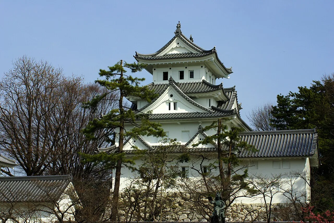
- Population
- 161,539
- 161.5K
- Elevation
- 7 m
- above sea level
- Local time
- UTC+09:00
- Asia/Tokyo · UTC+09:00
- Airports
- NKM Nagoya Airport / JASDF Komaki Air Base30 km
- NGO Chubu Centrair International Airport57 km
About Ōgaki
Ōgaki is a city. Location: Ōgaki Shi, Gifu. Population: 161,539. Elevation: 7 m.
Ōgaki (大垣市, Ōgaki-shi; Japanese pronunciation: [ò̞ó̞.ɡä́.k̟ʲí, -k̟ʲi̥.ɕì, -ŋä́-]) is a city located in Gifu, Japan. As of October 31, 2018, the city had an estimated population of 161,539, and a population density of 782 persons per km2 in 65,931 households. The total area of the city was 206.57 square kilometres (79.76 sq mi). Ōgaki was the final destination for the haiku poet Matsuo Bashō on one of his long journeys as recounted in his book Oku no Hosomichi. Every November the city holds a Bashō Festival.
Source: Wikipedia · CC BY-SA 4.0
Photos of Ōgaki
-

アセルス · CC BY-SA 4.0 -

アセルス · CC BY-SA 4.0 -

アセルス · CC BY-SA 4.0


Travel notes for Ōgaki
From Wikivoyage
Ogaki is a small/mid-sized city located 10 minutes by train from Gifu City, the capital of Gifu Prefecture. The population of Ogaki in 2012 was 164,000.
Understand+
Tourist information site:
水都旅 すいとりっぷ is a Japanese-only tourist guide site for the city and surrounding areas.
Get in+
Most travelers will arrive via the Tokaido Main Line. The line runs from Maibara to the west through Ogaki and onward to Gifu, Nagoya, and Toyohashi. Although Gifu-Hashima Station is within Gifu Prefecture, those traveling by Shinkansen can get here faster by transferring at Maibara (from the west) or Nagoya (from the east).
The Yoro Line runs from the northern city of Ibigawa (Ibi Station) to Kuwana down in Mie Prefecture. The Tarumi Line connects Ogaki with Motosu, although if you're in Motosu, you probably already went through Ogaki to get there.
The Sunomata area can be reached by bus from Gifu Station.
Source: Wikivoyage · CC BY-SA 4.0 · abridged
Places bordering Ōgaki
- Gifu
- Mizuho Shi
- Anpachi Chō
- Gōdo
- Wanouchi Chō
- Tarui
- Sekigahara Chō
- Ikeda Chō
- Yōrō Chō
- Maibara
- Taga Chō
- Inabe
Population of Ōgaki over time
| 2010 | 161,160 | |
|---|---|---|
| 2015 | 159,879 | |
| 2021 | 158,386 |
Censuses and official estimates; source: Wikidata.
Climate of Ōgaki
Best months for sightseeingBest months for sightseeing: May–June, October.
This month · November
A wet month
Day 16° · Night 7° · Rain 103 mm
Better nearby cities in November
- Kofu · 180 km east17°
- Fujinomiya · 182 km east18°
- Fuji · 189 km east20°
- Hottest month
- August (day 31°)
- Coldest month
- January (night 0°)
- Wettest month
- July (268 mm)
- Driest month
- December (83 mm)
Bars: average monthly low and high temperature. Below: precipitation. Monthly averages for 1970–2000 at about 18 km resolution, adjusted for elevation. Highlighted months are mild and relatively dry. Source: WorldClim 2.1 (CC BY 4.0).
Show values as a table
| Month | Jan | Feb | Mar | Apr | May | Jun | Jul | Aug | Sep | Oct | Nov | Dec |
|---|---|---|---|---|---|---|---|---|---|---|---|---|
| Average high (°C) | 8° | 8° | 12° | 18° | 23° | 26° | 30° | 31° | 27° | 22° | 16° | 11° |
| Average low (°C) | 0° | 0° | 3° | 9° | 13° | 18° | 22° | 23° | 19° | 13° | 7° | 2° |
| Precipitation (mm) | 95 | 101 | 136 | 181 | 180 | 266 | 268 | 168 | 243 | 138 | 103 | 83 |
How to get to Ōgaki
The nearest airport is Nagoya Airport / JASDF Komaki Air Base (NKM), 30 km to the east as the crow flies. For international flights: Chubu Centrair International Airport (NGO) (57 km). The nearest large city is Gifu, 15 km to the northeast.
Airports
- Nagoya Airport / JASDF Komaki Air Base (NKM) Nagoya 30 kmeast
- Chubu Centrair International Airport (NGO) Tokoname 57 kmsouth
- Komatsu Airport / JASDF Komatsu Air Base (KMQ) Kanazawa 117 kmnorth
Nearby large cities
- Gifu Population: 402.6K 15 kmnortheast
- Ichinomiya Population: 380.1K 18 kmeast
- Inazawa Population: 134.8K 19 kmsoutheast
- Kakamigahara Population: 144.5K 24 kmeast
- Komaki Population: 148.9K 28 kmeast
Straight-line distances; road distances are longer. Airport data: OurAirports.
Day trips from Ōgaki
Within 100 km: 27 historic and cultural sites, 27 natural sites, 34 lakes, rivers and coasts.
0–25 km4 places
- Neo River River 7 kmN
- Tsubo-gawa River 24 kmNE
- Mount Ryōzen Mountain 23 kmW
- Mount Ibuki Mountain 21 kmW
25–60 km21 places
- Toyota Stadium Landmark 58 kmSE
- Hida River River 41 kmE
- Nikkō River River 36 kmSE
- Hori River River 38 kmSE
60–100 km63 places
- Tōshi-jima Island 95 kmS
- Himakajima Island 80 kmSE
- Sakate-jima Island 98 kmS
- Kami-jima Island 95 kmS
Straight-line distances.
Ōgaki and similar cities
Side by side with cities of similar size in the same country: population, elevation and climate.
| Measure | Ōgaki | Miyakonojō | Sayama | Hadano |
|---|---|---|---|---|
| Population | 161.5K | 161.1K | 160.8K | 163.8K |
| Elevation | 7 m | 148 m | 81 m | 103 m |
| Summer day (hottest month) | 31° | 31° | 30° | 30° |
| Winter night (coldest month) | 0° | 0° | -2° | 0° |
| Annual rainfall | 1,962 mm | 2,483 mm | 1,388 mm | 1,650 mm |
| Best months | May–Jun, Oct | Apr–Jun, Oct–Nov | Apr–Jun, Sep–Oct | May–Jun, Oct |
| Distance | — | 653 km | 259 km | 237 km |
Climate values are 1970–2000 monthly averages; straight-line distance.
Nearby attractions & nature
Everything nearby-
Neo River River, Gifu6.7 km N
-
Mount Ryōzen Mountain, Taga Chō23 km W
-
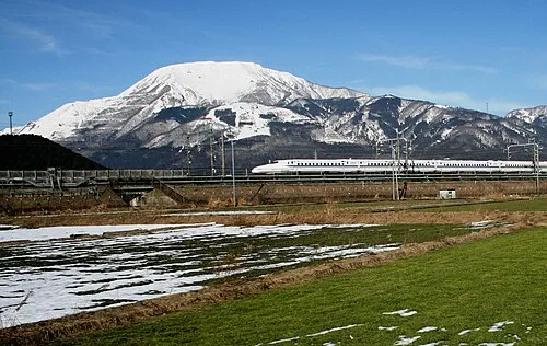 Mount Ibuki Mountain, Maibara-shi21 km W
-
Tsubo-gawa River, Gifu24 km NE
Sources & licences
Data last updated: · 2 independent sources