- Elevation
- 669 m
- above sea level
- Local time
- UTC+09:00
- Asia/Tokyo · UTC+09:00
- Places inside
- 1
- listed under Ōno Gun
- Airports
- KMQ Komatsu Airport / JASDF Komatsu Air Base47 km
- TOY Toyama Kitokito Airport55 km
About Ōno Gun
Ōno Gun is a district. Location: Gifu, Japan.
Ōno (大野郡, Ōno-gun) is a district located in Gifu Prefecture, Japan. The district is in a mountainous region near the geographic centre of Japan. Prior to February 1, 2005, the district comprised seven small communities, but on that day six of them merged into the expanded city of Takayama. Ōno district now contains only the village of Shirakawa, which is declining to merge with any municipality. As of July 2011, and counting only the village of Shirakawa, the district has an estimated population of 1,734.
Source: Wikipedia · CC BY-SA 4.0
At a glance
- Built
- 1879
Source: Wikidata
Climate of Ōno Gun
Best months for sightseeingBest months for sightseeing: May–June, September.
This month · November
A wet month
Day 12° · Night 3° · Rain 121 mm
Better nearby cities in November
- Kofu · 164 km east17°
- Fujinomiya · 192 km southeast18°
- Fuji · 201 km southeast20°
- Hottest month
- August (day 28°)
- Coldest month
- January (night -6°)
- Wettest month
- September (270 mm)
- Driest month
- February (102 mm)
Bars: average monthly low and high temperature. Below: precipitation. Monthly averages for 1970–2000 at about 18 km resolution, adjusted for elevation. Highlighted months are mild and relatively dry. Source: WorldClim 2.1 (CC BY 4.0).
Show values as a table
| Month | Jan | Feb | Mar | Apr | May | Jun | Jul | Aug | Sep | Oct | Nov | Dec |
|---|---|---|---|---|---|---|---|---|---|---|---|---|
| Average high (°C) | 2° | 2° | 7° | 14° | 20° | 23° | 27° | 28° | 23° | 18° | 12° | 6° |
| Average low (°C) | -6° | -6° | -2° | 4° | 9° | 14° | 19° | 20° | 16° | 9° | 3° | -2° |
| Precipitation (mm) | 115 | 102 | 131 | 163 | 165 | 238 | 269 | 230 | 270 | 151 | 121 | 112 |
How to get to Ōno Gun
The nearest airport is Komatsu Airport / JASDF Komatsu Air Base (KMQ), 47 km to the northwest as the crow flies. The nearest large city is Matsutō, 43 km to the northwest.
Airports
- Komatsu Airport / JASDF Komatsu Air Base (KMQ) Kanazawa 47 kmnorthwest
- Toyama Kitokito Airport (TOY) Toyama 55 kmnortheast
- Shinshu-Matsumoto Airport (MMJ) Matsumoto 94 kmeast
Nearby large cities
- Matsutō Population: 110.4K 43 kmnorthwest
- Komatsu Population: 108.5K 44 kmnorthwest
- Kanazawa Population: 466K 48 kmnorthwest
- Takaoka Population: 170.1K 60 kmnorth
- Toyama Population: 415.8K 61 kmnortheast
Straight-line distances; road distances are longer. Airport data: OurAirports.
Day trips from Ōno Gun
Within 100 km: 2 historic and cultural sites, 33 natural sites, 18 lakes, rivers and coasts.
0–25 km4 places
- Mount Dainichi Mountain 25 kmS
- Haku-san Mountain 12 kmSW
- Mount Sannomine Mountain 18 kmSW
- Betsu-zan Mountain 16 kmSW
25–60 km8 places
- Kakehashi River River 45 kmNW
- Mount Utatsu Mountain 43 kmNW
- Mount Iō Mountain 34 kmN
- Asano River River 51 kmNW
60–100 km41 places
- Mount Sekidō Mountain 83 kmN
- Toyama-wan Natural site 73 kmN
- Kuzuryu River River 66 kmW
- Sho River River 66 kmN
Straight-line distances.
Places in Ōno Gun
1 placeBar: population relative to the most populous place in this list.
Nearby attractions & nature
Everything nearby-
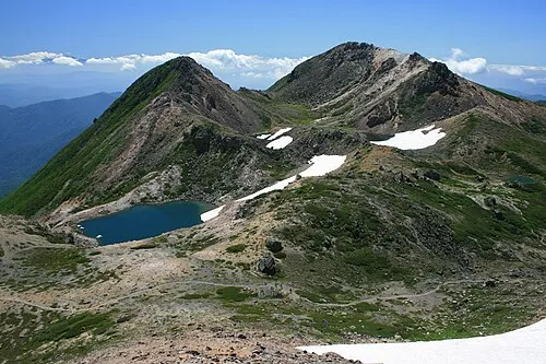 Haku-san Mountain, Hakusan Shi12 km SW
-
Mount Sannomine Mountain, Takayama Shi18 km SW
-
 Mount Dainichi Mountain, Gujō Shi25 km S
Sources & licences
Data last updated: · 2 independent sources