- Population
- 31,476
- 31.5K
- Elevation
- 3 m
- above sea level
- Local time
- UTC+09:00
- Asia/Tokyo · UTC+09:00
- Places inside
- 1
- listed under Yōrō Chō
- Airports
- NKM Nagoya Airport / JASDF Komaki Air Base33 km
- NGO Chubu Centrair International Airport53 km
About Yōrō Chō
Yōrō Chō is a municipality. Location: Yōrō-gun, Gifu. Population: 31,476. Elevation: 3 m.
Yōrō (養老町, Yōrō-chō) is a town located in Yōrō District, Gifu Prefecture, Japan. As of 1 April 2018, the town had an estimated population of 29,309 in 10,356 households and a population density of 405 persons per km2. The total area of the town was 72.29 square kilometres (27.91 sq mi).
Source: Wikipedia · CC BY-SA 4.0
Travel notes for Yōrō Chō
From Wikivoyage
Yōrō (養老町 Yōrō-chō) is a small town in southwestern Gifu Prefecture, Japan nestled between the farming land of greater Nagoya and the mountains.
Understand+
Yōrō lies at the foot of the mountains and is a popular momiji (autumn colours) viewing spot of central Japan. It is also the region chosen by the architectural duo Arakawa-Ginz to be first turned into their vision of the future.
Tourist information site:
The local tourist association has a Japanese-only guide site.
Get in+
Yoro Railway (養老鉄道) operates trains along the Yoro Line that stop in Yoro. To reach the Yoro Line, you can transfer from Ogaki or Kuwana.
Nexco also upkeeps an expressway service area and interchange on the northern fringe of town.
Source: Wikivoyage · CC BY-SA 4.0 · abridged
Places bordering Yōrō Chō
- Ōgaki
- Kaizu-shi
- Tarui
- Wanouchi Chō
- Inabe
Population of Yōrō Chō over time
| 2010 | 31,332 | |
|---|---|---|
| 2015 | 29,029 | |
| 2020 | 26,565 |
Censuses and official estimates; source: Wikidata.
Climate of Yōrō Chō
Best months for sightseeingBest months for sightseeing: May–June, October.
This month · November
Outside the best season
Day 16° · Night 7° · Rain 94 mm
Better nearby cities in November
- Kofu · 186 km east17°
- Fujinomiya · 187 km east18°
- Fuji · 193 km east20°
- Hottest month
- August (day 31°)
- Coldest month
- January (night 1°)
- Wettest month
- June (267 mm)
- Driest month
- December (65 mm)
Bars: average monthly low and high temperature. Below: precipitation. Monthly averages for 1970–2000 at about 18 km resolution, adjusted for elevation. Highlighted months are mild and relatively dry. Source: WorldClim 2.1 (CC BY 4.0).
Show values as a table
| Month | Jan | Feb | Mar | Apr | May | Jun | Jul | Aug | Sep | Oct | Nov | Dec |
|---|---|---|---|---|---|---|---|---|---|---|---|---|
| Average high (°C) | 8° | 9° | 12° | 18° | 23° | 26° | 30° | 31° | 27° | 22° | 16° | 11° |
| Average low (°C) | 1° | 1° | 3° | 9° | 14° | 18° | 22° | 23° | 20° | 13° | 7° | 3° |
| Precipitation (mm) | 73 | 89 | 130 | 180 | 180 | 267 | 263 | 171 | 242 | 136 | 94 | 65 |
How to get to Yōrō Chō
The nearest airport is Nagoya Airport / JASDF Komaki Air Base (NKM), 33 km to the east as the crow flies. For international flights: Chubu Centrair International Airport (NGO) (53 km). The nearest large city is Ōgaki, 8 km to the northeast.
Airports
- Nagoya Airport / JASDF Komaki Air Base (NKM) Nagoya 33 kmeast
- Chubu Centrair International Airport (NGO) Tokoname 53 kmsoutheast
- Osaka Itami International Airport (ITM) Osaka 117 kmsouthwest
Nearby large cities
- Ōgaki Population: 161.5K 8 kmnortheast
- Inazawa Population: 134.8K 20 kmeast
- Ichinomiya Population: 380.1K 21 kmeast
- Gifu Population: 402.6K 23 kmnortheast
- Kuwana Population: 140.1K 28 kmsouth
Straight-line distances; road distances are longer. Airport data: OurAirports.
Day trips from Yōrō Chō
Within 100 km: 29 historic and cultural sites, 26 natural sites, 35 lakes, rivers and coasts.
0–25 km3 places
- Neo River River 15 kmNE
- Mount Ryōzen Mountain 17 kmW
- Mount Ibuki Mountain 20 kmNW
25–60 km24 places
- Chita-hantō Natural site 59 kmSE
- Toyota Stadium Landmark 60 kmE
- Hida River River 48 kmE
- Nikkō River River 33 kmSE
60–100 km63 places
- Tōshi-jima Island 90 kmS
- Himakajima Island 76 kmSE
- Sakate-jima Island 93 kmS
- Kami-jima Island 91 kmSE
Straight-line distances.
Places in Yōrō Chō
1 placeBar: population relative to the most populous place in this list.
Nearby attractions & nature
Everything nearby-
Mount Ryōzen Mountain, Taga Chō17 km W
-
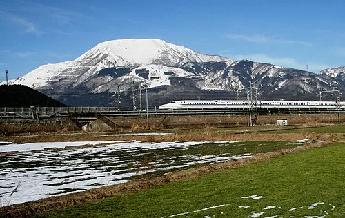 Mount Ibuki Mountain, Maibara-shi20 km NW
-
Neo River River, Gifu15 km NE
Sources & licences
Data last updated: · 2 independent sources