- Population
- 340,934
- 340.9K
- Elevation
- 157 m
- above sea level
- Local time
- UTC+09:00
- Asia/Tokyo · UTC+09:00
- Places inside
- 1
- listed under Maebashi Shi
- Airports
- MMJ Shinshu-Matsumoto Airport112 km
- HND Tokyo Haneda International Airport113 km
About Maebashi Shi
Maebashi Shi is a district. Location: Gunma, Japan. Population: 340,934.
Maebashi (前橋市, Maebashi-shi; Japanese pronunciation: [mä̀.é̞.bä̀.ɕì, mä́.è̞.bä̀.ɕì, mä̀.é̞.bä́.ɕí.ɕì, -ɕi̥.ɕì]) is the capital city of Gunma Prefecture, in the northern Kantō region of Japan. As of 31 August 2020, the city had an estimated population of 335,352 in 151,171 households, and a population density of 1100 persons per km2. The total area of the city is 311.59 km2 (120.31 sq mi). It was the most populous city within Gunma Prefecture until Takasaki merged with nearby towns between 2006 and 2009.
Read more on Wikipedia Text: Wikipedia contributors · CC BY-SA 4.0 · shortened
Places bordering Maebashi Shi
- Kiryū
- Takasaki
- Isesaki
- Shibukawa
- Numata
- Yoshioka Machi
- Shintō Mura
- Tamamura Machi
Twin towns and sister cities of Maebashi Shi
- Birmingham· United States
Source: Wikidata. Only places with a page on this site are shown.
Population of Maebashi Shi over time
| 2010 | 340,291 | |
|---|---|---|
| 2015 | 336,154 | |
| 2021 | 331,849 |
Censuses and official estimates; source: Wikidata.
Climate of Maebashi Shi
Best months for sightseeingBest months for sightseeing: May, October.
Bars: average monthly low and high temperature. Below: precipitation. Monthly averages for 1970–2000 at about 18 km resolution, adjusted for elevation. Highlighted months are mild and relatively dry. Source: WorldClim 2.1 (CC BY 4.0).
Show values as a table
| Month | Jan | Feb | Mar | Apr | May | Jun | Jul | Aug | Sep | Oct | Nov | Dec |
|---|---|---|---|---|---|---|---|---|---|---|---|---|
| Average high (°C) | 9° | 9° | 12° | 18° | 23° | 26° | 29° | 31° | 26° | 21° | 16° | 11° |
| Average low (°C) | -3° | -2° | 1° | 7° | 12° | 16° | 20° | 21° | 18° | 11° | 5° | 0° |
| Precipitation (mm) | 68 | 73 | 75 | 87 | 101 | 157 | 161 | 169 | 187 | 126 | 73 | 60 |
Airports nearest to Maebashi Shi
- Shinshu-Matsumoto Airport (MMJ) Matsumoto 112 km
- Tokyo Haneda International Airport (HND) Tokyo 113 km
- Ibaraki Airport (IBR) Omitama 118 km
Straight-line distance; airports with scheduled flights only. Source: OurAirports (public domain).
Places in Maebashi Shi
1 placeBar: population relative to the most populous place in this list.
Nearby attractions & nature
Everything nearby-
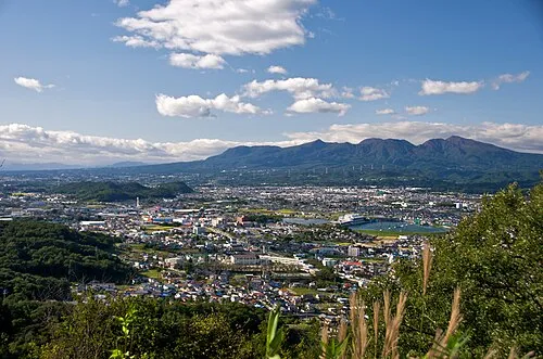 Mount Akagi Mountain, Gunma16 km N
-
Agatsuma River River, Gunma14 km NW
-
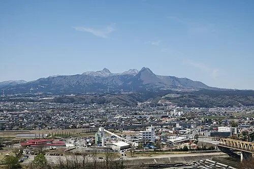 Mount Haruna Mountain, Gunma24 km W
-
 Lake Haruna Lake, Gunma25 km W
-
Karasu River River, Japan16 km S
Sources & licences
Data last updated: · 2 independent sources