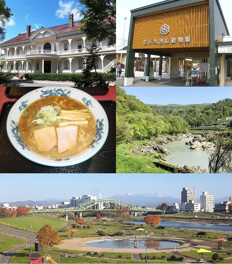
- Population
- 333,530
- 333.5K
- Elevation
- 121 m
- above sea level
- Local time
- UTC+09:00
- Asia/Tokyo · UTC+09:00
- Airports
- AKJ Asahikawa Airport13 km
- MBE Monbetsu Airport102 km
About Asahikawa
Asahikawa is a city. Location: Asahikawa City, Hokkaido. Population: 333,530. Elevation: 121 m. The best months to visit are June–September. The nearest airport is Asahikawa Airport (13 km). Nearby sights include Asahiyama Zoo and Mount Rubeshibe.
Photos of Asahikawa
-
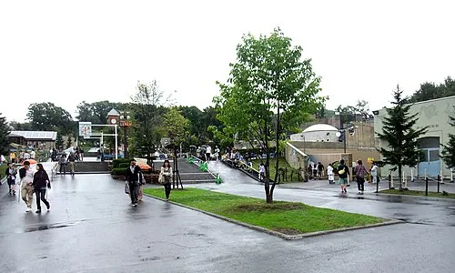
Asahiyama Zoo Mamusi Taka · CC BY-SA 3.0

Travel notes for Asahikawa
From Wikivoyage
Asahikawa (旭川) is the second-largest city on the northern island of Hokkaido, Japan. It is located at the confluence of four rivers and is surrounded by hills. It is near the centre of Hokkaido, and is a good base for visiting the nearby Daisetsuzan mountain range and the picturesque Biei-Furano area. The place has few foreign visitors, though Asahiyama Zoo attracts many Japanese tourists.
Understand+
With 130 rivers and streams, and over 740 bridges in the city, Asahikawa is a pleasant city to walk or cycle around, especially during the warm season. It is a middle-sized city with a rural feel and direct access to the mountain and outdoor areas.
1 Tourist Information Center, 8 Chome-3-1 Miyashitadōri (in Asahikawa Station), ☏ +61-166-24-2552. This center is a good place for information on transit and lodging. You can also buy local merchandise.
2 Higashikawa Information Center (東川町インフォメーションセンター 道草館), Higashimachi 1-1-15, Higashikawa, Kamikawa (on Highway 1150, a few kilometres SE of central Asahikawa), ☏ +81 166 68-4777. This rest area and information center ("michinoeki") has maps and information on the area. It also has extensive free indoor and outdoor seating, a gift shop, and a small deli selling fried food and ice cream. In the evening, the parking lot is quiet, and there is little road traffic.
Tourist information site:
The local tourist association has a Japanese-only guide site with integrated Google Translate.
The city government's site has a Japanese-only section on tourism.
Get in+
By plane:
1 Asahikawa Airport (AKJ IATA, 旭川空港), 2 Sen-16-98 Higashi, Higashikagura, ☏ +81 166-83-3939. Serves flights to Tokyo Haneda. There are also seasonal flights to Taipei on every Tuesday. The airport is a 30-minute bus ride from Asahikawa station.
By train:
2 Asahikawa station (旭川駅). (updated Sep 2025) is the terminus of the JR Hakodate Main Line to Sapporo, Otaru and Hakodate. The spacious station hosts a tourist information centre and lounge with free wifi; helpful English speakers are usually available.
From Sapporo:
The limited express Lilac and Kamui run from Sapporo frequently: every 30 min in the morning and evening, and hourly at other times. Additionally the limited express Soya runs one daily trip from Sapporo and the Okhotsk runs two daily trips. Journey time 1h 30min.
Local trains do not run directly from Sapporo, requiring one or two changes along the way. Total journey time can easily exceed 3h. Unless you have a Seishun 18 Ticket a bus may be the better option.
From Biei, Furano:
Asahikawa is the terminus of the Furano line. Service is infrequent: approximately once an hour in the morning and evenings and every two hours at other times. Journey time from Biei is 30min, from Furano it’s 1h. Until 2026 the Furano-Biei Norokko Train runs three times daily (in summer) from Furano and Biei; reservations are mandatory.
From Wakkanai:
Two limited express trains run from Wakkanai. The once daily Soya and the twice daily Sarobetsu (3h 40min).
The sparse local trains do not run directly from Wakkanai, requiring a change of trains at Nayoro. (From 5h 30min). As of 2025, two such connections are possible, departing Wakkanai 10:29 or 18:11 and arriving at Asahikawa 15:55 or 23:42.
From Abashiri:
The limited express Okhotsk runs twice daily from Abashiri (3h 45min). This is supplemented by the twice daily rapid express Taisetsu (3h 45min) and the once daily rapid Kitami (4h 7min).
Source: Wikivoyage · CC BY-SA 4.0 · abridged
Climate of Asahikawa
Best months for sightseeingBest months for sightseeing: June–September.
This month · November
A wet month
Day 6° · Night -2° · Rain 105 mm
- Hottest month
- August (day 26°)
- Coldest month
- January (night -13°)
- Wettest month
- August (140 mm)
- Driest month
- February (45 mm)
Bars: average monthly low and high temperature. Below: precipitation. Monthly averages for 1970–2000 at about 18 km resolution, adjusted for elevation. Highlighted months are mild and relatively dry. Source: WorldClim 2.1 (CC BY 4.0).
Show values as a table
| Month | Jan | Feb | Mar | Apr | May | Jun | Jul | Aug | Sep | Oct | Nov | Dec |
|---|---|---|---|---|---|---|---|---|---|---|---|---|
| Average high (°C) | -4° | -3° | 2° | 10° | 17° | 21° | 25° | 26° | 21° | 14° | 6° | -1° |
| Average low (°C) | -13° | -13° | -8° | 0° | 6° | 11° | 16° | 16° | 11° | 4° | -2° | -8° |
| Precipitation (mm) | 64 | 45 | 52 | 59 | 75 | 72 | 102 | 140 | 139 | 113 | 105 | 82 |
Other places to visit in this season: June July August September
How to get to Asahikawa
The nearest airport is Asahikawa Airport (AKJ), 13 km to the southeast as the crow flies. The nearest large city is Ebetsu, 99 km to the southwest.
Airports
- Asahikawa Airport (AKJ) Higashikagura 13 kmsoutheast
- Monbetsu Airport (MBE) Monbetsu 102 kmnortheast
- Sapporo Okadama Airport (OKD) Sapporo 108 kmsouthwest
Nearby large cities
- Ebetsu Population: 134K 99 kmsouthwest
- Sapporo Population: 2M 113 kmsouthwest
- Obihiro Population: 166.5K 117 kmsoutheast
- Kitami Population: 119.1K 123 kmeast
- Otaru Population: 115.3K 128 kmsouthwest
Straight-line distances; road distances are longer. Airport data: OurAirports.
Day trips from Asahikawa
Within 100 km: 1 historic or cultural site, 36 natural sites, 6 lakes, rivers and coasts.
0–25 km2 places
- Mount Rubeshibe Mountain 25 kmS
- Asahiyama Zoo Attraction 9 kmE
25–60 km22 places
- Hokkaido Island 59 kmSE
- Daisetsu-zan Mountain 44 kmE
- Mount Asahi Mountain 41 kmE
- Mount Otofuke Mountain 59 kmSE
60–100 km19 places
- Mount Midori Mountain 61 kmE
- Mount Tomamu Mountain 79 kmS
- Mount Sahoro Mountain 75 kmSE
- Kitami Sanchi Mountain 72 kmNE
Straight-line distances.
Asahikawa and similar cities
Side by side with cities of similar size in the same country: population, elevation and climate.
| Measure | Asahikawa | Maebashi | Kita-ku | Kochi |
|---|---|---|---|---|
| Population | 333.5K | 332.1K | 332.1K | 332.1K |
| Elevation | 121 m | 107 m | 17 m | 58 m |
| Summer day (hottest month) | 26° | 31° | 31° | 31° |
| Winter night (coldest month) | -13° | -2° | 1° | 2° |
| Annual rainfall | 1,048 mm | 1,337 mm | 1,432 mm | 2,076 mm |
| Best months | Jun–Sep | Apr–May, Oct | May–Jun, Oct | Apr–Jun, Oct–Nov |
| Distance | — | 865 km | 918 km | 1,369 km |
Climate values are 1970–2000 monthly averages; straight-line distance.
Nearby attractions & nature
Everything nearby-
Asahiyama Zoo Attraction, Asahikawa City9.2 km E
-
Mount Rubeshibe Mountain, Biei Chō25 km S
Sources & licences
Data last updated: