Shinhidaka Chō
Local name: 新ひだか町
Located in Hidaka-gun, Hokkaido Coordinates: 42°25′46″ N 142°38′25″ E
- Population
- 24,744
- 24.7K
- Elevation
- 738 m
- above sea level
- Local time
- UTC+09:00
- Asia/Tokyo · UTC+09:00
- Places inside
- 5
- listed under Shinhidaka Chō
- Airports
- OBO Tokachi-Obihiro Airport58 km
- CTS New Chitose Airport87 km
About Shinhidaka Chō
Shinhidaka Chō is a municipality. Location: Hidaka-gun, Hokkaido. Population: 24,744. Elevation: 738 m.
Shinhidaka (新ひだか町, Shinhidaka-chō) is a town located in Hidaka Subprefecture, Hokkaidō, Japan. As of 31 December 2025, the town had an estimated population of 19,785 in 1120 households, and a population density of 17 people per km2. The total area of the town is 1,147.55 km2 (443.07 sq mi). Although Urakawa is the capital of Hidaka Subprefecture, Shinhidaka is the most populous town and the economic center of the subprefecture.
Source: Wikipedia · CC BY-SA 4.0
Photos of Shinhidaka Chō
-
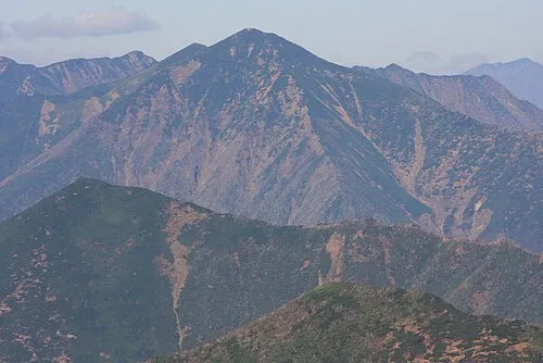
Mount Petegari Highten31 · CC BY-SA 3.0 -

Nakano Dake Koda6029 · CC0


Travel notes for Shinhidaka Chō
From Wikivoyage
Shinhidaka (新ひだか) is a town in Hidaka Subprefecture, Hokkaido.
Understand+
On 2006, the town of Mitsuishi (三石町) merged with the town of Shizunai (静内町) to create the new town of Shinhidaka. Shizunai is the largest town in the Subprefecture.
Tourist information site:
The local tourist association has a multilingual guide site.
Get in+
By train:
JR Hidaka main line
By bus:
Donan Bus. Connects Shizunai to Sapporo (2.5 hrs). ¥2,340.
By car:
Shizunai is about 2.5 hours from Sapporo by car.
Source: Wikivoyage · CC BY-SA 4.0 · abridged
Places bordering Shinhidaka Chō
- Urakawa
- Niikappu Chō
- Taiki Chō
- Nakasatsunai Mura
Twin towns and sister cities of Shinhidaka Chō
- Lexington· United States
- Sumoto· Japan
- Minamiawaji Shi· Japan
- Mima Shi· Japan
Source: Wikidata. Only places with a page on this site are shown.
Population of Shinhidaka Chō over time
| 2010 | 25,419 | |
|---|---|---|
| 2015 | 23,231 | |
| 2020 | 21,873 |
Censuses and official estimates; source: Wikidata.
Climate of Shinhidaka Chō
Best months for sightseeingBest months for sightseeing: July–August.
This month · November
A cold month
Day 5° · Night -4° · Rain 93 mm
- Hottest month
- August (day 20°)
- Coldest month
- January (night -13°)
- Wettest month
- September (163 mm)
- Driest month
- February (44 mm)
Bars: average monthly low and high temperature. Below: precipitation. Monthly averages for 1970–2000 at about 18 km resolution, adjusted for elevation. Highlighted months are mild and relatively dry. Source: WorldClim 2.1 (CC BY 4.0).
Show values as a table
| Month | Jan | Feb | Mar | Apr | May | Jun | Jul | Aug | Sep | Oct | Nov | Dec |
|---|---|---|---|---|---|---|---|---|---|---|---|---|
| Average high (°C) | -5° | -4° | -1° | 5° | 11° | 14° | 18° | 20° | 16° | 11° | 5° | -1° |
| Average low (°C) | -13° | -13° | -9° | -3° | 2° | 7° | 11° | 13° | 9° | 2° | -4° | -9° |
| Precipitation (mm) | 53 | 44 | 71 | 90 | 100 | 102 | 134 | 144 | 163 | 131 | 93 | 61 |
How to get to Shinhidaka Chō
The nearest airport is Tokachi-Obihiro Airport (OBO), 58 km to the northeast as the crow flies. For international flights: New Chitose Airport (CTS) (87 km). The nearest large city is Obihiro, 71 km to the northeast.
Airports
- Tokachi-Obihiro Airport (OBO) Obihiro 58 kmnortheast
- New Chitose Airport (CTS) Sapporo 87 kmnorthwest
- Sapporo Okadama Airport (OKD) Sapporo 128 kmnorthwest
Nearby large cities
- Obihiro Population: 166.5K 71 kmnortheast
- Tomakomai Population: 174.8K 88 kmwest
- Ebetsu Population: 134K 117 kmnorthwest
- Sapporo Population: 2M 127 kmnorthwest
- Asahikawa Population: 333.5K 151 kmnorth
Straight-line distances; road distances are longer. Airport data: OurAirports.
Day trips from Shinhidaka Chō
Within 100 km: 48 natural sites, 7 lakes, rivers and coasts.
0–25 km13 places
- Mount Rutori Mountain 25 kmE
- Mitsuishi River River 21 kmS
- Mount Kamui Mountain 22 kmE
- Hidaka Sanmyaku Mountain 19 kmNE
25–60 km30 places
- Mount Maru Mountain 57 kmE
- Mount Daimaru Mountain 56 kmE
- Mount Tengu Mountain 55 kmSE
- Mount Hiroo Mountain 50 kmSE
60–100 km12 places
- Mount Kannon Mountain 64 kmSE
- Mount Okishimappu Mountain 63 kmSE
- Mount Toyoni Mountain 63 kmSE
- Ruchishi Yama Mountain 61 kmSE
Straight-line distances.
Places in Shinhidaka Chō
5 placesBar: population relative to the most populous place in this list.
Mountains & nature4
- Mount Petegari · Mountain
- Mount Pirigai · Mountain
- Mount Pisenai · Mountain
- Nakano Dake · Mountain
Nearby attractions & nature
Everything nearby-
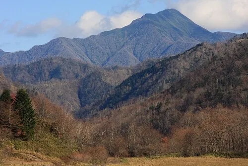 Mount Kamui Mountain, Taiki Chō22 km E
-
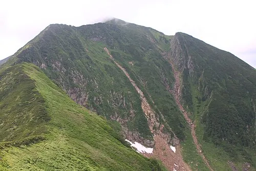 Mount Kamuiekuuchikaushi Mountain, Nakasatsunai Mura24 km NE
-
Mount Yaoromappu Mountain, Taiki Chō20 km NE
-
Mount Rubetsune Mountain, Taiki Chō20 km NE
-
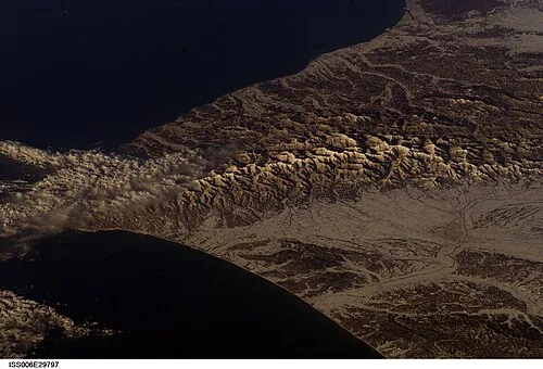 Hidaka Sanmyaku Mountain, Hokkaido19 km NE
-
Shunbetsu Yama Mountain, Hokkaido25 km E
-
Mount Rutori Mountain, Taiki Chō25 km E
-
Mitsuishi River River, Hokkaido21 km S
Sources & licences
Data last updated: · 2 independent sources