- Population
- 8,107
- 8.1K
- Elevation
- 49 m
- above sea level
- Local time
- UTC+09:00
- Asia/Tokyo · UTC+09:00
- Places inside
- 1
- listed under Shibecha Chō
- Airports
- KUH Kushiro Airport41 km
- SHB Nakashibetsu Airport45 km
About Shibecha Chō
Shibecha Chō is a municipality. Location: Kawakami-gun, Hokkaido. Population: 8,107. Elevation: 49 m. The best months to visit are July–September. The nearest airport is Kushiro Airport (41 km).
Climate of Shibecha Chō
Best months for sightseeingBest months for sightseeing: July–September.
This month · November
A cold month
Day 8° · Night 0° · Rain 80 mm
- Hottest month
- August (day 22°)
- Coldest month
- January (night -11°)
- Wettest month
- September (161 mm)
- Driest month
- February (40 mm)
Bars: average monthly low and high temperature. Below: precipitation. Monthly averages for 1970–2000 at about 18 km resolution, adjusted for elevation. Highlighted months are mild and relatively dry. Source: WorldClim 2.1 (CC BY 4.0).
Show values as a table
| Month | Jan | Feb | Mar | Apr | May | Jun | Jul | Aug | Sep | Oct | Nov | Dec |
|---|---|---|---|---|---|---|---|---|---|---|---|---|
| Average high (°C) | -2° | -2° | 1° | 8° | 13° | 16° | 20° | 22° | 19° | 15° | 8° | 1° |
| Average low (°C) | -11° | -10° | -5° | 1° | 6° | 10° | 14° | 16° | 13° | 7° | 0° | -6° |
| Precipitation (mm) | 51 | 40 | 70 | 81 | 100 | 94 | 103 | 128 | 161 | 115 | 80 | 51 |
How to get to Shibecha Chō
The nearest airport is Kushiro Airport (KUH), 41 km to the southwest as the crow flies. The nearest large city is Kushiro, 38 km to the southwest.
Airports
- Kushiro Airport (KUH) Kushiro 41 kmsouthwest
- Nakashibetsu Airport (SHB) Nakashibetsu 45 kmnortheast
- Memanbetsu Airport (MMB) Ōzora 73 kmnorthwest
Nearby large cities
- Kushiro Population: 167.9K 38 kmsouthwest
- Kitami Population: 119.1K 78 kmnorthwest
- Obihiro Population: 166.5K 118 kmwest
- Asahikawa Population: 333.5K 185 kmwest
- Ebetsu Population: 134K 245 kmwest
Straight-line distances; road distances are longer. Airport data: OurAirports.
Day trips from Shibecha Chō
Within 100 km: 16 natural sites, 17 lakes, rivers and coasts.
0–25 km1 place
- Shisetsuri Gawa River 20 kmW
25–60 km17 places
- Ahoro Dake Mountain 47 kmNW
- Lake Mashū Lake 32 kmN
- Mount Samakke Nupuri Mountain 45 kmN
- Mount Iō Mountain 37 kmN
60–100 km15 places
- Mount Chinishibetsu Mountain 90 kmNE
- Shiretoko Peninsula Natural site 86 kmNE
- Lake Notoro Lake 91 kmN
- Shibetsu River River 62 kmNE
Straight-line distances.
Places in Shibecha Chō
1 place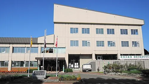
Shibecha
Population: 7.2K
Sources & licences
Data last updated: