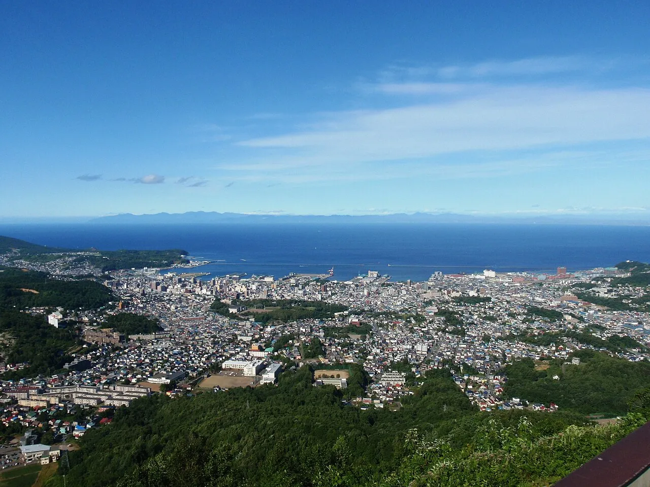
- Population
- 115,333
- 115.3K
- Elevation
- 30 m
- above sea level
- Local time
- UTC+09:00
- Asia/Tokyo · UTC+09:00
- Airports
- OKD Sapporo Okadama Airport32 km
- CTS New Chitose Airport73 km
About Otaru
Otaru is a city. Location: Otaru Shi, Hokkaido. Population: 115,333. Elevation: 30 m. The best months to visit are June–September. The nearest airport is Sapporo Okadama Airport (32 km).
Photos of Otaru
-

Sergiy Galyonkin · CC BY-SA 4.0 -

Sergiy Galyonkin · CC BY-SA 4.0 -

iyoupapa · CC BY-SA 2.0 -

Adam Jones from Kelowna, BC, Canada · CC BY-SA 2.0 -

Party Lin · CC BY 2.0


Travel notes for Otaru
From Wikivoyage
Otaru (小樽) is a port city in Hokkaido, Japan along the coast of the Sea of Japan. The city is near Sapporo and it is a tourist destination for its food, its historical buildings and its shops.
Understand+
Approximately 30 km to the west of Sapporo, Otaru is a port city by the Sea of Japan with a canal and well-preserved architectures of early modern Japan in the Meiji era. Most of the attractions are found in the city center surrounding the Otaru port.
Otaru's original name in the local Ainu language was "Otarunai" or "Ota-or-nai", meaning "river flowing through sand". The area's recorded history goes back to the 16th century, when an explorer from the Honshu island reported settlement. Otaru's early modern history as a port city started in 1871, when Japan's Meiji government opened a colonization office in Sapporo. Rapid development followed, especially after the first railway in Hokkaido was built in 1880 between Otaru and Sapporo. Still a busy port town, today's Otaru has a thriving tourism industry.
Winter in Otaru is less severe than in most other cities in Hokkaido; the yearly average temperature is 8.6 °C.
Tourist information:
The local tourist association has a Japanese-only guide site with integrated Google Translate.
Get in+
By train:
There are 3 stations in Otaru. 1 Otaru Station. (updated Nov 2020) is the closest station to downtown and a major station on the JR Hakodate Line. It is the terminus of most services from Sapporo and Niseko. All trains from Sapporo also call at 2 Minami-Otaru Station. (updated Nov 2020) and 3 Otaruchikko station. (updated Sep 2025).
From Sapporo:
Trains from Sapporo are frequent, approximately once every 20 minutes throughout the day. The fastest service, the Airport Rapid, takes 30 minutes from Sapporo; from New Chitose Airport it takes 70 minutes. In September, the Niseko (Limited Express) operates one daily trip from Sapporo to Otaru; seat reservations are mandatory.
From Niseko:
There are only 8 services a day from Niseko. All services are local trains, stopping at all intermediate stations. Travel time is approximately 2 hours from Niseko. In September the Niseko (Limited Express) operates one daily trip from Niseko to Otaru in the afternoon; seat reservations are mandatory.
By car:
Otaru is 25 minutes away from Sapporo by car.
By ferry:
Otaru is one of Hokkaido's key ferry ports, and the closest to Sapporo. Shin-Nihonkai Ferry(+81 6-6348-1120) operates a daily service between Otaru and Niigata (18 hours, ¥6,200+) and between Otaru and Maizuru near Kyoto (20 hours, ¥9,600+). Both services are overnight, and private cabins are available for a higher fare (the base fare buys sleeping space on the floor). All services depart/arrive from 4 Otaru Ferry Terminal. (updated Sep 2025).
Source: Wikivoyage · CC BY-SA 4.0 · abridged
Climate of Otaru
Best months for sightseeingBest months for sightseeing: June–September.
This month · November
A wet month
Day 8° · Night 1° · Rain 139 mm
- Hottest month
- August (day 25°)
- Coldest month
- January (night -6°)
- Wettest month
- November (139 mm)
- Driest month
- April (61 mm)
Bars: average monthly low and high temperature. Below: precipitation. Monthly averages for 1970–2000 at about 18 km resolution, adjusted for elevation. Highlighted months are mild and relatively dry. Source: WorldClim 2.1 (CC BY 4.0).
Show values as a table
| Month | Jan | Feb | Mar | Apr | May | Jun | Jul | Aug | Sep | Oct | Nov | Dec |
|---|---|---|---|---|---|---|---|---|---|---|---|---|
| Average high (°C) | -1° | 0° | 3° | 10° | 16° | 20° | 24° | 25° | 22° | 15° | 8° | 2° |
| Average low (°C) | -6° | -6° | -3° | 2° | 7° | 12° | 16° | 18° | 14° | 7° | 1° | -4° |
| Precipitation (mm) | 137 | 102 | 77 | 61 | 62 | 65 | 88 | 131 | 133 | 128 | 139 | 137 |
Other places to visit in this season: June July August September
How to get to Otaru
The nearest airport is Sapporo Okadama Airport (OKD), 32 km to the east as the crow flies. For international flights: New Chitose Airport (CTS) (73 km). The nearest large city is Sapporo, 31 km to the southeast.
Airports
- Sapporo Okadama Airport (OKD) Sapporo 32 kmeast
- New Chitose Airport (CTS) Sapporo 73 kmsoutheast
- Asahikawa Airport (AKJ) Higashikagura 129 kmnortheast
Nearby large cities
- Sapporo Population: 2M 31 kmsoutheast
- Ebetsu Population: 134K 46 kmeast
- Tomakomai Population: 174.8K 79 kmsoutheast
- Asahikawa Population: 333.5K 128 kmnortheast
- Hakodate Population: 275.7K 159 kmsouth
Straight-line distances; road distances are longer. Airport data: OurAirports.
Day trips from Otaru
Within 100 km: 2 historic and cultural sites, 13 natural sites, 9 lakes, rivers and coasts.
0–25 km1 place
- Zenibako River River 15 kmSE
25–60 km16 places
- Yūbari River River 48 kmE
- Toyohira River River 42 kmE
- Ishikari River River 31 kmE
- Chitose River River 50 kmE
60–100 km7 places
- Kuttara-ko Lake 78 kmS
- Toya Lake Lake 66 kmS
- Mount Tarumae Mountain 64 kmSE
- Mount Fuppushi Mountain 60 kmSE
Straight-line distances.
Otaru and similar cities
Side by side with cities of similar size in the same country: population, elevation and climate.
| Measure | Otaru | Urasoe | Ichinoseki | Hatsukaichi |
|---|---|---|---|---|
| Population | 115.3K | 115.7K | 114.5K | 114.2K |
| Elevation | 30 m | 50 m | 30 m | 4 m |
| Summer day (hottest month) | 25° | 31° | 28° | 31° |
| Winter night (coldest month) | -6° | 14° | -5° | 2° |
| Annual rainfall | 1,260 mm | 2,105 mm | 1,259 mm | 1,972 mm |
| Best months | Jun–Sep | Nov–May | May–Jul, Sep | May–Jun, Oct |
| Distance | — | 2,231 km | 475 km | 1,236 km |
Climate values are 1970–2000 monthly averages; straight-line distance.
Sources & licences
Data last updated: