- Population
- 12,339
- 12.3K
- Elevation
- 153 m
- above sea level
- Local time
- UTC+09:00
- Asia/Tokyo · UTC+09:00
- Places inside
- 10
- listed under Shari Chō
- Airports
- SHB Nakashibetsu Airport45 km
- MMB Memanbetsu Airport62 km
About Shari Chō
Shari Chō is a municipality. Location: Shari-gun, Hokkaido. Population: 12,339. Elevation: 153 m.
Shari (斜里町, Shari-chō) is a town located in Okhotsk Subprefecture, Hokkaido, Japan.
Source: Wikipedia · CC BY-SA 4.0
Travel notes for Shari Chō
From Wikivoyage
Shari (斜里町) is a town on the northern coast of Hokkaido, Japan.
Understand+
Shari is east of Abashiri and west of Shiretoko National Park. In fact, the village of Utoro, a part of this area, is one of the two gateways to the national park.
1 Utoro & Shirietokku Michi no Eki (Roadside rest area) (斜里町道の駅うとろ・シリエトク), Utoro Nishi 186-8, Shari (on Highway 334 in central Utoro, a few hundred meters SW of the major hotels), ☏ +81 152 22-5000. This rest area has a gift shop, visitor desk with maps and information, and large parking lot. If you're headed into Shiretoko National Park, it would be better to go to the park visitor center, but if you're wandering through Utoro, this is a good starting point.
2 Michi no Eki Shari (道の駅しゃり), 本町37 (1 block NE of JR Shiretokoshari Station.), ☏ +81 152 26-8888. Information daily 09:00-19:00, restrooms 24 hr. This small rest area is located in downtown Shari. Though quiet in the evening, it is a useful information stop during the day.
Tourist information site:
The local tourist association has a Japanese-only guide site.
Get in+
Shari can be reached by car, bus, or train. That being said, having a car once you're in Shari is highly desirable, so renting one in Abashiri is a reasonable idea.
Source: Wikivoyage · CC BY-SA 4.0 · abridged
Places bordering Shari Chō
- Koshimizu
- Kiyosato Chō
- Shibetsu Chō
- Rausu Chō
Twin towns and sister cities of Shari Chō
- Taketomi Chō· Japan
- Hirosaki· Japan
Source: Wikidata. Only places with a page on this site are shown.
Population of Shari Chō over time
| 2010 | 13,045 | |
|---|---|---|
| 2015 | 12,231 | |
| 2020 | 11,302 |
Censuses and official estimates; source: Wikidata.
Climate of Shari Chō
Best months for sightseeingBest months for sightseeing: July–August.
This month · November
A cold month
Day 7° · Night 1° · Rain 88 mm
- Hottest month
- August (day 22°)
- Coldest month
- February (night -9°)
- Wettest month
- September (160 mm)
- Driest month
- February (49 mm)
Bars: average monthly low and high temperature. Below: precipitation. Monthly averages for 1970–2000 at about 18 km resolution, adjusted for elevation. Highlighted months are mild and relatively dry. Source: WorldClim 2.1 (CC BY 4.0).
Show values as a table
| Month | Jan | Feb | Mar | Apr | May | Jun | Jul | Aug | Sep | Oct | Nov | Dec |
|---|---|---|---|---|---|---|---|---|---|---|---|---|
| Average high (°C) | -3° | -3° | 1° | 7° | 12° | 17° | 20° | 22° | 19° | 14° | 7° | 1° |
| Average low (°C) | -8° | -9° | -5° | 2° | 6° | 11° | 15° | 17° | 14° | 8° | 1° | -5° |
| Precipitation (mm) | 66 | 49 | 78 | 79 | 95 | 83 | 98 | 128 | 160 | 121 | 88 | 60 |
How to get to Shari Chō
The nearest airport is Nakashibetsu Airport (SHB), 45 km to the south as the crow flies. The nearest large city is Kitami, 85 km to the west.
Airports
- Nakashibetsu Airport (SHB) Nakashibetsu 45 kmsouth
- Memanbetsu Airport (MMB) Ōzora 62 kmwest
- Kushiro Airport (KUH) Kushiro 120 kmsouthwest
Nearby large cities
- Kitami Population: 119.1K 85 kmwest
- Kushiro Population: 167.9K 120 kmsouth
- Obihiro Population: 166.5K 182 kmsouthwest
- Asahikawa Population: 333.5K 207 kmwest
- Ebetsu Population: 134K 289 kmwest
Straight-line distances; road distances are longer. Airport data: OurAirports.
Day trips from Shari Chō
Within 100 km: 26 natural sites, 12 lakes, rivers and coasts.
0–25 km8 places
- Mount Chinishibetsu Mountain 12 kmNE
- Mount Minami Mountain 24 kmNE
- Mount Sashirui Mountain 22 kmNE
- Shiretoko Peninsula Natural site 7 kmE
25–60 km18 places
- Mount Poromoi Mountain 45 kmNE
- Mount Chienbetsu Mountain 26 kmNE
- Mount Higashi Mountain 27 kmNE
- Mount Rusha Mountain 30 kmNE
60–100 km12 places
- Ahoro Dake Mountain 85 kmSW
- Akan National Park Natural site 62 kmSW
- Benten-jima Island 88 kmSE
- Nemuro Hantō Natural site 92 kmSE
Straight-line distances.
Places in Shari Chō
10 placesBar: population relative to the most populous place in this list.
Mountains & nature9
- Mount Chienbetsu · Mountain
- Mount Chinishibetsu · Mountain
- Mount Higashi · Mountain
- Mount Iō · Mountain
- Mount Minami · Mountain
- Mount Onnebetsu · Mountain
- Mount Rusha · Mountain
- Mount Unabetsu · Mountain
- Shari Dake · Mountain
Nearby attractions & nature
Everything nearby-
 Shiretoko Peninsula Natural site, Hokkaido6.8 km E
-
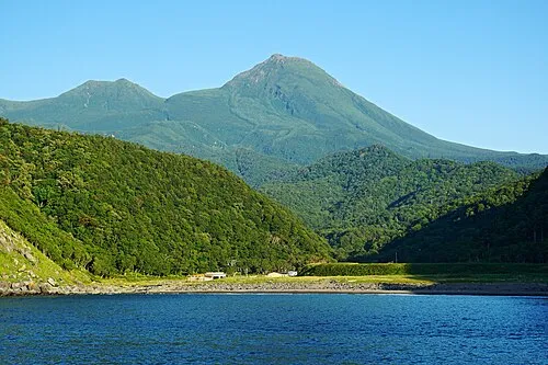 Rausu Dake Mountain, Rausu Chō19 km NE
-
Mount Sashirui Mountain, Rausu Chō22 km NE
-
Okkabake Dake Mountain, Rausu Chō23 km NE
Other cities and towns in Shari-gun
-
Koshimizu Chō Municipality, Shari-gun41 km SW
-
 Koshimizu Town, Koshimizu Chō39 km W
Sources & licences
Data last updated: · 2 independent sources