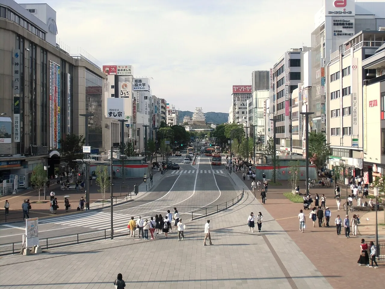
- Population
- 530,495
- 530.5K
- Elevation
- 8 m
- above sea level
- Local time
- UTC+09:00
- Asia/Tokyo · UTC+09:00
- Airports
- UKB Kobe Airport52 km
- KIX Kansai International Airport66 km
About Himeji
Himeji is a city. Location: Himeji Shi, Hyōgo. Population: 530,495. Elevation: 8 m.
Himeji (姫路市, Himeji-shi; Japanese pronunciation: [çì.mé̞.(ɟ̟͡)ʑí(.ɕì), çí.mè̞.(ɟ̟͡)ʑì]) is a city located in Hyōgo Prefecture in the Kansai region of Japan. As of 1 June 2022, the city had an estimated population of 525,682 in 227,099 households and a population density of 980 persons per km2. The total area of the city is 534.35 square kilometres (206.31 sq mi).
Source: Wikipedia · CC BY-SA 4.0
Photos of Himeji
-

Fin 22 · CC BY-SA 4.0 -

姫路市文化コンベンションセンター · CC BY-SA 4.0


Travel notes for Himeji
From Wikivoyage
Himeji (姫路) is a city near the western edge of the Kansai region of Japan, which has a World Heritage castle.
Understand+
Himeji's main attractions are its gorgeous castle, one of the largest wooden structures in the world, built in the late 1500s, and Mount Shoshazan, a temple with a history of over 1,000 years.
Because of its picturesque old Japanese appearance, Himeji has been used for filming many Japanese and foreign movies; props from these films, including "The Last Samurai," can be found in the JR station information center.
Tourist information site:
Visit Himeji is the city's official multilingual guide site.
Get in+
By plane:
Kansai International Airport (KIX IATA is 126 km southeast of Himeji and is the closest major international airport. Airport Limousine Buses operate every 1-2 hours between the airport and Himeji station (2 hr 20 min, ¥3300 one-way/¥5150 round-trip). More expensive, but free for users of the Japan Rail Pass, is to take the JR Haruka limited express to Shin-Osaka and transfer to the shinkansen (1 hr 45 min, ¥5020). It's also possible to buy a one-day JR Kansai Area Pass (¥2300) to reach Himeji in around 2 hours using a combination of the Haruka and the Special Rapid Service.
Osaka Itami International Airport (ITM IATA is 85km east of Himeji. Buses operate eight times per day between the airport and Himeji station (1 hr 20 min, ¥2160). If you can't catch a direct bus, take a bus to Shin-Osaka instead (25 min, ¥500) and change to the JR line (1 hr, ¥1490 by Special Rapid Service, or 30 min, ¥3220 by shinkansen).
Kobe Airport (UKB IATA is 65km southeast of Himeji, but has fewer flight options than the airports in Osaka. To reach Himeji, take the Port Liner to Sannomiya and change to the JR Special Rapid Service (75 min, ¥1300).
By train:
Himeji is along the Sanyo Shinkansen Line (山陽新幹線) from Osaka and Kobe to Okayama and Hiroshima. The Sakura and Hikari offer frequent service to Himeji within the Sanyo region, as do the all-stopping Kodama trains. Since the station is elevated, it is possible to see Himeji Castle from a passing train.
From Tokyo, one Nozomi train per hour runs through to Himeji (3 hr, ¥16160), otherwise you have to change at Shin-Osaka. If you have a Japan Rail Pass, there is also one Hikari train departing each hour, running through to Himeji, which you can take at no charge (3 hr 40 min).
The overnight Sunrise Izumo/Sunrise Seto from Tokyo stops at Himeji. If you have a Japan Rail Pass, you can book a carpeted floor space at no charge; otherwise you can travel in a compartment or room by paying the applicable room fee and surcharges.
Source: Wikivoyage · CC BY-SA 4.0 · abridged
Places bordering Himeji
- Kakogawa
- Takasago
- Kasai
- Tatsunochō-tominaga
- Taishi-machi
- Fukusaki Chō
- Ichikawa Chō
Twin towns and sister cities of Himeji
- Charleroi· Belgium
- Tottori-shi· Japan
- Matsumoto· Japan
- Phoenix· United States
- Toyota· Japan
Source: Wikidata. Only places with a page on this site are shown.
Population of Himeji over time
| 2010 | 536,270 | |
|---|---|---|
| 2015 | 535,664 | |
| 2021 | 527,596 |
Censuses and official estimates; source: Wikidata.
Climate of Himeji
Best months for sightseeingBest months for sightseeing: May, October.
This month · November
Outside the best season
Day 17° · Night 7° · Rain 71 mm
Better nearby cities in November
- Kochi · 177 km southwest18°
- Ōita · 336 km southwest18°
- Beppu · 341 km southwest17°
- Hottest month
- August (day 32°)
- Coldest month
- January (night 0°)
- Wettest month
- June (206 mm)
- Driest month
- December (37 mm)
Bars: average monthly low and high temperature. Below: precipitation. Monthly averages for 1970–2000 at about 18 km resolution, adjusted for elevation. Highlighted months are mild and relatively dry. Source: WorldClim 2.1 (CC BY 4.0).
Show values as a table
| Month | Jan | Feb | Mar | Apr | May | Jun | Jul | Aug | Sep | Oct | Nov | Dec |
|---|---|---|---|---|---|---|---|---|---|---|---|---|
| Average high (°C) | 9° | 9° | 13° | 19° | 23° | 26° | 30° | 32° | 28° | 22° | 17° | 12° |
| Average low (°C) | 0° | 0° | 3° | 8° | 13° | 18° | 23° | 23° | 19° | 13° | 7° | 2° |
| Precipitation (mm) | 45 | 58 | 91 | 130 | 138 | 206 | 158 | 100 | 201 | 108 | 71 | 37 |
How to get to Himeji
The nearest airport is Kobe Airport (UKB), 52 km to the southeast as the crow flies. The nearest large city is Kakogawa, 13 km to the southeast.
Airports
- Kobe Airport (UKB) Kobe 52 kmsoutheast
- Kansai International Airport (KIX) Osaka 66 kmsoutheast
- Osaka Itami International Airport (ITM) Osaka 68 kmeast
Nearby large cities
- Kakogawa Population: 271.6K 13 kmsoutheast
- Akashi Population: 303.6K 33 kmsoutheast
- Sandachō Population: 132.9K 49 kmeast
- Nishinomiya Population: 485.6K 59 kmeast
- Takarazuka Population: 226.4K 60 kmeast
Straight-line distances; road distances are longer. Airport data: OurAirports.
Day trips from Himeji
Within 100 km: 28 historic and cultural sites, 27 natural sites, 30 lakes, rivers and coasts.
0–25 km3 places
- Ibo Gawa River 12 kmSW
- Ieshima Shotō Island 25 kmSW
- Himeji castle Historic site 3 kmN
25–60 km18 places
- Awaji Island Island 49 kmS
- Mount Rokkō Mountain 52 kmE
- Osaka Bay Natural site 53 kmSE
- Shōdo Island Island 52 kmSW
60–100 km64 places
- Nao Shima Island 77 kmSW
- Te Shima Island 68 kmSW
- Ogi Shima Island 73 kmSW
- Megi Shima Island 76 kmSW
Straight-line distances.
Himeji and similar cities
Side by side with cities of similar size in the same country: population, elevation and climate.
| Measure | Himeji | Utsunomiya | Matsuyama | Matsudo |
|---|---|---|---|---|
| Population | 530.5K | 518.8K | 511.2K | 498.6K |
| Elevation | 8 m | 137 m | 28 m | 10 m |
| Summer day (hottest month) | 32° | 29° | 31° | 30° |
| Winter night (coldest month) | 0° | -4° | 2° | 0° |
| Annual rainfall | 1,343 mm | 1,318 mm | 1,623 mm | 1,367 mm |
| Best months | May, Oct | May–Jun, Sep–Oct | May–Jun, Oct | May–Jun, Oct |
| Distance | — | 508 km | 208 km | 485 km |
Climate values are 1970–2000 monthly averages; straight-line distance.
Nearby attractions & nature
Everything nearby-
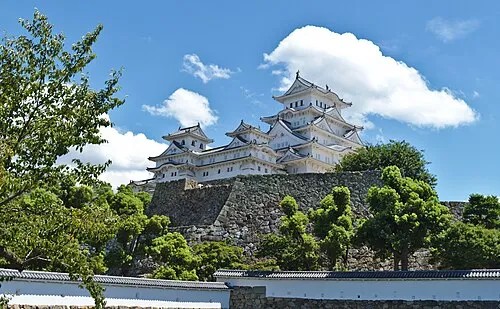 Himeji castle Historic site, Himeji Shi2.6 km N
-
Ibo Gawa River, Hyōgo12 km SW
-
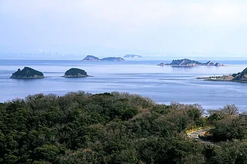 Ieshima Shotō Island, Hyōgo25 km SW
Sources & licences
Data last updated: · 2 independent sources