- Population
- 33,477
- 33.5K
- Elevation
- 17 m
- above sea level
- Local time
- UTC+09:00
- Asia/Tokyo · UTC+09:00
- Airports
- UKB Kobe Airport63 km
- OKJ Okayama Momotaro Airport67 km
About Ikaruga
Ikaruga is a town. Location: Taishi-machi, Ibo-gun. Population: 33,477. Elevation: 17 m. The best months to visit are May–June, October. The nearest airport is Kobe Airport (63 km). Nearby sights include Himeji castle and Ibo Gawa.
Climate of Ikaruga
Best months for sightseeingBest months for sightseeing: May–June, October.
This month · November
Outside the best season
Day 16° · Night 7° · Rain 75 mm
Better nearby cities in November
- Kochi · 172 km southwest18°
- Ōita · 327 km southwest18°
- Beppu · 332 km southwest17°
- Hottest month
- August (day 31°)
- Coldest month
- January (night 0°)
- Wettest month
- September (211 mm)
- Driest month
- December (45 mm)
Bars: average monthly low and high temperature. Below: precipitation. Monthly averages for 1970–2000 at about 18 km resolution, adjusted for elevation. Highlighted months are mild and relatively dry. Source: WorldClim 2.1 (CC BY 4.0).
Show values as a table
| Month | Jan | Feb | Mar | Apr | May | Jun | Jul | Aug | Sep | Oct | Nov | Dec |
|---|---|---|---|---|---|---|---|---|---|---|---|---|
| Average high (°C) | 8° | 9° | 12° | 18° | 23° | 26° | 30° | 31° | 27° | 22° | 16° | 11° |
| Average low (°C) | 0° | 0° | 2° | 8° | 13° | 18° | 22° | 23° | 19° | 12° | 7° | 2° |
| Precipitation (mm) | 55 | 67 | 97 | 132 | 141 | 208 | 178 | 108 | 211 | 111 | 75 | 45 |
How to get to Ikaruga
The nearest airport is Kobe Airport (UKB), 63 km to the east as the crow flies. The nearest large city is Himeji, 11 km to the east.
Airports
- Kobe Airport (UKB) Kobe 63 kmeast
- Okayama Momotaro Airport (OKJ) Okayama 67 kmwest
- Kansai International Airport (KIX) Osaka 76 kmsoutheast
Nearby large cities
- Himeji Population: 530.5K 11 kmeast
- Kakogawa Population: 271.6K 24 kmeast
- Akashi Population: 303.6K 44 kmsoutheast
- Tsuyama Population: 102.3K 58 kmnorthwest
- Sandachō Population: 132.9K 60 kmeast
Straight-line distances; road distances are longer. Airport data: OurAirports.
Day trips from Ikaruga
Within 100 km: 16 historic and cultural sites, 20 natural sites, 31 lakes, rivers and coasts.
0–25 km4 places
- Ibo Gawa River 7 kmS
- Ieshima Shotō Island 20 kmS
- Himeji castle Historic site 11 kmE
- Ako Castle Historic site 20 kmSW
25–60 km16 places
- Awaji Island Island 55 kmSE
- Shōdo Island Island 46 kmSW
- Sen Zan Mountain 58 kmSE
- Mount Maya Mountain 50 kmSE
60–100 km47 places
- Nao Shima Island 69 kmSW
- Shiwaku Islands Island 94 kmSW
- Te Shima Island 61 kmSW
- Mount Rokkō Mountain 63 kmE
Straight-line distances.
Nearby attractions & nature
Everything nearby-
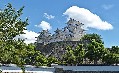 Himeji castle Historic site, Himeji Shi11 km E
-
Ibo Gawa River, Hyōgo7.3 km S
-
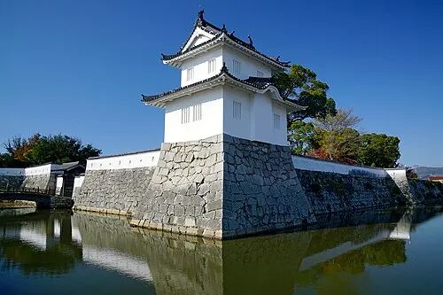 Ako Castle Historic site, Akō Shi20 km SW
-
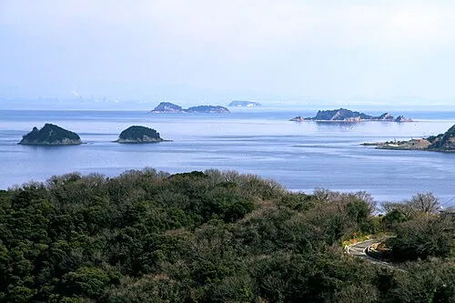 Ieshima Shotō Island, Hyōgo20 km S
Sources & licences
Data last updated: