- Population
- 271,634
- 271.6K
- Elevation
- 6 m
- above sea level
- Local time
- UTC+09:00
- Asia/Tokyo · UTC+09:00
- Airports
- UKB Kobe Airport39 km
- KIX Kansai International Airport54 km
About Kakogawa
Kakogawa is a city. Location: Kakogawa Shi, Hyōgo. Population: 271,634. Elevation: 6 m.
Kakogawa (加古川市, Kakogawa-shi) is a city located in Hyōgo Prefecture, Japan. As of 1 June 2024, the city had an estimated population of 255,523 in 110,380 households and a population density of 1,800 persons per km2. The total area of the city is 138.48 square kilometres (53.47 sq mi).
Source: Wikipedia · CC BY-SA 4.0
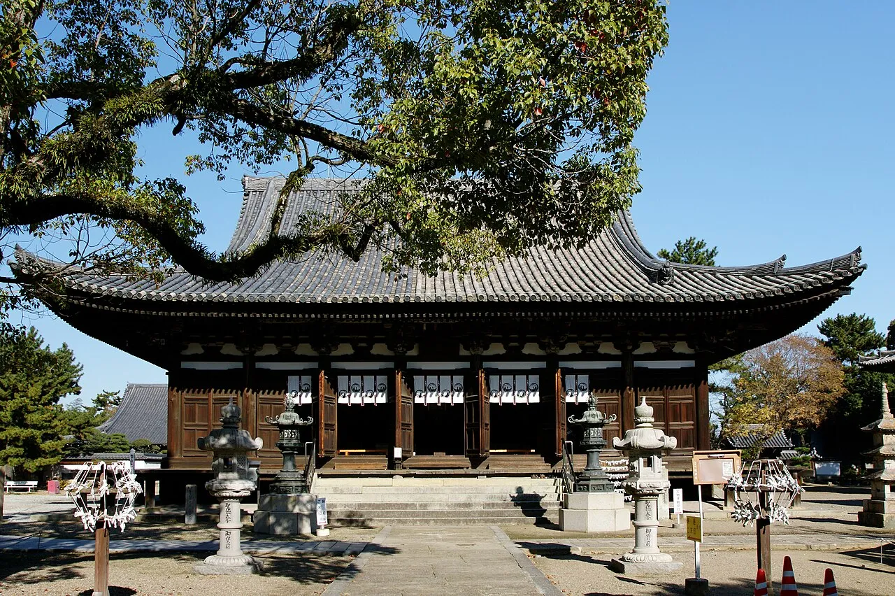
Photos of Kakogawa
-

Indiana jo · CC BY-SA 4.0 -

高砂の浦 · CC BY 4.0 -

inunami · CC BY 2.0 -

Harimawood · CC BY-SA 4.0 -

Harimawood · CC BY-SA 4.0


Places bordering Kakogawa
- Akashi
- Takasago
- Himeji
- Kasai
- Miki
- Ono
- Harima-cho
- Inami-cho
Population of Kakogawa over time
| 2010 | 266,937 | |
|---|---|---|
| 2015 | 267,435 | |
| 2021 | 260,595 |
Censuses and official estimates; source: Wikidata.
Climate of Kakogawa
Best months for sightseeingBest months for sightseeing: May, October.
This month · November
Outside the best season
Day 17° · Night 7° · Rain 71 mm
Better nearby cities in November
- Kochi · 181 km southwest18°
- Ōita · 343 km southwest18°
- Fujinomiya · 349 km east18°
- Hottest month
- August (day 32°)
- Coldest month
- January (night 0°)
- Wettest month
- June (206 mm)
- Driest month
- December (37 mm)
Bars: average monthly low and high temperature. Below: precipitation. Monthly averages for 1970–2000 at about 18 km resolution, adjusted for elevation. Highlighted months are mild and relatively dry. Source: WorldClim 2.1 (CC BY 4.0).
Show values as a table
| Month | Jan | Feb | Mar | Apr | May | Jun | Jul | Aug | Sep | Oct | Nov | Dec |
|---|---|---|---|---|---|---|---|---|---|---|---|---|
| Average high (°C) | 9° | 9° | 13° | 19° | 23° | 26° | 30° | 32° | 28° | 22° | 17° | 12° |
| Average low (°C) | 0° | 0° | 3° | 8° | 13° | 18° | 23° | 23° | 19° | 13° | 7° | 2° |
| Precipitation (mm) | 45 | 58 | 91 | 130 | 138 | 206 | 158 | 100 | 201 | 108 | 71 | 37 |
How to get to Kakogawa
The nearest airport is Kobe Airport (UKB), 39 km to the southeast as the crow flies. The nearest large city is Himeji, 13 km to the northwest.
Airports
- Kobe Airport (UKB) Kobe 39 kmsoutheast
- Kansai International Airport (KIX) Osaka 54 kmsoutheast
- Osaka Itami International Airport (ITM) Osaka 56 kmeast
Nearby large cities
- Himeji Population: 530.5K 13 kmnorthwest
- Akashi Population: 303.6K 21 kmsoutheast
- Sandachō Population: 132.9K 39 kmeast
- Nishinomiya Population: 485.6K 46 kmeast
- Takarazuka Population: 226.4K 48 kmeast
Straight-line distances; road distances are longer. Airport data: OurAirports.
Day trips from Kakogawa
Within 100 km: 34 historic and cultural sites, 36 natural sites, 27 lakes, rivers and coasts.
0–25 km4 places
- Ibo Gawa River 22 kmW
- Himeji castle Historic site 15 kmNW
- Akashi Castle Historic site 20 kmSE
- Akashi Kaikyō Bridge Landmark 24 kmSE
25–60 km23 places
- Awaji Island Island 42 kmS
- Mount Rokkō Mountain 40 kmE
- Tomoga Shima Island 56 kmS
- Osaka Bay Natural site 41 kmSE
60–100 km70 places
- Nao Shima Island 85 kmSW
- Te Shima Island 76 kmSW
- Ogi Shima Island 80 kmSW
- Megi Shima Island 83 kmSW
Straight-line distances.
Kakogawa and similar cities
Side by side with cities of similar size in the same country: population, elevation and climate.
| Measure | Kakogawa | Mito | Yao | Tsu |
|---|---|---|---|---|
| Population | 271.6K | 270.7K | 273.2K | 274.5K |
| Elevation | 6 m | 28 m | 13 m | 1 m |
| Summer day (hottest month) | 32° | 29° | 33° | 31° |
| Winter night (coldest month) | 0° | -3° | 1° | 1° |
| Annual rainfall | 1,343 mm | 1,395 mm | 1,406 mm | 1,785 mm |
| Best months | May, Oct | May–Jun, Sep–Oct | Apr–May, Oct | May–Jun, Sep–Oct |
| Distance | — | 539 km | 73 km | 155 km |
Climate values are 1970–2000 monthly averages; straight-line distance.
Nearby attractions & nature
Everything nearby-
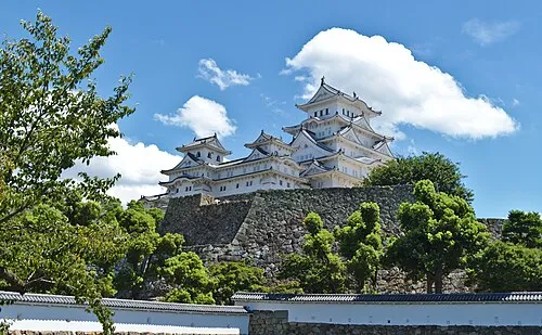 Himeji castle Historic site, Himeji Shi15 km NW
-
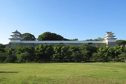 Akashi Castle Historic site, Akashi Shi20 km SE
-
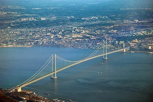 Akashi Kaikyō Bridge Landmark, Japan24 km SE
-
Ibo Gawa River, Hyōgo22 km W
Sources & licences
Data last updated: · 2 independent sources