- Population
- 21,554
- 21.6K
- Elevation
- 67 m
- above sea level
- Local time
- UTC+09:00
- Asia/Tokyo · UTC+09:00
- Airports
- UKB Kobe Airport39 km
- ITM Osaka Itami International Airport46 km
About Yashiro
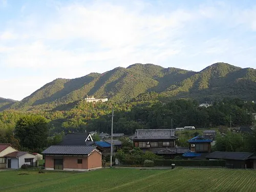
Yashiro is a town. Location: Katō Shi, Hyōgo. Population: 21,554. Elevation: 67 m.
Yashiro (社町, Yashiro-chō) was a town located in Katō District, Hyōgo Prefecture, Japan. As of 2003, the town had an estimated population of 21,409 and a density of 244.95 persons per km2. The total area was 87.40 km2. On March 20, 2006, Yashiro, along with the towns of Takino and Tōjō (all from Katō District), was merged to create the city of Katō. Yashiro was the Japanese sister city of Olympia, Washington.
Source: Wikipedia · CC BY-SA 4.0
At a glance
- Built
- 1912
Source: Wikidata
Climate of Yashiro
Best months for sightseeingBest months for sightseeing: May–June, October.
This month · November
Outside the best season
Day 16° · Night 7° · Rain 78 mm
Better nearby cities in November
- Kochi · 201 km southwest18°
- Fujinomiya · 334 km east18°
- Kofu · 337 km east17°
- Hottest month
- August (day 31°)
- Coldest month
- January (night 0°)
- Wettest month
- June (202 mm)
- Driest month
- December (48 mm)
Bars: average monthly low and high temperature. Below: precipitation. Monthly averages for 1970–2000 at about 18 km resolution, adjusted for elevation. Highlighted months are mild and relatively dry. Source: WorldClim 2.1 (CC BY 4.0).
Show values as a table
| Month | Jan | Feb | Mar | Apr | May | Jun | Jul | Aug | Sep | Oct | Nov | Dec |
|---|---|---|---|---|---|---|---|---|---|---|---|---|
| Average high (°C) | 8° | 9° | 12° | 18° | 23° | 26° | 30° | 31° | 27° | 22° | 16° | 11° |
| Average low (°C) | 0° | 0° | 2° | 8° | 13° | 18° | 22° | 23° | 19° | 12° | 7° | 2° |
| Precipitation (mm) | 58 | 70 | 99 | 129 | 139 | 202 | 162 | 101 | 195 | 111 | 78 | 48 |
How to get to Yashiro
The nearest airport is Kobe Airport (UKB), 39 km to the southeast as the crow flies. The nearest large city is Kakogawa, 21 km to the southwest.
Airports
- Kobe Airport (UKB) Kobe 39 kmsoutheast
- Osaka Itami International Airport (ITM) Osaka 46 kmeast
- Kansai International Airport (KIX) Osaka 60 kmsoutheast
Nearby large cities
- Kakogawa Population: 271.6K 21 kmsouthwest
- Sandachō Population: 132.9K 24 kmeast
- Himeji Population: 530.5K 27 kmsouthwest
- Akashi Population: 303.6K 29 kmsouth
- Takarazuka Population: 226.4K 38 kmeast
Straight-line distances; road distances are longer. Airport data: OurAirports.
Nearby attractions & nature
Everything nearby-
 Mount Chigogabaka Mountain, Kita Ku22 km SE
-
Mount Taishaku Mountain, Kita Ku20 km SE
Sources & licences
Data last updated: · 2 independent sources