- Population
- 40,011
- 40K
- Elevation
- 28 m
- above sea level
- Local time
- UTC+09:00
- Asia/Tokyo · UTC+09:00
- Airports
- OKJ Okayama Momotaro Airport65 km
- UKB Kobe Airport67 km
About Tatsunochō-tominaga
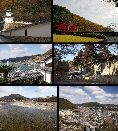
Tatsunochō-tominaga is a town. Location: Tatsuno-shi, Hyōgo. Population: 40,011. Elevation: 28 m. The best months to visit are May–June, October. The nearest airport is Okayama Momotaro Airport (65 km). Nearby sights include Himeji castle and Ako Castle.
Photos of Tatsunochō-tominaga
-

ぬんもさ? · CC BY-SA 4.0 -

ぬんもさ? · CC BY-SA 4.0 -

663highland · CC BY 2.5 -

Wikimedia Commons · CC BY-SA 3.0


Travel notes for Tatsunochō-tominaga
From Wikivoyage
Tatsuno (たつの) is a city of 71,000 people (2024) in Hyogo. It is home to a reconstructed Edo Period palace castle.
Understand+
Tourist information:
The local tourist association has a Japanese-only guide site.
Get in+
There are two train lines that run through Tatsuno, the Sanyo Main Line and the Kishin Line. On the Sanyo Main Line, the only station within the city is Tatsuno Station. If you're traveling on the Shinkansen from the west, it is one stop from Aioi Station or a short train ride from Himeji Station if you're coming from the east. The Kishin Line travels northwest through the city from Himeji to Sayo (and continuing on further to Tsuyama and eventually terminating in Niimi). There are 5 stations along the Kishin Line in Tatsuno. Those wanting to travel to the former castle town area should get off at Hon-Tatsuno Station.
Source: Wikivoyage · CC BY-SA 4.0 · abridged
Climate of Tatsunochō-tominaga
Best months for sightseeingBest months for sightseeing: May–June, October.
This month · November
Outside the best season
Day 16° · Night 7° · Rain 75 mm
Better nearby cities in November
- Kochi · 174 km southwest18°
- Ōita · 327 km southwest18°
- Beppu · 332 km southwest17°
- Hottest month
- August (day 31°)
- Coldest month
- January (night 0°)
- Wettest month
- September (211 mm)
- Driest month
- December (45 mm)
Bars: average monthly low and high temperature. Below: precipitation. Monthly averages for 1970–2000 at about 18 km resolution, adjusted for elevation. Highlighted months are mild and relatively dry. Source: WorldClim 2.1 (CC BY 4.0).
Show values as a table
| Month | Jan | Feb | Mar | Apr | May | Jun | Jul | Aug | Sep | Oct | Nov | Dec |
|---|---|---|---|---|---|---|---|---|---|---|---|---|
| Average high (°C) | 8° | 9° | 12° | 18° | 23° | 26° | 30° | 31° | 27° | 22° | 16° | 11° |
| Average low (°C) | 0° | 0° | 2° | 8° | 13° | 18° | 22° | 23° | 19° | 12° | 7° | 2° |
| Precipitation (mm) | 55 | 67 | 97 | 132 | 141 | 208 | 178 | 108 | 211 | 111 | 75 | 45 |
How to get to Tatsunochō-tominaga
The nearest airport is Okayama Momotaro Airport (OKJ), 65 km to the west as the crow flies. The nearest large city is Himeji, 15 km to the east.
Airports
- Okayama Momotaro Airport (OKJ) Okayama 65 kmwest
- Kobe Airport (UKB) Kobe 67 kmsoutheast
- Konotori Tajima Airport (TJH) Toyooka 75 kmnorth
Nearby large cities
- Himeji Population: 530.5K 15 kmeast
- Kakogawa Population: 271.6K 27 kmsoutheast
- Akashi Population: 303.6K 48 kmsoutheast
- Tsuyama Population: 102.3K 55 kmnorthwest
- Sandachō Population: 132.9K 62 kmeast
Straight-line distances; road distances are longer. Airport data: OurAirports.
Day trips from Tatsunochō-tominaga
Within 100 km: 15 historic and cultural sites, 19 natural sites, 30 lakes, rivers and coasts.
0–25 km4 places
- Ibo Gawa River 11 kmS
- Ieshima Shotō Island 23 kmS
- Himeji castle Historic site 13 kmE
- Ako Castle Historic site 20 kmSW
25–60 km14 places
- Awaji Island Island 59 kmSE
- Shōdo Island Island 47 kmSW
- Mount Maya Mountain 54 kmSE
- Yoshino River River 42 kmW
60–100 km46 places
- Nao Shima Island 69 kmSW
- Shiwaku Islands Island 93 kmSW
- Te Shima Island 61 kmSW
- Mount Rokkō Mountain 66 kmE
Straight-line distances.
Nearby attractions & nature
Everything nearby-
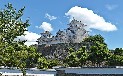 Himeji castle Historic site, Himeji Shi13 km E
-
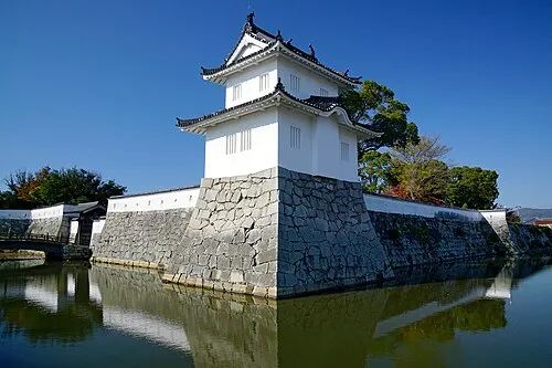 Ako Castle Historic site, Akō Shi20 km SW
-
Ibo Gawa River, Hyōgo11 km S
-
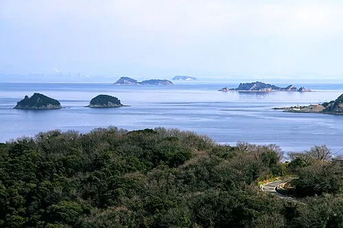 Ieshima Shotō Island, Hyōgo23 km S
Sources & licences
Data last updated: