- Population
- 50,300
- 50.3K
- Elevation
- 2 m
- above sea level
- Local time
- UTC+09:00
- Asia/Tokyo · UTC+09:00
- Airports
- NTQ Noto Satoyama Airport27 km
- TOY Toyama Kitokito Airport48 km
About Nanao
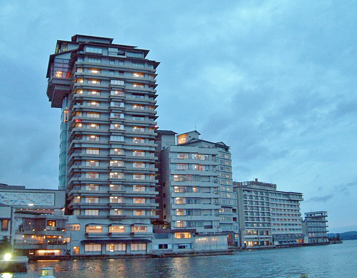
Nanao is a city. Location: Nanao Shi, Ishikawa. Population: 50,300. Elevation: 2 m.
Nanao (七尾市, Nanao-shi) is a city located in Ishikawa Prefecture, Japan. As of 31 March 2022, the city had an estimated population of 49,660 people in 21,809 households. The total area of the city was 318.32 square kilometres (122.90 sq mi). Nanao is the fifth largest city by population in Ishikawa, behind Kanazawa, Hakusan, Komatsu, and Kaga.
Source: Wikipedia · CC BY-SA 4.0
Photos of Nanao
-

MathieuMD · CC BY-SA 4.0 -

Daderot · CC0 -

Daderot · CC0 -

くろふね · CC BY 3.0 -

inunami · CC BY 2.0


Travel notes for Nanao
From Wikivoyage
Nanao (七尾) is the largest city in the Noto Peninsula, the northern part of Ishikawa, Japan. This quiet city has few tourist attractions, but offers several amazing views of nature as well as an honest glimpse into the simple country life of Japan. The hot spring town of Wakura Onsen is also within Nanao city limits, but covered in its own article.
Understand+
Nanao was once the economic, cultural, and political capital of Noto province, in what is today known as Ishikawa prefecture. Though it has a history dating back to 718, little remains of the city's past.
The modern city of Nanao was established in 1939, and was expanded in 2004 to include several surrounding towns.
Climate:
The climate of Nanao is much like the rest of Ishikawa prefecture - wet and unpredictable. Though the rainy season lasts from July until August, Ishikawa is notorious for its cloudy weather and sudden rain showers all year round.
Summer tends to see more sunny days with temperatures between 25-30°C, while winter is somewhat mild, rarely dipping below 0°C. Snowfall tends to vary year by year, but one can expect at least a few blizzards in the winter months.
Spring has the mildest weather, where winter has melted and flowers (especially cherry blossoms) start to bloom, and it's not yet as hot and humid as summer will become.
Tourist information site:
The tourist associations of Nanao City and Nakanoto Town jointly maintain a bilingual guide site.
Get in+
By train:
Nanao is on the JR Noto Line and has local trains coming north roughly every hour from Kanazawa via Tsubata. Limited express trains from Kanazawa stop at Nanao on their way to the JR Noto Line terminus, Wakura Onsen. Nanao is also the terminus of the private Noto Railway to/from Anamizu to the north, and the station shares both lines.
By plane:
Noto Airport (NTQ IATA) a small airport. All Nippon Airways from Tokyo-Haneda are offered twice daily.
Nakajima Taxi, ☏ +81 767-66-0114. Taxi service from the airport to Nanao/Wakura. It takes about 1 hour and costs ¥1,300, and must be booked in advance.
Komatsu Airport (KMQ IATA) is a larger airport than Noto's, and it offers flights to/from a variety of destinations including: Haneda, Narita, Sendai, Fukuoka, Naha, and Seoul. There is an airport bus that goes to Kanazawa station and takes about 40 min and costs ¥1130. From Kanazawa station it's 1.5 hours and ¥1,280 by local train to Nanao.
By car:
Travelling by car is the easiest way to navigate Nanao and its surrounding areas. Coming by car from major cities via expressway, Tokyo is 5 hours away, Osaka is 4.5 hours, and Nagoya is 4 hours.
Entering via express toll roads:
Get off the Hokuriku expressway at Kanazawa East IC (金沢東IC) and take the Noto toll road (能登有料 Noto yūryō).
You can enter Nanao at any one of four toll road exits: Uwadana Yada (上棚矢駄), Nishiyama (西山), Tokuda Otsu (徳田大津), or Yokota (横田).
Entering via local roads:
The #159 and #2 roads head into Nanao from the south.
The #1 heads south-east from the upper Noto into Nanao.
The #160 heads into Nanao from the north-east.
By bus:
While the bus does go most everywhere around Nanao, it should be avoided if at all possible. It's slow and relatively expensive compared to the train.
One out-of-the-way area the train cannot go is the scenic Notojima. You can take a bus (能登島交通 Notojima Kōtsū) there from either Nanao or Wakura stations.
Source: Wikivoyage · CC BY-SA 4.0 · abridged
Places bordering Nanao
- Nakanoto Machi
- Shika Machi
- Anamizu Machi
- Himi
Population of Nanao over time
| 2010 | 57,900 | |
|---|---|---|
| 2015 | 55,325 | |
| 2020 | 50,207 |
Censuses and official estimates; source: Wikidata.
Climate of Nanao
Best months for sightseeingBest months for sightseeing: May–June, September–October.
This month · November
A wet month
Day 14° · Night 7° · Rain 214 mm
Better nearby cities in November
- Kofu · 210 km southeast17°
- Fujinomiya · 252 km southeast18°
- Fuji · 260 km southeast20°
- Hottest month
- August (day 30°)
- Coldest month
- February (night 0°)
- Wettest month
- December (238 mm)
- Driest month
- April (119 mm)
Bars: average monthly low and high temperature. Below: precipitation. Monthly averages for 1970–2000 at about 18 km resolution, adjusted for elevation. Highlighted months are mild and relatively dry. Source: WorldClim 2.1 (CC BY 4.0).
Show values as a table
| Month | Jan | Feb | Mar | Apr | May | Jun | Jul | Aug | Sep | Oct | Nov | Dec |
|---|---|---|---|---|---|---|---|---|---|---|---|---|
| Average high (°C) | 6° | 6° | 9° | 16° | 20° | 23° | 28° | 30° | 25° | 20° | 14° | 9° |
| Average low (°C) | 0° | 0° | 2° | 7° | 12° | 17° | 21° | 22° | 18° | 12° | 7° | 2° |
| Precipitation (mm) | 221 | 154 | 130 | 119 | 126 | 169 | 197 | 157 | 235 | 162 | 214 | 238 |
Other places to visit in this season: May June September October
How to get to Nanao
The nearest airport is Noto Satoyama Airport (NTQ), 27 km to the north as the crow flies. For international flights: Komatsu Airport / JASDF Komatsu Air Base (KMQ) (88 km). The nearest large city is Takaoka, 33 km to the south.
Airports
- Noto Satoyama Airport (NTQ) Wajima 27 kmnorth
- Toyama Kitokito Airport (TOY) Toyama 48 kmsoutheast
- Komatsu Airport / JASDF Komatsu Air Base (KMQ) Kanazawa 88 kmsouthwest
Nearby large cities
- Takaoka Population: 170.1K 33 kmsouth
- Toyama Population: 415.8K 45 kmsoutheast
- Kanazawa Population: 466K 59 kmsouthwest
- Matsutō Population: 110.4K 69 kmsouthwest
- Komatsu Population: 108.5K 85 kmsouthwest
Straight-line distances; road distances are longer. Airport data: OurAirports.
Day trips from Nanao
Within 100 km: 22 natural sites, 13 lakes, rivers and coasts.
0–25 km3 places
- Noto Jima Island 9 kmN
- Mount Sekidō Mountain 9 kmS
- Mount Koizumi Natural site 9 kmNE
25–60 km10 places
- Kurobe River River 43 kmE
- Jinzu River River 39 kmSE
- Mount Utatsu Mountain 58 kmSW
- Toyama-wan Natural site 30 kmSE
60–100 km22 places
- Hegura Jima Island 89 kmN
- Kasaga-take Mountain 97 kmSE
- Mount Kurobegorō Mountain 89 kmSE
- Takahara River River 70 kmS
Straight-line distances.
Nanao and similar cities
Side by side with cities of similar size in the same country: population, elevation and climate.
| Measure | Nanao | Asakura | Midori | Kasaoka |
|---|---|---|---|---|
| Population | 50.3K | 50.3K | 50.3K | 50.2K |
| Elevation | 2 m | 51 m | 254 m | 9 m |
| Summer day (hottest month) | 30° | 31° | 30° | 32° |
| Winter night (coldest month) | 0° | 1° | -3° | 0° |
| Annual rainfall | 2,122 mm | 1,923 mm | 1,335 mm | 1,397 mm |
| Best months | May–Jun, Sep–Oct | May, Oct | May–Jun, Sep–Oct | May, Oct |
| Distance | — | 697 km | 217 km | 421 km |
Climate values are 1970–2000 monthly averages; straight-line distance.
Nearby attractions & nature
Everything nearby-
Mount Koizumi Natural site, Nanao Shi8.6 km NE
-
 Noto Jima Island, Ishikawa9 km N
-
Mount Sekidō Mountain, Nakanoto Machi9.2 km S
Sources & licences
Data last updated: · 2 independent sources