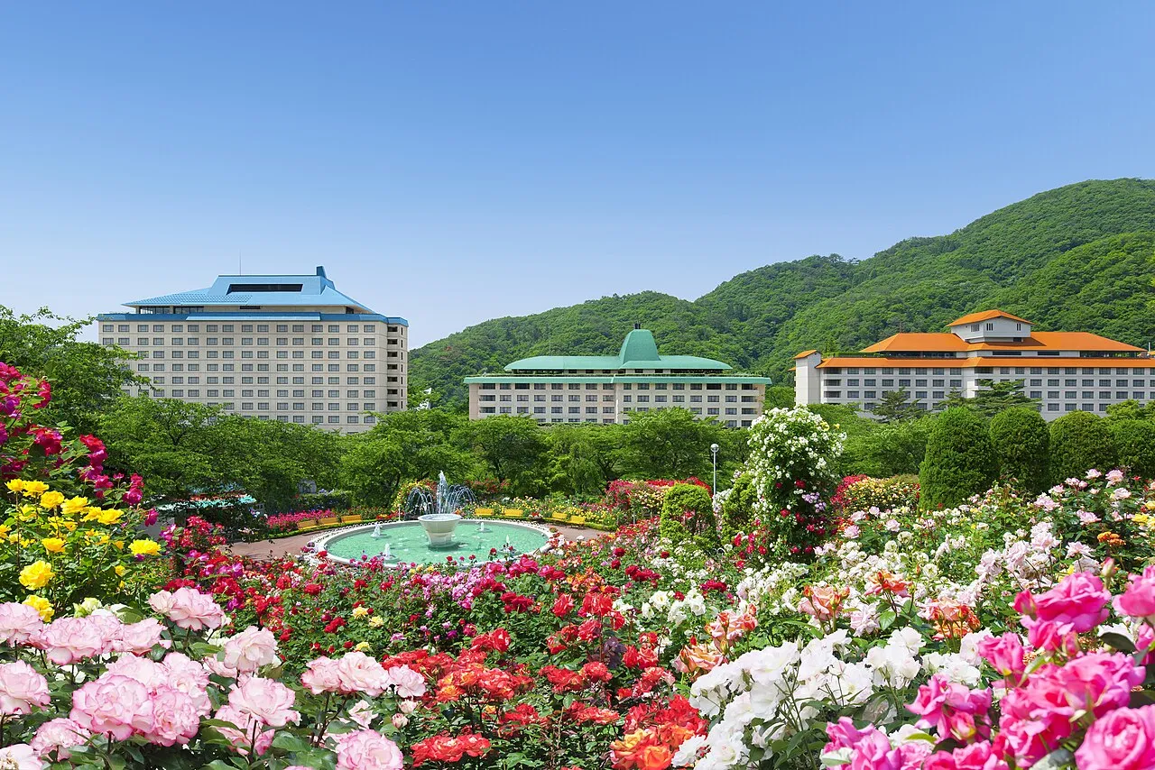
- Population
- 100,722
- 100.7K
- Elevation
- 87 m
- above sea level
- Local time
- UTC+09:00
- Asia/Tokyo · UTC+09:00
- Places inside
- 2
- listed under Hanamaki Shi
- Airports
- HNA Iwate Hanamaki Airport3 km
- AXT Akita Airport84 km
About Hanamaki Shi
Hanamaki Shi is a district. Location: Iwate, Japan. Population: 100,722.
Hanamaki (花巻市, Hanamaki-shi) is a city in Iwate Prefecture, Japan. As of 31 March 2020, the city had an estimated population of 94,691, and a population density of 100 persons per km2, in 37,773 households. The total area of the city is 908.39 square kilometres (350.73 sq mi). Hanamaki is famous as the birthplace of the novelist and poet Kenji Miyazawa and Iwate Prefecture's local specialty, Wanko soba, as well as its hot spring resorts.
Source: Wikipedia · CC BY-SA 4.0
Places bordering Hanamaki Shi
- Morioka
- Kitakami
- Tōno
- Ōshū
- Miyako
- Shiwa Chō
- Nishiwaga Machi
- Shizukuishi
Twin towns and sister cities of Hanamaki Shi
- Hot Springs Township· United States
- Towada· Japan
- Hiratsuka· Japan
Source: Wikidata. Only places with a page on this site are shown.
Population of Hanamaki Shi over time
| 2010 | 101,438 | |
|---|---|---|
| 2015 | 97,702 | |
| 2021 | 92,815 |
Censuses and official estimates; source: Wikidata.
Climate of Hanamaki Shi
Best months for sightseeingBest months for sightseeing: May–July, September.
This month · November
A cold month
Day 11° · Night 2° · Rain 88 mm
- Hottest month
- August (day 28°)
- Coldest month
- January (night -6°)
- Wettest month
- July (174 mm)
- Driest month
- February (61 mm)
Bars: average monthly low and high temperature. Below: precipitation. Monthly averages for 1970–2000 at about 18 km resolution, adjusted for elevation. Highlighted months are mild and relatively dry. Source: WorldClim 2.1 (CC BY 4.0).
Show values as a table
| Month | Jan | Feb | Mar | Apr | May | Jun | Jul | Aug | Sep | Oct | Nov | Dec |
|---|---|---|---|---|---|---|---|---|---|---|---|---|
| Average high (°C) | 2° | 3° | 7° | 14° | 19° | 22° | 26° | 28° | 23° | 18° | 11° | 5° |
| Average low (°C) | -6° | -6° | -2° | 3° | 9° | 14° | 18° | 20° | 15° | 8° | 2° | -3° |
| Precipitation (mm) | 65 | 61 | 81 | 102 | 105 | 124 | 174 | 162 | 171 | 117 | 88 | 75 |
Other places to visit in this season: May June July September
How to get to Hanamaki Shi
The nearest airport is Iwate Hanamaki Airport (HNA), 3 km to the southwest as the crow flies. The nearest large city is Morioka, 29 km to the north.
Airports
- Iwate Hanamaki Airport (HNA) Hanamaki 3 kmsouthwest
- Akita Airport (AXT) Akita 84 kmwest
- Odate Noshiro Airport (ONJ) Kitaakita 108 kmnorthwest
Nearby large cities
- Morioka Population: 290.7K 29 kmnorth
- Ōshū Population: 112.9K 34 kmsouth
- Ichinoseki Population: 114.5K 58 kmsouth
- Akita Population: 307.7K 95 kmwest
- Ōsaki Population: 128.8K 96 kmsouth
Straight-line distances; road distances are longer. Airport data: OurAirports.
Places in Hanamaki Shi
2 places
Hanamaki
Population: 94.7K
Nearby attractions & nature
Everything nearby-
Sarugaishi River River, Iwate5.6 km SW
-
Kinu Gawa River, Iwate8.4 km SE
-
Anano River River, Iwate16 km W
-
Waga River River, Iwate19 km S
Sources & licences
Data last updated: · 2 independent sources