Ichinoseki
Local name: 一関市
Located in Ichinoseki-shi, Iwate Coordinates: 38°55′00″ N 141°08′00″ E
- Population
- 114,476
- 114.5K
- Elevation
- 30 m
- above sea level
- Local time
- UTC+09:00
- Asia/Tokyo · UTC+09:00
- Airports
- HNA Iwate Hanamaki Airport57 km
- GAJ Yamagata Airport87 km
About Ichinoseki
Ichinoseki is a city. Location: Ichinoseki-shi, Iwate. Population: 114,476. Elevation: 30 m.
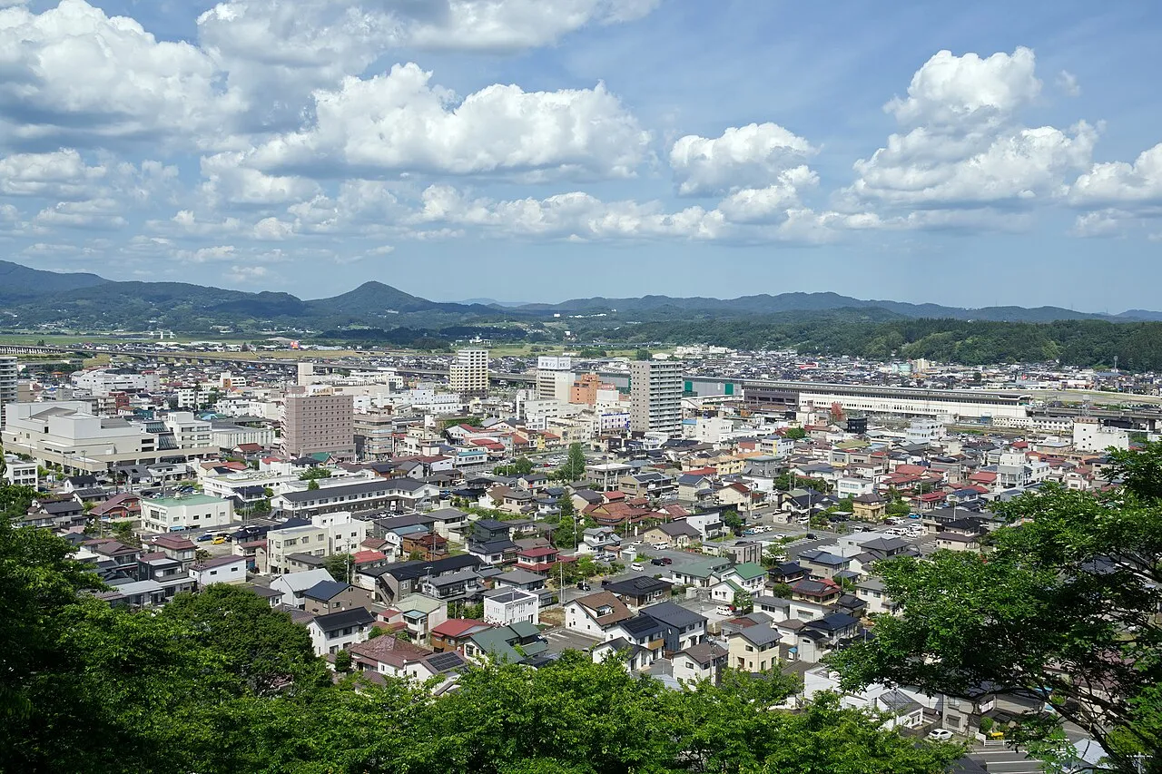
Ichinoseki (一関市, Ichinoseki-shi; Japanese pronunciation: [ì.c̟͡ɕí.nó̞.sè̞.k̟ʲì, -sé̞.k̟ʲi̥.ɕì]) is a city located in Iwate Prefecture, in the Tōhoku region of northern Japan. As of 1 May 2020, the city had a population of 114,476 and a population density of 91 persons per km2 in 46,375 households. It is currently the second largest city by population in the prefecture, after Morioka. The total area of the city was 1,256.42 square kilometers (485.11 sq mi).
Source: Wikipedia · CC BY-SA 4.0
Travel notes for Ichinoseki
From Wikivoyage
Ichinoseki (一関) is a city in Iwate Prefecture in the north eastern part of the main island (Honshu) in Japan.
Understand+
While the city merged in 2006 with surrounding municipalities, it is still not a very large town, and the downtown area which contains most entertainment facilities is compact. NEC, Sony and Fujitsu General Electronics are the main employers, with their factories providing work for mostly Brazilian migrants. The city has warm summers and cold winters, so dress appropriately for the season.
Tourist information site:
The local tourist association has a multilingual guide site.
Get in+
Take the Yamabiko Shinkansen from Tokyo or Ueno station; this journey takes about 3 hours with stops at Sendai and more on the way up. From Sendai, the Shinkansen takes about half an hour, while there are also local trains and a highway bus for those on a budget.
From Sendai, there is a bus that goes to Ichinoseki on the hour. One-way is ¥1500, and round-trip is ¥2700. 80 minutes. Board in front of Sakurano department store on Aoba street, near the station's west exit.
Source: Wikivoyage · CC BY-SA 4.0 · abridged
Places bordering Ichinoseki
- Rikuzen-takata Shi
- Ōshū
- Sumita Chō
- Kurihara
- Tome Shi
- Kesennuma
- Higashinaruse Mura
Twin towns and sister cities of Ichinoseki
- Miharu Machi· Japan
- Tanabe· Japan
- Yoshikawa· Japan
- Kesennuma· Japan
Source: Wikidata. Only places with a page on this site are shown.
Population of Ichinoseki over time
| 2010 | 127,642 | |
|---|---|---|
| 2015 | 121,583 | |
| 2021 | 111,824 |
Censuses and official estimates; source: Wikidata.
Climate of Ichinoseki
Best months for sightseeingBest months for sightseeing: May–July, September.
This month · November
A cold month
Day 12° · Night 3° · Rain 78 mm
- Hottest month
- August (day 28°)
- Coldest month
- January (night -5°)
- Wettest month
- July (167 mm)
- Driest month
- February (61 mm)
Bars: average monthly low and high temperature. Below: precipitation. Monthly averages for 1970–2000 at about 18 km resolution, adjusted for elevation. Highlighted months are mild and relatively dry. Source: WorldClim 2.1 (CC BY 4.0).
Show values as a table
| Month | Jan | Feb | Mar | Apr | May | Jun | Jul | Aug | Sep | Oct | Nov | Dec |
|---|---|---|---|---|---|---|---|---|---|---|---|---|
| Average high (°C) | 2° | 3° | 7° | 14° | 19° | 22° | 26° | 28° | 23° | 18° | 12° | 5° |
| Average low (°C) | -5° | -4° | -2° | 4° | 9° | 14° | 19° | 20° | 16° | 9° | 3° | -2° |
| Precipitation (mm) | 66 | 61 | 72 | 96 | 99 | 127 | 167 | 137 | 166 | 116 | 78 | 74 |
Other places to visit in this season: May June July September
How to get to Ichinoseki
The nearest airport is Iwate Hanamaki Airport (HNA), 57 km to the north as the crow flies. For international flights: Sendai Airport (SDJ) (88 km). The nearest large city is Ōshū, 25 km to the north.
Airports
- Iwate Hanamaki Airport (HNA) Hanamaki 57 kmnorth
- Yamagata Airport (GAJ) Higashine 87 kmsouthwest
- Sendai Airport (SDJ) Natori 88 kmsouth
Nearby large cities
- Ōshū Population: 112.9K 25 kmnorth
- Ōsaki Population: 128.8K 39 kmsouth
- Ishinomaki Population: 140.2K 57 kmsouth
- Sendai Population: 1.1M 76 kmsouth
- Morioka Population: 290.7K 87 kmnorth
Straight-line distances; road distances are longer. Airport data: OurAirports.
Day trips from Ichinoseki
Within 100 km: 3 historic and cultural sites, 6 natural sites, 19 lakes, rivers and coasts.
0–25 km1 place
- Chūson-ji Attraction 10 kmN
25–60 km10 places
- Waga River River 39 kmN
- Isawa-gawa River 30 kmN
- Naruse River River 59 kmS
- Matsu Shima Island 44 kmE
60–100 km17 places
- Miyago Jima Island 65 kmS
- Tashiro Jima Island 73 kmS
- Mount Funagata Mountain 68 kmSW
- Abukuma River River 98 kmS
Straight-line distances.
Ichinoseki and similar cities
Side by side with cities of similar size in the same country: population, elevation and climate.
| Measure | Ichinoseki | Hatsukaichi | Akishima | Tōkai |
|---|---|---|---|---|
| Population | 114.5K | 114.2K | 113.9K | 113.8K |
| Elevation | 30 m | 4 m | 110 m | 7 m |
| Summer day (hottest month) | 28° | 31° | 30° | 32° |
| Winter night (coldest month) | -5° | 2° | -2° | 1° |
| Annual rainfall | 1,259 mm | 1,972 mm | 1,484 mm | 1,934 mm |
| Best months | May–Jul, Sep | May–Jun, Oct | Apr–Jun, Sep–Oct | Apr–Jun, Oct |
| Distance | — | 935 km | 387 km | 573 km |
Climate values are 1970–2000 monthly averages; straight-line distance.
Sources & licences
Data last updated: · 2 independent sources