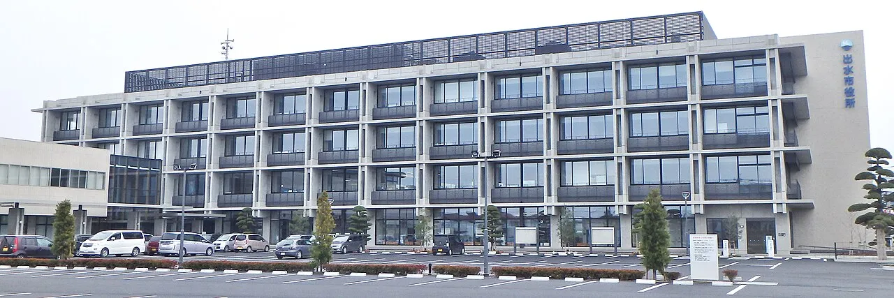
- Population
- 51,994
- 52K
- Elevation
- 37 m
- above sea level
- Local time
- UTC+09:00
- Asia/Tokyo · UTC+09:00
- Airports
- KOJ Kagoshima Airport46 km
- AXJ Amakusa Airport48 km
About Izumi
Izumi is a city. Location: Izumi Shi, Kagoshima. Population: 51,994. Elevation: 37 m.
Izumi (出水市, Izumi-shi; Japanese pronunciation: [í.(d͡)zɨ̀.mʲì, ì.(d͡)zɨ́.mʲí.ɕì)]) is a city located in Kagoshima Prefecture, Japan. As of 1 July 2024, the city had an estimated population of 51,450 in 25838 households, and a population density of 160 persons per km2. The total area of the city is 329.98 km2 (127.41 sq mi).
Source: Wikipedia · CC BY-SA 4.0
Photos of Izumi
-

Sanjo · CC BY-SA 4.0 -

Saigen Jiro · Public domain -

きじばる · CC BY-SA 4.0 -

きじばる · CC BY-SA 4.0 -

hyolee2 · CC BY-SA 3.0


Travel notes for Izumi
From Wikivoyage
Izumi (出水) is a city in the northwestern part of Kagoshima prefecture approximately 80 km north-northwest of Kagoshima City. It is known as a migratory place for cranes.
Understand+
The northern part of the city faces the Yatsushiro Sea (Shiranui Sea).
Tourist information sites:
Izumi Navi is the city's official multilingual guide site.
The local tourist association has a Japanese-only guide site.
Get in+
There is a stop on the Kyushu Shinkansen.
By plane:
The nearest airports are Kagoshima Airport and Aso Kumamoto Airport, both of which take about an hour and a half by public transportation. From Kagoshima Airport, there is a direct airport bus to various parts of the city. From Aso Kumamoto Airport, it is a connection between the Kyushu Shinkansen and the airport bus (Super Banpeiyu) (the transfer station is Shin-Yatsushiro Station).
By train:
Izumi Station serves the Kyushu Railway Company (JR Kyushu) and the Kyushu Shinkansen.
Hisatsu Orange Railway trains stop at Komenotsu Station, Izumi Station, Nishi Izumi Station, Takaono Station and Nodago Station.
By bus:
An airport shuttle bus operated by Nankoku Kotsu from Kagoshima Airport stops at Miyanojo, Izumi Station, and Akune City Hall.
A shuttle bus from Kuranomoto Airport operated by Nankoku Kotsu connects to the ferry bound for Amakusa, and to Izumi Station in front of Dandan Market.
Source: Wikivoyage · CC BY-SA 4.0 · abridged
Places bordering Izumi
- Sendai
- Isa Shi
- Satsuma-cho
- Akune
- Minamata
Twin towns and sister cities of Izumi
- Kushiro· Japan
Source: Wikidata. Only places with a page on this site are shown.
Population of Izumi over time
| 2010 | 55,621 | |
|---|---|---|
| 2014 | 54,464 | |
| 2015 | 53,758 | |
| 2021 | 51,893 |
Censuses and official estimates; source: Wikidata.
Climate of Izumi
Best months for sightseeingBest months for sightseeing: May, October.
This month · November
Outside the best season
Day 18° · Night 10° · Rain 91 mm
Better nearby cities in November
- Kirishima · 53 km southeast19°
- Kagoshima · 60 km south19°
- Miyakonojō · 77 km southeast18°
- Hottest month
- August (day 31°)
- Coldest month
- January (night 2°)
- Wettest month
- June (439 mm)
- Driest month
- December (75 mm)
Bars: average monthly low and high temperature. Below: precipitation. Monthly averages for 1970–2000 at about 18 km resolution, adjusted for elevation. Highlighted months are mild and relatively dry. Source: WorldClim 2.1 (CC BY 4.0).
Show values as a table
| Month | Jan | Feb | Mar | Apr | May | Jun | Jul | Aug | Sep | Oct | Nov | Dec |
|---|---|---|---|---|---|---|---|---|---|---|---|---|
| Average high (°C) | 10° | 11° | 15° | 20° | 24° | 26° | 30° | 31° | 28° | 23° | 18° | 13° |
| Average low (°C) | 2° | 3° | 6° | 11° | 15° | 19° | 23° | 24° | 21° | 15° | 10° | 4° |
| Precipitation (mm) | 89 | 107 | 162 | 213 | 246 | 439 | 426 | 240 | 214 | 112 | 91 | 75 |
How to get to Izumi
The nearest airport is Kagoshima Airport (KOJ), 46 km to the southeast as the crow flies. The nearest large city is Honmachi, 52 km to the northeast.
Airports
- Kagoshima Airport (KOJ) Kagoshima 46 kmsoutheast
- Amakusa Airport (AXJ) Amakusa 48 kmnorthwest
- Kumamoto Airport (KMJ) Kumamoto 95 kmnortheast
Nearby large cities
- Honmachi Population: 123.1K 52 kmnortheast
- Kirishima Population: 123.2K 53 kmsoutheast
- Kagoshima Population: 595K 60 kmsouth
- Miyakonojō Population: 161.1K 77 kmsoutheast
- Nagasaki Population: 409.1K 87 kmnorthwest
Straight-line distances; road distances are longer. Airport data: OurAirports.
Day trips from Izumi
Within 100 km: 4 historic and cultural sites, 11 natural sites, 17 lakes, rivers and coasts.
25–60 km9 places
- Shimoshima Island Island 38 kmNW
- Kamikoshiki Jima Island 54 kmSW
- Kami Shima Island 40 kmNW
- Ōyano Jima Island 56 kmN
60–100 km23 places
- Kyūshū Island 70 kmNE
- Suizenji Jōjuen Attraction 86 kmNE
- Mount Kinbō Mountain 85 kmN
- Kikuchi River River 90 kmN
Straight-line distances.
Izumi and similar cities
Side by side with cities of similar size in the same country: population, elevation and climate.
| Measure | Izumi | Shiraoka | Noshiro | Futtsu |
|---|---|---|---|---|
| Population | 52K | 52.2K | 52.3K | 51.6K |
| Elevation | 37 m | 13 m | 13 m | 5 m |
| Summer day (hottest month) | 31° | 30° | 28° | 30° |
| Winter night (coldest month) | 2° | -2° | -3° | 2° |
| Annual rainfall | 2,414 mm | 1,295 mm | 1,467 mm | 1,731 mm |
| Best months | May, Oct | May–Jun, Oct | Jun, Sep | May–Jun, Sep–Oct |
| Distance | — | 962 km | 1,251 km | 946 km |
Climate values are 1970–2000 monthly averages; straight-line distance.
Sources & licences
Data last updated: · 2 independent sources