Kokubu-matsuki
Local name: 国分松木
Located in Kirishima Shi, Kagoshima Coordinates: 31°44′00″ N 130°46′00″ E
- Population
- 57,896
- 57.9K
- Elevation
- 0 m
- above sea level
- Local time
- UTC+09:00
- Asia/Tokyo · UTC+09:00
- Airports
- KOJ Kagoshima Airport9 km
- KMI Miyazaki Airport67 km
About Kokubu-matsuki
Kokubu-matsuki is a town. Location: Kirishima Shi, Kagoshima. Population: 57,896. Elevation: 0 m. The best months to visit are April–May, October–November. The nearest airport is Kagoshima Airport (9 km). Nearby sights include Kirishima Yama and Shinmoe Dake.
Climate of Kokubu-matsuki
Best months for sightseeingBest months for sightseeing: April–May, October–November.
This month · November
A good month to visit
Day 19° · Night 9° · Rain 88 mm
- Hottest month
- August (day 31°)
- Coldest month
- January (night 2°)
- Wettest month
- June (430 mm)
- Driest month
- December (62 mm)
Bars: average monthly low and high temperature. Below: precipitation. Monthly averages for 1970–2000 at about 18 km resolution, adjusted for elevation. Highlighted months are mild and relatively dry. Source: WorldClim 2.1 (CC BY 4.0).
Show values as a table
| Month | Jan | Feb | Mar | Apr | May | Jun | Jul | Aug | Sep | Oct | Nov | Dec |
|---|---|---|---|---|---|---|---|---|---|---|---|---|
| Average high (°C) | 11° | 13° | 16° | 21° | 24° | 27° | 31° | 31° | 29° | 24° | 19° | 14° |
| Average low (°C) | 2° | 3° | 6° | 11° | 15° | 20° | 24° | 24° | 21° | 15° | 9° | 3° |
| Precipitation (mm) | 71 | 110 | 153 | 227 | 246 | 430 | 372 | 268 | 218 | 115 | 88 | 62 |
Other places to visit in this season: April May October November
How to get to Kokubu-matsuki
The nearest airport is Kagoshima Airport (KOJ), 9 km to the northwest as the crow flies. The nearest large city is Kirishima, 1 km to the northwest.
Airports
- Kagoshima Airport (KOJ) Kagoshima 9 kmnorthwest
- Miyazaki Airport (KMI) Miyazaki 67 kmeast
- Amakusa Airport (AXJ) Amakusa 101 kmnorthwest
Nearby large cities
- Kirishima Population: 123.2K 1 kmnorthwest
- Kagoshima Population: 595K 28 kmsouthwest
- Miyakonojō Population: 161.1K 28 kmeast
- Kanoya Population: 101.1K 40 kmsouth
- Miyazaki Population: 401.3K 65 kmeast
Straight-line distances; road distances are longer. Airport data: OurAirports.
Day trips from Kokubu-matsuki
Within 100 km: 11 natural sites, 16 lakes, rivers and coasts.
0–25 km5 places
- Sakura Jima Island 19 kmSW
- Sakurajima Mountain 19 kmSW
- Shinmoe Dake Mountain 23 kmNE
- Kirishima Yama Mountain 22 kmNE
25–60 km5 places
- Lake Ikeda Lake 58 kmS
- Satsuma Peninsula Natural site 48 kmSW
- Chiringa Shima Island 51 kmS
- Ōsumi Peninsula Natural site 47 kmS
60–100 km17 places
- Kyūshū Island 80 kmN
- Shimoshima Island Island 93 kmNW
- Kamikoshiki Jima Island 85 kmW
- Ao Shima Island 68 kmE
Straight-line distances.
Kokubu-matsuki and similar cities
Side by side with cities of similar size in the same country: population, elevation and climate.
| Measure | Kokubu-matsuki | Murakami | Sakurai | Choshi |
|---|---|---|---|---|
| Population | 57.9K | 58.3K | 58.4K | 58.4K |
| Elevation | 0 m | 4 m | 108 m | 5 m |
| Summer day (hottest month) | 31° | 30° | 31° | 29° |
| Winter night (coldest month) | 2° | -1° | 0° | 0° |
| Annual rainfall | 2,360 mm | 2,098 mm | 1,784 mm | 1,470 mm |
| Best months | Apr–May, Oct–Nov | May–Jun, Sep | May–Jun, Oct | May–Jul, Sep–Oct |
| Distance | — | 1,073 km | 565 km | 1,032 km |
Climate values are 1970–2000 monthly averages; straight-line distance.
Nearby attractions & nature
Everything nearby-
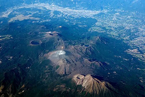 Kirishima Yama Mountain, Kagoshima22 km NE
-
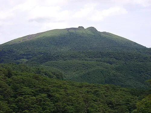 Shinmoe Dake Mountain, Kobayashi Shi23 km NE
-
 Mount Karakuni Mountain, Kobayashi Shi24 km N
-
 Sakura Jima Island, Kagoshima19 km SW
-
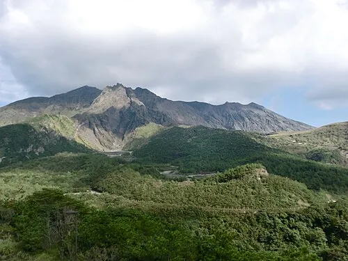 Sakurajima Mountain, Kagoshima Shi19 km SW
Sources & licences
Data last updated: · 2 independent sources