
- Local time
- UTC+09:00
- Asia/Tokyo · UTC+09:00
- Elevation
- 11 m
- above sea level
- Airports
- HND Tokyo Haneda International Airport17 km
- NRT Narita International Airport76 km
About Yokohama Marine Tower
Yokohama Marine Tower is a landmark. Location: Naka Ku, Yokohama.
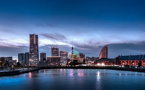
Yokohama Marine Tower (横浜マリンタワー, Yokohama Marin Tawā) is a 106 metres (348 feet) high lattice tower with an observation deck at a height of 100 metres in Naka Ward, Yokohama, Japan. The light characteristic is marked by a flash every twenty seconds, whereby the light's colour is alternating red and green. Originally, at night, the tower shaft itself was lit green and red according to its markings, but now, after the reopening in May 2009, the lights are white.
Source: Wikipedia · CC BY-SA 4.0
At a glance
- Built
- 1961
- Opened
- 1961
- Architect
- Shimizu Corporation
- Height
- 101 m
- Area
- 0.2 ha
- Official website
- marinetower.yokohama
Source: Wikidata
Photos of Yokohama Marine Tower
-

Suicasmo · CC BY-SA 4.0 -

Negishi Bay 妖精書士 · CC BY-SA 3.0 -

Tsurumi River Pqks758 · Public domain -

Sōji Ji Pqks758 · Public domain -
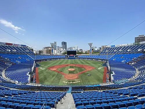
Yokohama Stadium 横浜1978 · CC BY-SA 4.0


Climate of Yokohama Marine Tower
Best months for sightseeingBest months for sightseeing: May–June, October.
This month · November
A wet month
Day 17° · Night 9° · Rain 106 mm
Better nearby cities in November
- Isehara · 31 km west18°
- Odawara · 49 km southwest19°
- Mishima · 76 km southwest18°
- Hottest month
- August (day 31°)
- Coldest month
- January (night 1°)
- Wettest month
- September (216 mm)
- Driest month
- December (52 mm)
Bars: average monthly low and high temperature. Below: precipitation. Monthly averages for 1970–2000 at about 18 km resolution, adjusted for elevation. Highlighted months are mild and relatively dry. Source: WorldClim 2.1 (CC BY 4.0).
Show values as a table
| Month | Jan | Feb | Mar | Apr | May | Jun | Jul | Aug | Sep | Oct | Nov | Dec |
|---|---|---|---|---|---|---|---|---|---|---|---|---|
| Average high (°C) | 10° | 11° | 13° | 19° | 23° | 25° | 29° | 31° | 27° | 22° | 17° | 13° |
| Average low (°C) | 1° | 2° | 5° | 10° | 14° | 18° | 22° | 23° | 20° | 14° | 9° | 4° |
| Precipitation (mm) | 56 | 72 | 126 | 141 | 157 | 213 | 162 | 175 | 216 | 195 | 106 | 52 |
How to get to Yokohama Marine Tower
The nearest airport is Tokyo Haneda International Airport (HND), 17 km to the northeast as the crow flies. The nearest large city is Yokohama, 1 km to the south.
Airports
- Tokyo Haneda International Airport (HND) Tokyo 17 kmnortheast
- Narita International Airport (NRT) Narita 76 kmnortheast
- Oshima Airport (OIM) Izu Oshima 78 kmsouth
Nearby large cities
- Yokohama Population: 3.8M 1 kmsouth
- Kawasaki Population: 1.5M 10 kmnortheast
- Ōta-ku Population: 748.1K 14 kmnortheast
- Kamakura Population: 172.9K 18 kmsouthwest
- Yokosuka Population: 409.5K 18 kmsouth
Straight-line distances; road distances are longer. Airport data: OurAirports.
Day trips from Yokohama Marine Tower
Within 100 km: 50 historic and cultural sites, 42 natural sites, 45 lakes, rivers and coasts.
0–25 km35 places
- Enoshima Island 22 kmSW
- Mount Ōyama Natural site 15 kmS
- Obitsu River River 23 kmE
- Koito River River 21 kmSE
25–60 km69 places
- Jōga Shima Island 35 kmS
- Saitama Super Arena Landmark 50 kmN
- Iruma River River 53 kmN
- Saitama Stadium 2002 Landmark 51 kmN
60–100 km33 places
- Ō Shima Island 82 kmS
- Hatsu-shima Island 63 kmSW
- Mount Bukō Mountain 75 kmNW
- Lake Shoji Lake 95 kmW
Straight-line distances.
Nearby attractions & nature
Everything nearby-
Yokohama Stadium Landmark, Naka Ku1 km W
-
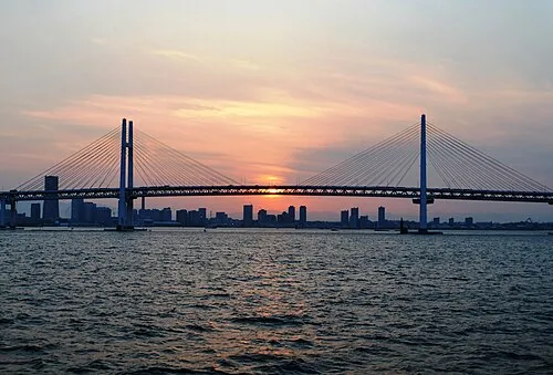 Yokohama Bay Bridge Landmark, Kanagawa2.4 km NE
-
Ōoka River River, Kanagawa1.8 km NW
-
Sōji Ji Attraction, Tsurumi Ku7.2 km N
-
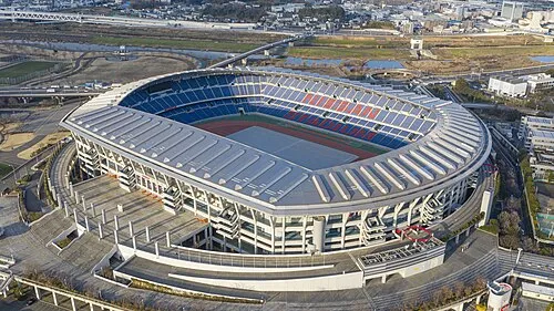 Nissan Stadium Landmark, Kōhoku-ku8.3 km NW
-
Tsurumi River River, Kanagawa4.8 km NE
-
Negishi Bay Natural site, Kanagawa5.2 km S
-
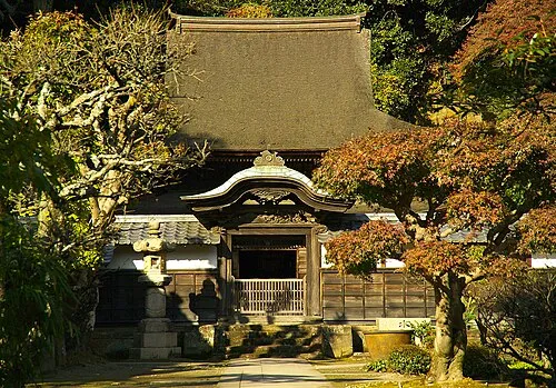 Engaku Ji Attraction, Kamakura15 km SW
Nearest towns and villages


Sources & licences
Data last updated: · 2 independent sources