- Population
- 50,860
- 50.9K
- Elevation
- 61 m
- above sea level
- Local time
- UTC+09:00
- Asia/Tokyo · UTC+09:00
- Airports
- TJH Konotori Tajima Airport26 km
- TTJ Tottori Sand Dunes Conan Airport80 km
About Kyōtango
Kyōtango is a city. Location: Kyōtango Shi, Kyoto. Population: 50,860. Elevation: 61 m. The best months to visit are May–June, October. The nearest airport is Konotori Tajima Airport (26 km). Nearby sights include Mount Ooe and Maruyama River.
Climate of Kyōtango
Best months for sightseeingBest months for sightseeing: May–June, October.
This month · November
A wet month
Day 16° · Night 7° · Rain 148 mm
Better nearby cities in November
- Kochi · 267 km southwest18°
- Kofu · 318 km east17°
- Fujinomiya · 327 km east18°
- Hottest month
- August (day 31°)
- Coldest month
- February (night 0°)
- Wettest month
- September (225 mm)
- Driest month
- April (116 mm)
Bars: average monthly low and high temperature. Below: precipitation. Monthly averages for 1970–2000 at about 18 km resolution, adjusted for elevation. Highlighted months are mild and relatively dry. Source: WorldClim 2.1 (CC BY 4.0).
Show values as a table
| Month | Jan | Feb | Mar | Apr | May | Jun | Jul | Aug | Sep | Oct | Nov | Dec |
|---|---|---|---|---|---|---|---|---|---|---|---|---|
| Average high (°C) | 7° | 7° | 11° | 18° | 23° | 26° | 30° | 31° | 26° | 21° | 16° | 10° |
| Average low (°C) | 0° | 0° | 2° | 7° | 12° | 17° | 22° | 22° | 18° | 12° | 7° | 2° |
| Precipitation (mm) | 188 | 159 | 136 | 116 | 132 | 177 | 182 | 133 | 225 | 146 | 148 | 159 |
How to get to Kyōtango
The nearest airport is Konotori Tajima Airport (TJH), 26 km to the southwest as the crow flies. For international flights: Osaka Itami International Airport (ITM) (98 km). The nearest large city is Tottori-shi, 74 km to the west.
Airports
- Konotori Tajima Airport (TJH) Toyooka 26 kmsouthwest
- Tottori Sand Dunes Conan Airport (TTJ) Tottori 80 kmwest
- Osaka Itami International Airport (ITM) Osaka 98 kmsouth
Nearby large cities
- Tottori-shi Population: 188.5K 74 kmwest
- Sandachō Population: 132.9K 82 kmsouth
- Himeji Population: 530.5K 93 kmsouth
- Ikeda Population: 105K 94 kmsouth
- Kawanishi Population: 155.2K 94 kmsouth
Straight-line distances; road distances are longer. Airport data: OurAirports.
Nearby attractions & nature
Everything nearby-
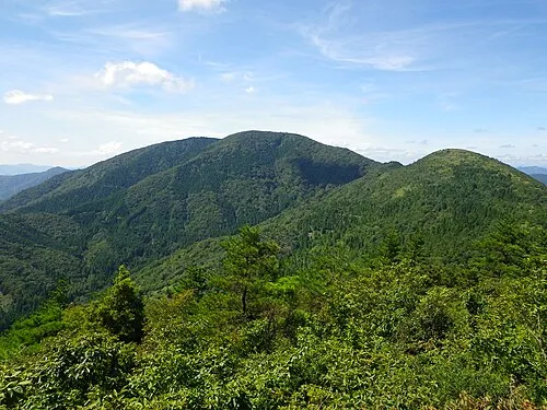 Mount Ooe Mountain, Yosano Chō18 km S
-
Maruyama River River, Hyōgo19 km W
-
Yura River River, Kyoto24 km SE
Sources & licences
Data last updated: