Kesennuma
Local name: 気仙沼市
Located in Kesennuma Shi, Miyagi Coordinates: 38°54′04″ N 141°34′39″ E
- Population
- 61,147
- 61.1K
- Elevation
- 14 m
- above sea level
- Local time
- UTC+09:00
- Asia/Tokyo · UTC+09:00
- Airports
- HNA Iwate Hanamaki Airport70 km
- SDJ Sendai Airport102 km
About Kesennuma
Kesennuma is a city. Location: Kesennuma Shi, Miyagi. Population: 61,147. Elevation: 14 m.
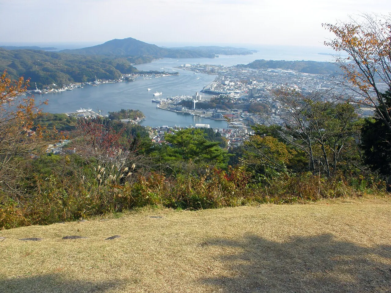
Kesennuma (気仙沼市, Kesennuma-shi) is a city in Miyagi Prefecture, Japan. As of 1 August 2020, the city had an estimated population of 59,803 and a population density of 190 inhabitants per square kilometre (490/sq mi) in 26,390 households. The total area of the city is 332.44 square kilometres (128.36 sq mi). Large sections of the city were destroyed by the 2011 Tōhoku earthquake and tsunami and major fires on March 11, 2011.
Source: Wikipedia · CC BY-SA 4.0
Photos of Kesennuma
-

Satoh Junpei · CC BY-SA 3.0 -

タコノマクラ · CC BY-SA 3.0


Travel notes for Kesennuma
From Wikivoyage
Kesennuma (気仙沼市 Kesennuma-shi) is a city in Miyagi, Japan. It is home to the only shark museum in the country. There you can try a shark fin burger or various other delicacies of the city.
Oshima, which lays off the coast, is accessible by ferry from multiple ferry ports. Oshima is home to beautiful beaches which are quite popular in the summer, as is the Kame-yama lift which takes you up Oshima's Kameyama. The view of the island and city is beautiful.
Understand+
Tourist information site:
The local tourist association has a bilingual guide site.
Get in+
By car:
The nearest expressway to Kesennuma can be found in Ichinoseki, an hour's drive to the east. There are local highways that run north along the coast to Aomori and south toward Ishinomaki. These are rather scenic but are relatively slow, particularly in areas where post-tsunami construction work is heavy.
By train:
Before the tsunami, there was a train line running up the coast from Sendai. There was also a train line continuing north from Kesennuma. Both were destroyed and have not been replaced. To reach Kesennuma by train, one can take the Tohoku Shinkansen to Ichinoseki, Iwate, and transfer to a local line, which terminates at Kesennuma Station.
1 Kesennuma Station (気仙沼駅), 古町一丁目5-25. 05:00-20:00. This is the main train station for Kesennuma. There is a small store and sitting area.
By bus:
Highway buses connect Kesennuma with Sendai and Tokyo. Buses between Sendai and Kesennuma run six times a day. An overnight bus linking Kesennuma and Ikebukuro in Tokyo runs every night.
The BRT (bus rapid transit), which replaced the train line running up the coast from Sendai, also connects Kesennuma with Minamisanriku, and Sendai by way of transfer to train lines starting near Ishinomaki.
Source: Wikivoyage · CC BY-SA 4.0 · abridged
Places bordering Kesennuma
- Rikuzen-takata Shi
- Ichinoseki
- Tome Shi
- Minamisanriku Chō
Twin towns and sister cities of Kesennuma
- Ichinoseki· Japan
- Meguro-ku· Japan
Source: Wikidata. Only places with a page on this site are shown.
Population of Kesennuma over time
| 2010 | 73,489 | |
|---|---|---|
| 2015 | 64,988 | |
| 2021 | 59,341 |
Censuses and official estimates; source: Wikidata.
Climate of Kesennuma
Best months for sightseeingBest months for sightseeing: June–July, September.
This month · November
Outside the best season
Day 13° · Night 4° · Rain 81 mm
- Hottest month
- August (day 27°)
- Coldest month
- January (night -3°)
- Wettest month
- September (182 mm)
- Driest month
- January (45 mm)
Bars: average monthly low and high temperature. Below: precipitation. Monthly averages for 1970–2000 at about 18 km resolution, adjusted for elevation. Highlighted months are mild and relatively dry. Source: WorldClim 2.1 (CC BY 4.0).
Show values as a table
| Month | Jan | Feb | Mar | Apr | May | Jun | Jul | Aug | Sep | Oct | Nov | Dec |
|---|---|---|---|---|---|---|---|---|---|---|---|---|
| Average high (°C) | 5° | 5° | 8° | 14° | 18° | 21° | 25° | 27° | 23° | 18° | 13° | 7° |
| Average low (°C) | -3° | -3° | -1° | 5° | 10° | 14° | 18° | 20° | 16° | 10° | 4° | 0° |
| Precipitation (mm) | 45 | 55 | 78 | 116 | 125 | 138 | 158 | 164 | 182 | 131 | 81 | 47 |
How to get to Kesennuma
The nearest airport is Iwate Hanamaki Airport (HNA), 70 km to the northwest as the crow flies. For international flights: Sendai Airport (SDJ) (102 km). The nearest large city is Ichinoseki, 39 km to the west.
Airports
- Iwate Hanamaki Airport (HNA) Hanamaki 70 kmnorthwest
- Sendai Airport (SDJ) Natori 102 kmsouthwest
- Yamagata Airport (GAJ) Higashine 118 kmsouthwest
Nearby large cities
- Ichinoseki Population: 114.5K 39 kmwest
- Ōshū Population: 112.9K 44 kmnorthwest
- Ishinomaki Population: 140.2K 59 kmsouthwest
- Ōsaki Population: 128.8K 63 kmsouthwest
- Sendai Population: 1.1M 94 kmsouthwest
Straight-line distances; road distances are longer. Airport data: OurAirports.
Day trips from Kesennuma
Within 100 km: 3 historic and cultural sites, 5 natural sites, 17 lakes, rivers and coasts.
0–25 km1 place
- Matsu Shima Island 9 kmNE
25–60 km5 places
- Kitakami River River 37 kmS
- Kitakami-gawa River 37 kmS
- Chūson-ji Attraction 43 kmW
- Waga River River 57 kmNW
60–100 km19 places
- Miyago Jima Island 73 kmSW
- Tashiro Jima Island 68 kmS
- Mount Funagata Mountain 97 kmSW
- Zuigan Ji Attraction 74 kmSW
Straight-line distances.
Kesennuma and similar cities
Side by side with cities of similar size in the same country: population, elevation and climate.
| Measure | Kesennuma | Chichibu | Hashimoto | Itoman |
|---|---|---|---|---|
| Population | 61.1K | 61.2K | 61.1K | 61K |
| Elevation | 14 m | 236 m | 79 m | 5 m |
| Summer day (hottest month) | 27° | 30° | 31° | 31° |
| Winter night (coldest month) | -3° | -2° | 1° | 15° |
| Annual rainfall | 1,320 mm | 1,433 mm | 1,787 mm | 2,110 mm |
| Best months | Jun–Jul, Sep | May–Jun, Sep–Oct | May–Jun, Oct | Nov–Apr |
| Distance | — | 392 km | 737 km | 1,923 km |
Climate values are 1970–2000 monthly averages; straight-line distance.
Sources & licences
Data last updated: · 2 independent sources