Ike-jima
Local name: 池島
Located in Nagasaki Shi, Nagasaki Coordinates: 32°53′05″ N 129°35′56″ E
- Local time
- UTC+09:00
- Asia/Tokyo · UTC+09:00
- Airports
- NGS Nagasaki Airport30 km
- AXJ Amakusa Airport69 km
About Ike-jima
Ike-jima is an island. Location: Nagasaki Shi, Nagasaki.
Ikeshima or Ikejima (Japanese: 池島), also sometimes listed as Ike Island, is an island in Nagasaki Prefecture, Japan. Initially within the borders of Kamiura village, from 1955 until its merger with the city of Nagasaki in 2005, it was part of Sotome municipality. Thousands of coal miners who lived on the island were formerly employed there, representing the vast majority of its population. The coal mines opened in 1959 and closed in 2001. The number of miners was reported to be 8,000, or over 10,000 at its peak.
Source: Wikipedia · CC BY-SA 4.0
Travel notes for Ike-jima
From Wikivoyage
Ikeshima (池島), also known as Ike Island, is a small island in Nagasaki, Japan.
Understand+
The last open-pit coal mine in Japan, Ikeshima housed nearly 10,000 people at its peak, but closed down in 2001. A little over 100 people are left now, mostly tending to a nascent tourist industry of people visiting the ruins.
The island is often compared to nearby Gunkanjima (Battleship Island) of James Bond fame, but is far less well known and, as a (barely) living community, is much more freely accessible. The mine areas are still marked off and can legally only be accessed on guided tours.
Tourist information site:
Nagasaki City has a separate Japanese-only guide site for the sea area including Ikeshima.
Get in+
The island is served by 7 daily ferries from Konoura port (神浦港) and 6 from Seto port (瀬戸港), a frankly absurd level of subsidized service given the tiny population. Fares range from ¥370-570 and travel times from 10-26 minutes depending on the ship, see the above guide site for schedules.
Both ports can be reached by bus from central Nagasaki, but you will need to transfer at Sakuranosato Terminal (桜の里ターミナル) and the trip will take at least 1.5 hours.
Source: Wikivoyage · CC BY-SA 4.0 · abridged
Climate of Ike-jima
Best months for sightseeingBest months for sightseeing: May–June, October.
This month · November
Outside the best season
Day 17° · Night 10° · Rain 92 mm
Better nearby cities in November
- Kirishima · 168 km southeast19°
- Kagoshima · 172 km southeast19°
- Beppu · 182 km east17°
- Hottest month
- August (day 30°)
- Coldest month
- January (night 3°)
- Wettest month
- June (335 mm)
- Driest month
- December (67 mm)
Bars: average monthly low and high temperature. Below: precipitation. Monthly averages for 1970–2000 at about 18 km resolution, adjusted for elevation. Highlighted months are mild and relatively dry. Source: WorldClim 2.1 (CC BY 4.0).
Show values as a table
| Month | Jan | Feb | Mar | Apr | May | Jun | Jul | Aug | Sep | Oct | Nov | Dec |
|---|---|---|---|---|---|---|---|---|---|---|---|---|
| Average high (°C) | 9° | 10° | 13° | 18° | 22° | 25° | 29° | 30° | 27° | 22° | 17° | 12° |
| Average low (°C) | 3° | 3° | 6° | 10° | 14° | 19° | 23° | 24° | 20° | 15° | 10° | 5° |
| Precipitation (mm) | 78 | 89 | 132 | 190 | 199 | 335 | 324 | 194 | 212 | 101 | 92 | 67 |
How to get to Ike-jima
The nearest airport is Nagasaki Airport (NGS), 30 km to the east as the crow flies. The nearest large city is Nagasaki, 31 km to the southeast.
Airports
- Nagasaki Airport (NGS) Nagasaki 30 kmeast
- Amakusa Airport (AXJ) Amakusa 69 kmsoutheast
- Kyushu Saga International Airport (HSG) Saga 72 kmnortheast
Nearby large cities
- Nagasaki Population: 409.1K 31 kmsoutheast
- Sasebo Population: 243.2K 34 kmnorth
- Isahaya Population: 135.5K 42 kmeast
- Karatsu Population: 117.7K 71 kmnortheast
- Saga Population: 233.3K 76 kmnortheast
Straight-line distances; road distances are longer. Airport data: OurAirports.
Day trips from Ike-jima
Within 100 km: 5 historic and cultural sites, 9 natural sites, 18 lakes, rivers and coasts.
0–25 km1 place
- Nishisonoki-hantō Natural site 15 kmE
25–60 km13 places
- Goto Group Island 59 kmW
- Hario Jima Island 30 kmNE
- Wakamatsu Island Island 56 kmW
- Iō Jima Island 26 kmSE
60–100 km18 places
- Shimoshima Island Island 76 kmSE
- Mount Unzen Mountain 66 kmE
- Ōyano Jima Island 85 kmSE
- Naru Island Island 62 kmW
Straight-line distances.
Nearest towns and villages
-
Saikai City, Saikai Shi13 km NE
-
Togitsu Chō Municipality, Nishisonogi-gun22 km E
-
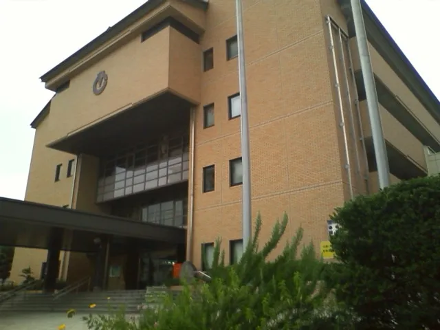 Togitsu Town, Togitsu Chō24 km E
-
Nagasaki City, Nagasaki Shi31 km SE
-
Sakitochō-hongō Village, Saikai Shi14 km N
-
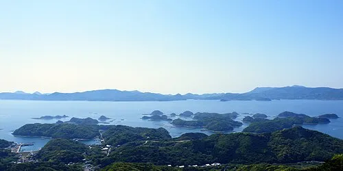 Sasebo City, Sasebo Shi34 km N
Sources & licences
Data last updated: · 2 independent sources