Yahiko
Local name: 弥彦村
Located in Yahiko Mura, Nishikanbara District Coordinates: 37°42′00″ N 138°50′00″ E
- Population
- 7,705
- 7.7K
- Elevation
- 17 m
- above sea level
- Local time
- UTC+09:00
- Asia/Tokyo · UTC+09:00
- Airports
- KIJ Niigata Airport37 km
- SDS Sado Airport54 km
About Yahiko
Yahiko is a town. Location: Yahiko Mura, Nishikanbara District. Population: 7,705. Elevation: 17 m.
Yahiko (弥彦村, Yahiko-mura) is a village located in Niigata Prefecture, Japan. As of 1 July 2019, the village had an estimated population of 7,824, and a population density of 311 persons per km2. The total area of the village was 25.17 square kilometres (9.72 sq mi).
Source: Wikipedia · CC BY-SA 4.0
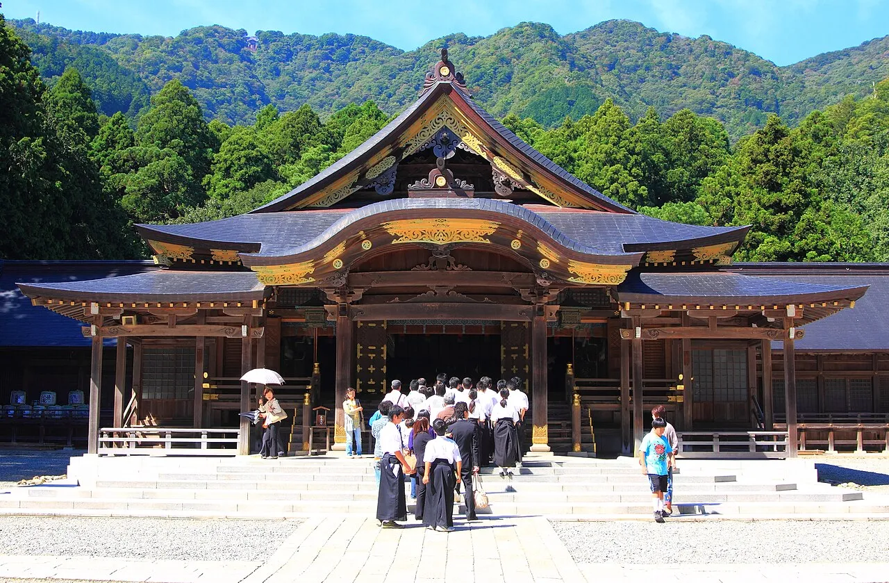
Photos of Yahiko
-

AT · CC BY-SA 4.0 -

雷太 · CC BY 2.0 -

Fred Cherrygarden · CC BY-SA 4.0 -

Triglav · CC BY-SA 3.0 -

marufuku_sign_collec… · CC BY 3.0


Places bordering Yahiko
- Niigata Shi
- Tsubame
- Nagaoka Shi
Population of Yahiko over time
| 2010 | 8,582 | |
|---|---|---|
| 2015 | 8,209 | |
| 2021 | 7,655 |
Censuses and official estimates; source: Wikidata.
Climate of Yahiko
Best months for sightseeingBest months for sightseeing: May–June, September.
This month · November
A wet month
Day 14° · Night 6° · Rain 240 mm
Better nearby cities in November
- Kofu · 227 km south17°
- Isehara · 259 km south18°
- Odawara · 273 km south19°
- Hottest month
- August (day 29°)
- Coldest month
- February (night -1°)
- Wettest month
- December (317 mm)
- Driest month
- May (105 mm)
Bars: average monthly low and high temperature. Below: precipitation. Monthly averages for 1970–2000 at about 18 km resolution, adjusted for elevation. Highlighted months are mild and relatively dry. Source: WorldClim 2.1 (CC BY 4.0).
Show values as a table
| Month | Jan | Feb | Mar | Apr | May | Jun | Jul | Aug | Sep | Oct | Nov | Dec |
|---|---|---|---|---|---|---|---|---|---|---|---|---|
| Average high (°C) | 5° | 5° | 8° | 15° | 20° | 23° | 27° | 29° | 25° | 19° | 14° | 8° |
| Average low (°C) | -1° | -1° | 1° | 6° | 11° | 16° | 21° | 22° | 18° | 12° | 6° | 2° |
| Precipitation (mm) | 276 | 187 | 133 | 108 | 105 | 132 | 184 | 139 | 185 | 177 | 240 | 317 |
How to get to Yahiko
The nearest airport is Niigata Airport (KIJ), 37 km to the northeast as the crow flies. The nearest large city is Nagaoka, 28 km to the south.
Airports
- Niigata Airport (KIJ) Niigata 37 kmnortheast
- Sado Airport (SDS) Sado 54 kmnorthwest
- Shonai Airport (SYO) Shonai 149 kmnortheast
Nearby large cities
- Nagaoka Population: 266.9K 28 kmsouth
- Jōetsu Population: 189.4K 81 kmsouthwest
- Aizu-Wakamatsu Population: 118.2K 101 kmeast
- Nagano Population: 372.8K 130 kmsouthwest
- Kōriyama Population: 327.7K 141 kmeast
Straight-line distances; road distances are longer. Airport data: OurAirports.
Day trips from Yahiko
Within 100 km: 2 historic and cultural sites, 10 natural sites, 8 lakes, rivers and coasts.
25–60 km5 places
- Sado Island Island 53 kmNW
- Kamo Ko Lake 54 kmNW
- Uono River River 48 kmS
- Shinano River River 35 kmNE
60–100 km15 places
- Awashima Island Island 92 kmNE
- Arakawa River River 77 kmSW
- Takada castle Historic site 83 kmSW
- Naeba-san Mountain 96 kmS
Straight-line distances.
Sources & licences
Data last updated: · 2 independent sources