
- Population
- 64,874
- 64.9K
- Elevation
- 90 m
- above sea level
- Local time
- UTC+09:00
- Asia/Tokyo · UTC+09:00
- Airports
- FUK Fukuoka Airport54 km
- KMJ Kumamoto Airport54 km
About Hita
Hita is a city. Location: Hita Shi, Oita. Population: 64,874. Elevation: 90 m.
Hita (日田市, Hita-shi) is a city located in Ōita Prefecture, Japan. As of 30 November 2023, the city had an estimated population of 61,148 in 27,556 households, and a population density of 96 persons per km2. The total area of the city is 666.03 km2 (257.16 sq mi).
Source: Wikipedia · CC BY-SA 4.0
Photos of Hita
-

そらみみ · CC BY-SA 4.0 -

そらみみ · CC BY-SA 4.0 -

inunami · CC BY 2.0 -
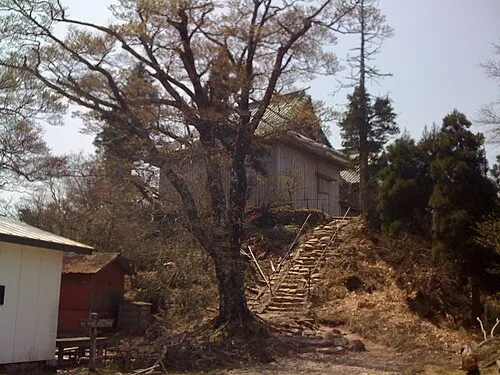
Mount Hiko Antake · CC BY-SA 3.0


Travel notes for Hita
From Wikivoyage
Hita (日田市 Hita-shi) is a small city in the west of Oita prefecture, Japan. It's closer to Fukuoka than Oita, the prefectural capital.
Understand+
1 Hita Tourist Information Center (日田市観光案内所), 11-3 Motomachi, ☏ +81 97-322-2036. Daily 09:00-17:00. A great starting point for tourist information. (updated Aug 2024)
Get in+
By bus:
Highway buses to Fukuoka (Tenjin and Hakata) leave approximately every 20 minutes from Hita Bus Centre (1½ hours, ¥1750) Some buses stop at the airport which adds on about 15 minutes to the journey. You can buy a book of 4 tickets (a Super Joshaken) for ¥5600. Buses to Oita City leave from the highway stop every 1-2 hours.
By train:
Although Hita does have a station, the train is not as convenient as the bus, being more expensive, irregular and less frequent. Services run east to Yufuin (74 min, ¥1080) and Oita (130 min, ¥2070), and west to Kurume (75 min, ¥1080).
By car:
The Oita Expressway has an exit here. Driving northwest it takes about 1 hour to drive to Fukuoka (¥1650). Going east it takes about 1 hour to get to Beppu (¥2000) and about 1 hour 20 minutes to get all the way to Oita (¥2350).
Source: Wikivoyage · CC BY-SA 4.0 · abridged
Places bordering Hita
- Nakatsu
- Kusu Machi
- Yamaga
- Kikuchi
- Aso
- Minamioguni Machi
- Oguni Machi
- Ukiha Shi
- Yame Shi
- Asakura Shi
- Soeda Machi
- Tōhō Mura
Population of Hita over time
| 2010 | 70,940 | |
|---|---|---|
| 2011 | 71,537 | |
| 2015 | 66,523 | |
| 2021 | 61,755 |
Censuses and official estimates; source: Wikidata.
Climate of Hita
Best months for sightseeingBest months for sightseeing: May–June, October.
This month · November
Outside the best season
Day 17° · Night 8° · Rain 77 mm
Better nearby cities in November
- Beppu · 52 km east17°
- Ōita · 62 km east18°
- Nobeoka · 106 km southeast18°
- Hottest month
- August (day 31°)
- Coldest month
- January (night 1°)
- Wettest month
- July (413 mm)
- Driest month
- December (58 mm)
Bars: average monthly low and high temperature. Below: precipitation. Monthly averages for 1970–2000 at about 18 km resolution, adjusted for elevation. Highlighted months are mild and relatively dry. Source: WorldClim 2.1 (CC BY 4.0).
Show values as a table
| Month | Jan | Feb | Mar | Apr | May | Jun | Jul | Aug | Sep | Oct | Nov | Dec |
|---|---|---|---|---|---|---|---|---|---|---|---|---|
| Average high (°C) | 8° | 9° | 13° | 19° | 23° | 26° | 30° | 31° | 27° | 22° | 17° | 11° |
| Average low (°C) | 1° | 1° | 4° | 10° | 14° | 19° | 23° | 23° | 20° | 14° | 8° | 3° |
| Precipitation (mm) | 73 | 95 | 136 | 177 | 205 | 381 | 413 | 228 | 203 | 111 | 77 | 58 |
How to get to Hita
The nearest airport is Fukuoka Airport (FUK), 54 km to the northwest as the crow flies. The nearest large city is Kurume, 40 km to the west.
Airports
- Fukuoka Airport (FUK) Fukuoka 54 kmnorthwest
- Kumamoto Airport (KMJ) Kumamoto 54 kmsouth
- Kitakyushu Airport (KKJ) Kitakyushu 59 kmnorth
Nearby large cities
- Kurume Population: 303.6K 40 kmwest
- Iizuka Population: 126.4K 42 kmnorthwest
- Chikushino-shi Population: 103.3K 44 kmnorthwest
- Ōnojō Population: 102.1K 49 kmnorthwest
- Kasuga Population: 111K 50 kmnorthwest
Straight-line distances; road distances are longer. Airport data: OurAirports.
Day trips from Hita
Within 100 km: 20 historic and cultural sites, 22 natural sites, 12 lakes, rivers and coasts.
0–25 km1 place
- Mount Hiko Mountain 18 kmN
25–60 km22 places
- Chikugo River River 58 kmW
- Mount Tsurumi Mountain 46 kmE
- Mount Sarakura Mountain 60 kmN
- Kyūshū Kokuritsu Hakubutsukan Museum 43 kmNW
60–100 km31 places
- Kyūshū Island 99 kmS
- Hiko Shima Island 68 kmN
- Mount Ōkueyama Mountain 84 kmSE
- Mount Unzen Mountain 88 kmSW
Straight-line distances.
Hita and similar cities
Side by side with cities of similar size in the same country: population, elevation and climate.
| Measure | Hita | Sodegaura | Asahi | Tomigusuku |
|---|---|---|---|---|
| Population | 64.9K | 64.9K | 64.7K | 64.6K |
| Elevation | 90 m | 18 m | 5 m | 47 m |
| Summer day (hottest month) | 31° | 30° | 29° | 31° |
| Winter night (coldest month) | 1° | 1° | -1° | 14° |
| Annual rainfall | 2,157 mm | 1,523 mm | 1,455 mm | 2,105 mm |
| Best months | May–Jun, Oct | May–Jul, Sep–Oct | May–Jul, Sep–Oct | Nov–May |
| Distance | — | 867 km | 930 km | 851 km |
Climate values are 1970–2000 monthly averages; straight-line distance.
Sources & licences
Data last updated: · 2 independent sources