- Population
- 84,701
- 84.7K
- Elevation
- 7 m
- above sea level
- Local time
- UTC+09:00
- Asia/Tokyo · UTC+09:00
- Airports
- KKJ Kitakyushu Airport31 km
- UBJ Yamaguchi Ube Airport38 km
About Nakatsu
Nakatsu is a city. Location: Nakatsu Shi, Oita. Population: 84,701. Elevation: 7 m.
Nakatsu (中津市, Nakatsu-shi) is a city on the northern border of Ōita Prefecture in Kyushu, Japan. As of 31 October 2023, the city had an estimated population of 82,301 in 41,222 households, and a population density of 96 persons per km2. The total area of the city is 491.53 km2 (189.78 sq mi).
Source: Wikipedia · CC BY-SA 4.0
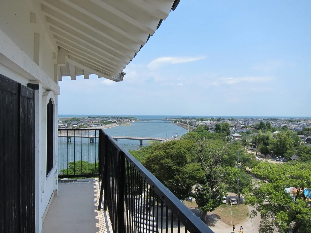
Photos of Nakatsu
-

福原邦展 · CC BY 3.0 -

福原邦展 · CC BY 3.0 -

veroyama · CC BY 2.0 -

そらみみ · CC BY-SA 4.0 -

そらみみ · CC BY-SA 4.0


Places bordering Nakatsu
- Usa Shi
- Hita
- Kusu Machi
- Buzen
- Soeda Machi
- Kōge Machi
- Yoshitomi
- Chikujō Machi
- Miyako Machi
Population of Nakatsu over time
| 2010 | 84,312 | |
|---|---|---|
| 2015 | 83,965 | |
| 2021 | 82,714 |
Censuses and official estimates; source: Wikidata.
Climate of Nakatsu
Best months for sightseeingBest months for sightseeing: May, October.
This month · November
Outside the best season
Day 17° · Night 8° · Rain 66 mm
Better nearby cities in November
- Beppu · 46 km southeast17°
- Ōita · 56 km southeast18°
- Nobeoka · 121 km south18°
- Hottest month
- August (day 31°)
- Coldest month
- January (night 1°)
- Wettest month
- June (272 mm)
- Driest month
- January (52 mm)
Bars: average monthly low and high temperature. Below: precipitation. Monthly averages for 1970–2000 at about 18 km resolution, adjusted for elevation. Highlighted months are mild and relatively dry. Source: WorldClim 2.1 (CC BY 4.0).
Show values as a table
| Month | Jan | Feb | Mar | Apr | May | Jun | Jul | Aug | Sep | Oct | Nov | Dec |
|---|---|---|---|---|---|---|---|---|---|---|---|---|
| Average high (°C) | 9° | 10° | 13° | 19° | 23° | 26° | 30° | 31° | 27° | 22° | 17° | 12° |
| Average low (°C) | 1° | 2° | 4° | 10° | 14° | 19° | 23° | 24° | 20° | 14° | 8° | 3° |
| Precipitation (mm) | 52 | 80 | 101 | 150 | 152 | 272 | 270 | 145 | 221 | 104 | 66 | 52 |
How to get to Nakatsu
The nearest airport is Kitakyushu Airport (KKJ), 31 km to the northwest as the crow flies. The nearest large city is Ube, 39 km to the north.
Airports
- Kitakyushu Airport (KKJ) Kitakyushu 31 kmnorthwest
- Yamaguchi Ube Airport (UBJ) Ube 38 kmnorth
- Oita Airport (OIT) Oita 53 kmeast
Nearby large cities
- Ube Population: 173.7K 39 kmnorth
- Beppu Population: 122.6K 46 kmsoutheast
- Shimonoseki Population: 265.7K 46 kmnorthwest
- Iizuka Population: 126.4K 47 kmwest
- Ōita Population: 477.7K 56 kmsoutheast
Straight-line distances; road distances are longer. Airport data: OurAirports.
Day trips from Nakatsu
Within 100 km: 18 historic and cultural sites, 17 natural sites, 12 lakes, rivers and coasts.
25–60 km18 places
- Hiko Shima Island 45 kmNW
- Mount Hōman Mountain 58 kmW
- Mount Hiko Mountain 27 kmSW
- Mount Tsurumi Mountain 41 kmSE
60–100 km29 places
- Kumamoto castle Historic site 99 kmSW
- Genkai Island Island 89 kmW
- Aino-Island Island 78 kmW
- Mount Sefuri Mountain 78 kmW
Straight-line distances.
Nakatsu and similar cities
Side by side with cities of similar size in the same country: population, elevation and climate.
| Measure | Nakatsu | Ushiku | Komae | Chita |
|---|---|---|---|---|
| Population | 84.7K | 84.7K | 84.8K | 84.4K |
| Elevation | 7 m | 26 m | 28 m | 9 m |
| Summer day (hottest month) | 31° | 29° | 31° | 32° |
| Winter night (coldest month) | 1° | -1° | 0° | 0° |
| Annual rainfall | 1,665 mm | 1,320 mm | 1,545 mm | 1,934 mm |
| Best months | May, Oct | May–Jun, Sep–Oct | May–Jun, Oct | Apr–Jun, Oct |
| Distance | — | 859 km | 801 km | 545 km |
Climate values are 1970–2000 monthly averages; straight-line distance.
Sources & licences
Data last updated: · 2 independent sources