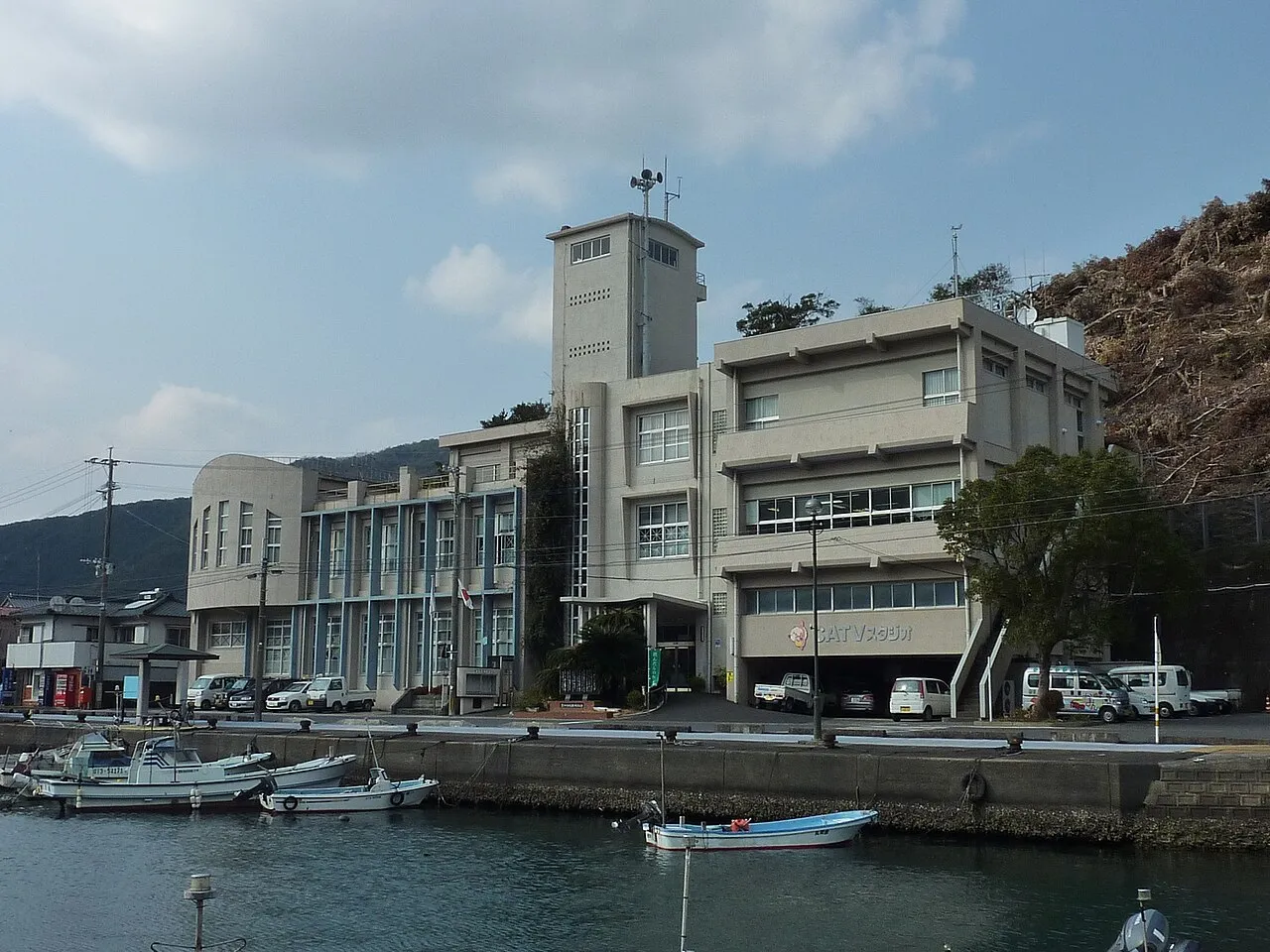
- Population
- 66,851
- 66.9K
- Elevation
- 3 m
- above sea level
- Local time
- UTC+09:00
- Asia/Tokyo · UTC+09:00
- Airports
- OIT Oita Airport61 km
- KMJ Kumamoto Airport99 km
About Saiki
Saiki is a city. Location: Saiki Shi, Oita. Population: 66,851. Elevation: 3 m.
Saiki (佐伯市, Saiki-shi) is a city located in Ōita Prefecture, Japan. As of 31 October 2023, the city had an estimated population of 65,870 in 32921 households, and a population density of 73 persons per km2. The total area of the city is 903.11 km2 (348.69 sq mi), making it the largest city by area in Kyushu.
Source: Wikipedia · CC BY-SA 4.0
Travel notes for Saiki
From Wikivoyage
Saiki (佐伯) is the easternmost city in Kyushu, the island's largest by area, and Ōita Prefecture's fourth-largest by population.
Understand+
Tourist information site:
The local tourist association has a Japanese-only guide site.
Get in+
By plane:
The nearest airport is Ōita Airport. Buses run six times a day to and from Cosmo Town, Ōtemae and Saiki Station, taking a little over two hours and costing ¥2880 (¥4940 return).
Miyazaki Airport is accessible by train; see below.
By train:
Saiki is on the Nippō Main Line.
There are hourly Nichirin Limited Expresses, which will take you to Ōita (1 hour 5 minutes, ¥2630) via Usuki (30 minutes, ¥1700) or Miyazaki Airport (2 hours 20 minutes, ¥4680) via Nobeoka (1 hour, ¥2450) and Miyazaki (2 hours 10 minutes, ¥4560).
There are three direct Sonic, Nichirin and Nichirin Seagaia trains a day to Kokura (2 hours 45 minutes, ¥5570) for the San'yō Shinkansen, of which two come from Hakata (3 hours 30 minutes, ¥7190). Otherwise, take a Sonic from either station to Ōita and change there.
Local trains are less frequent, but will get you in from Ōita in about 1 hour 30 minutes for ¥1290, and from Usuki in 45 minutes and ¥560. Local trains to and from Nobeoka (1 hour 10 minutes, ¥1110) are so infrequent and inconveniently timed as to be practically nonexistent.
There is a nimai-kippu which allows a return trip to Ōita within one month using Limited Expresses for ¥3900 (a saving of ¥1360). Another nimai-kippu allows return travel to any JR station in the Fukuoka City Area for ¥10,080 (saving ¥4300).
All these trains are covered by the Japan Rail Pass and JR Kyūshū's All Kyūshū Area Pass, but not the Northern or Southern Kyūshū Area Pass.
By ferry:
Saiki Port is a 10-minute walk or 5-minute drive north of Saiki Station.
Sukumo Ferry runs three ferries a day to and from Sukumo, taking 3 hours 10 minutes. Prices start at ¥2710. The ferry terminal at Sukumo is a 30-minute walk or 10-minute drive from Sukumo Station.
This is the easiest way to reach most of Kōchi Prefecture. With the possible exception of Uwajima, a better way across the Bungo Channel to Ehime Prefecture is to take the ferry from Usuki to Yawatahama.
Source: Wikivoyage · CC BY-SA 4.0 · abridged
Places bordering Saiki
- Usuki
- Tsukumiura
- Bungo-ōno Shi
- Nobeoka
- Hinokage
Population of Saiki over time
| 2010 | 76,951 | |
|---|---|---|
| 2015 | 72,211 | |
| 2021 | 66,497 |
Censuses and official estimates; source: Wikidata.
Climate of Saiki
Best months for sightseeingBest months for sightseeing: May–June, October–November.
This month · November
A good month to visit
Day 18° · Night 10° · Rain 80 mm
- Hottest month
- August (day 30°)
- Coldest month
- January (night 2°)
- Wettest month
- July (307 mm)
- Driest month
- January (47 mm)
Bars: average monthly low and high temperature. Below: precipitation. Monthly averages for 1970–2000 at about 18 km resolution, adjusted for elevation. Highlighted months are mild and relatively dry. Source: WorldClim 2.1 (CC BY 4.0).
Show values as a table
| Month | Jan | Feb | Mar | Apr | May | Jun | Jul | Aug | Sep | Oct | Nov | Dec |
|---|---|---|---|---|---|---|---|---|---|---|---|---|
| Average high (°C) | 11° | 11° | 14° | 19° | 23° | 25° | 29° | 30° | 27° | 23° | 18° | 13° |
| Average low (°C) | 2° | 3° | 6° | 11° | 15° | 19° | 23° | 24° | 20° | 15° | 10° | 4° |
| Precipitation (mm) | 47 | 87 | 120 | 173 | 197 | 282 | 307 | 250 | 293 | 160 | 80 | 51 |
Other places to visit in this season: May June October November
How to get to Saiki
The nearest airport is Oita Airport (OIT), 61 km to the north as the crow flies. For international flights: Kumamoto Airport (KMJ) (99 km). The nearest large city is Ōita, 42 km to the northwest.
Airports
- Oita Airport (OIT) Oita 61 kmnorth
- Kumamoto Airport (KMJ) Kumamoto 99 kmwest
- Matsuyama Airport (MYJ) Matsuyama 122 kmnortheast
Nearby large cities
- Ōita Population: 477.7K 42 kmnorthwest
- Nobeoka Population: 119.5K 46 kmsouthwest
- Beppu Population: 122.6K 52 kmnorthwest
- Tokuyama Population: 101.1K 122 kmnorth
- Miyazaki Population: 401.3K 123 kmsouth
Straight-line distances; road distances are longer. Airport data: OurAirports.
Sources & licences
Data last updated: · 2 independent sources