- Population
- 14,041
- 14K
- Elevation
- 31 m
- above sea level
- Local time
- UTC+09:00
- Asia/Tokyo · UTC+09:00
- Airports
- OKJ Okayama Momotaro Airport28 km
- TAK Takamatsu Airport60 km
About Yakage
Yakage is a town. Location: Yakage-chō, Oda-gun. Population: 14,041. Elevation: 31 m.
Yakage (矢掛町, Yakage-chō) is a town located in Oda District, Okayama Prefecture, Japan. As of 1 March 2023, the town had an estimated population of 13,418 in 5445 households and a population density of 150 persons per km2. The total area of the town is 90.62 square kilometres (34.99 sq mi).
Source: Wikipedia · CC BY-SA 4.0
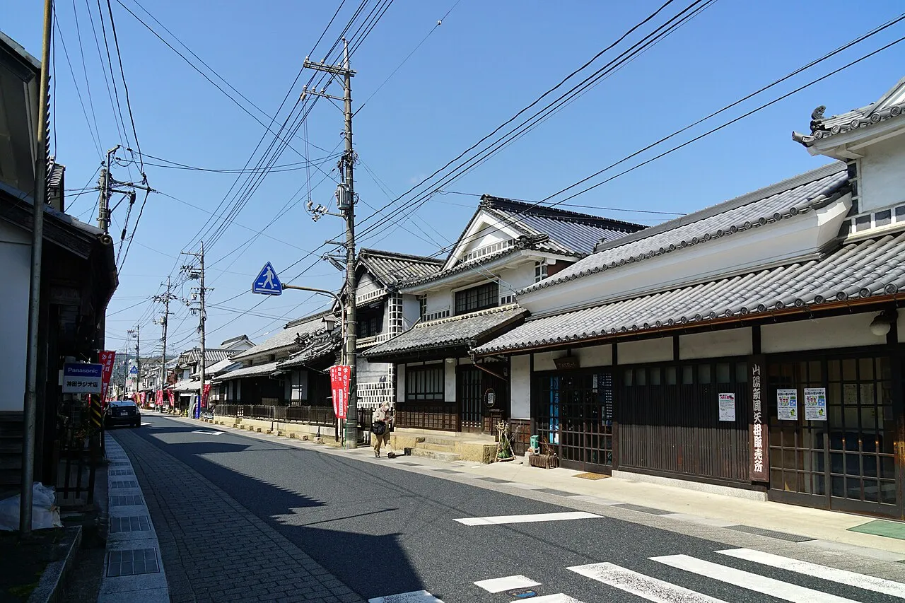
Photos of Yakage
-

eitarov · CC BY 2.0 -

Kugel~commonswiki · CC BY-SA 4.0 -

Ebiebi2 · CC0 -

eitarov · CC BY 2.0 -

Ebiebi2 · CC0


Travel notes for Yakage
From Wikivoyage
Yakage (矢掛町) is in Okayama, Japan.
Understand+
Yakage was built up as a post-town, the Yakage-juku, along the Old Sanyo Road that connected the area to Edo. It is the only former post town to have both its original honjin and wakihonjin intact.
Tourist information site:
The local DMO (Destination Management Organization) has a multilingual guide site.
Get in+
Ibara Railway (井原鉄道) runs through Yakage with three stations falling within town limits; Oda, Yakage, and Mitani. It can be accessed from Okayama by changing trains at Kiyone Station in Kurashiki or Soja Station in Soja. On the opposite terminus, the line is accessible from Kannabe Station in Fukuyama. Ibara Railway offers a "Super Holiday Pass" (スーパーホリデーパス) on weekends and holidays for ¥1400. It provides savings for a roundtrip ticket to Yakage from Kannabe.
Source: Wikivoyage · CC BY-SA 4.0 · abridged
Places bordering Yakage
- Kurashiki
- Kasaoka
- Ibara
- Sōja
- Asakuchi Shi
Population of Yakage over time
| 2010 | 15,092 | |
|---|---|---|
| 2015 | 14,201 | |
| 2021 | 13,218 |
Censuses and official estimates; source: Wikidata.
Climate of Yakage
Best months for sightseeingBest months for sightseeing: May, October.
This month · November
Outside the best season
Day 16° · Night 7° · Rain 64 mm
Better nearby cities in November
- Kochi · 120 km south18°
- Ōita · 241 km southwest18°
- Beppu · 245 km southwest17°
- Hottest month
- August (day 32°)
- Coldest month
- January (night 0°)
- Wettest month
- June (224 mm)
- Driest month
- December (33 mm)
Bars: average monthly low and high temperature. Below: precipitation. Monthly averages for 1970–2000 at about 18 km resolution, adjusted for elevation. Highlighted months are mild and relatively dry. Source: WorldClim 2.1 (CC BY 4.0).
Show values as a table
| Month | Jan | Feb | Mar | Apr | May | Jun | Jul | Aug | Sep | Oct | Nov | Dec |
|---|---|---|---|---|---|---|---|---|---|---|---|---|
| Average high (°C) | 8° | 9° | 13° | 18° | 23° | 26° | 30° | 32° | 27° | 22° | 16° | 11° |
| Average low (°C) | 0° | 0° | 3° | 8° | 13° | 18° | 23° | 24° | 20° | 13° | 7° | 2° |
| Precipitation (mm) | 40 | 56 | 86 | 133 | 140 | 224 | 204 | 113 | 198 | 106 | 64 | 33 |
How to get to Yakage
The nearest airport is Okayama Momotaro Airport (OKJ), 28 km to the northeast as the crow flies. The nearest large city is Kurashiki, 17 km to the east.
Airports
- Okayama Momotaro Airport (OKJ) Okayama 28 kmnortheast
- Takamatsu Airport (TAK) Takamatsu 60 kmsoutheast
- Hiroshima Airport (HIJ) Hiroshima 65 kmwest
Nearby large cities
- Kurashiki Population: 483.6K 17 kmeast
- Fukuyama Population: 468.8K 26 kmsouthwest
- Marugame Population: 109.5K 42 kmsoutheast
- Onomichi Population: 131.2K 43 kmsouthwest
- Takamatsu Population: 419K 53 kmsoutheast
Straight-line distances; road distances are longer. Airport data: OurAirports.
Day trips from Yakage
Within 100 km: 8 historic and cultural sites, 14 natural sites, 30 lakes, rivers and coasts.
0–25 km2 places
- Bitchu Matsuyama castle Historic site 20 kmN
- Takahashi River River 15 kmSE
25–60 km22 places
- Ikuchi Jima Island 58 kmSW
- Nao Shima Island 40 kmSE
- Shiwaku Islands Island 29 kmSE
- Te Shima Island 47 kmE
60–100 km28 places
- Shikoku Island 98 kmS
- Ōmi Shima Island 68 kmSW
- Mount Inamura Mountain 100 kmS
- Shikoku-sammyaku Mountain 89 kmS
Straight-line distances.
Nearby attractions & nature
Everything nearby-
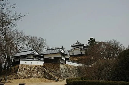 Bitchu Matsuyama castle Historic site, Takahashi Shi20 km N
-
Takahashi River River, Okayama15 km SE
Sources & licences
Data last updated: · 2 independent sources