Takahashi
Local name: 高梁市
Located in Takahashi Shi, Okayama Coordinates: 34°47′00″ N 133°37′00″ E
- Population
- 31,556
- 31.6K
- Elevation
- 66 m
- above sea level
- Local time
- UTC+09:00
- Asia/Tokyo · UTC+09:00
- Airports
- OKJ Okayama Momotaro Airport22 km
- TAK Takamatsu Airport73 km
About Takahashi
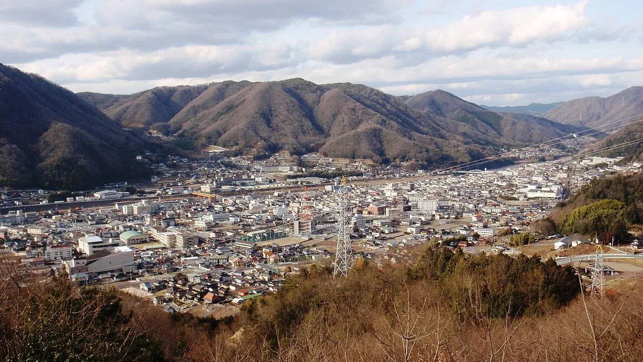
Takahashi is a city. Location: Takahashi Shi, Okayama. Population: 31,556. Elevation: 66 m.
Takahashi (高梁市, Takahashi-shi) is a city located in Okayama Prefecture, Japan. As of 28 February 2023, the city had an estimated population of 27,538 in 13,678 households. and a population density of 50 persons per km2. The total area of the city is 546.99 square kilometres (211.19 sq mi). Bitchū Matsuyama Castle overlooks the town. Another significant location is Raikyū-ji, a Buddhist temple with a historic garden.
Source: Wikipedia · CC BY-SA 4.0
Photos of Takahashi
-

SNHRRN · CC BY-SA 3.0 -

Jogungagon · CC BY-SA 4.0 -

Nesnad · CC BY 4.0 -

Ohtani tanya · CC0 -

Jogungagon · CC BY-SA 4.0


Travel notes for Takahashi
From Wikivoyage
Takahashi (高梁市 Takahashi-shi) is a city in Okayama Prefecture in the western Chugoku region of the island of Honshu in Japan.
Understand+
Tourist information site:
The local tourist association has a Japanese-only guide site
There is also a tourist information center in the Takahashi City Library, attached to the train station.
Get in+
By train:
Takahashi City can be accessed via the JR Hakubi Line from Niimi (¥580) to the north and Soja (¥410), Kurashiki (¥580), and Okayama (¥840, 36/55 min express/regular) from the south. Get off at 1 Bitchū Takahashi Station (備中高梁駅).
It can also be accessed via the Yakumo Limited Express train which is more expensive but faster than the JR Hakubi Line, especially if traveling from Matsue or Okayama.
By car:
Route 180 passes directly through Takahashi City, so from Okayama and Soja, travel North on Route 180. From Yonago, connect to Route 180 from the Yonago West Interchange and travel south through Niimi. From Hokuei and Kurayoshi, you travel south on Route 313, or north from Ibara. From the west, reach Takahashi on Route 484.
For travel to the Fukiya area, Route 85 takes you to the Bengara Village.
Source: Wikivoyage · CC BY-SA 4.0 · abridged
Places bordering Takahashi
- Shōbara
- Jinsekikogen
- Sōja
- Ibara
- Niimi
- Maniwa Shi
- Kibi-chūō Chō
Twin towns and sister cities of Takahashi
- Chikusei· Japan
- Naie· Japan
- Yamaga· Japan
- Shimanto Shi· Japan
Source: Wikidata. Only places with a page on this site are shown.
Population of Takahashi over time
| 2010 | 34,963 | |
|---|---|---|
| 2015 | 32,075 | |
| 2021 | 28,825 |
Censuses and official estimates; source: Wikidata.
Climate of Takahashi
Best months for sightseeingBest months for sightseeing: May–June, October.
This month · November
Outside the best season
Day 16° · Night 7° · Rain 66 mm
Better nearby cities in November
- Kochi · 137 km south18°
- Ōita · 253 km southwest18°
- Beppu · 257 km southwest17°
- Hottest month
- August (day 31°)
- Coldest month
- January (night 0°)
- Wettest month
- June (231 mm)
- Driest month
- December (40 mm)
Bars: average monthly low and high temperature. Below: precipitation. Monthly averages for 1970–2000 at about 18 km resolution, adjusted for elevation. Highlighted months are mild and relatively dry. Source: WorldClim 2.1 (CC BY 4.0).
Show values as a table
| Month | Jan | Feb | Mar | Apr | May | Jun | Jul | Aug | Sep | Oct | Nov | Dec |
|---|---|---|---|---|---|---|---|---|---|---|---|---|
| Average high (°C) | 8° | 8° | 12° | 18° | 23° | 26° | 30° | 31° | 27° | 21° | 16° | 11° |
| Average low (°C) | 0° | 0° | 3° | 8° | 13° | 18° | 23° | 24° | 19° | 13° | 7° | 2° |
| Precipitation (mm) | 45 | 62 | 92 | 137 | 147 | 231 | 228 | 133 | 203 | 106 | 66 | 40 |
How to get to Takahashi
The nearest airport is Okayama Momotaro Airport (OKJ), 22 km to the east as the crow flies. The nearest large city is Kurashiki, 26 km to the southeast.
Airports
- Okayama Momotaro Airport (OKJ) Okayama 22 kmeast
- Takamatsu Airport (TAK) Takamatsu 73 kmsoutheast
- Hiroshima Airport (HIJ) Hiroshima 75 kmsouthwest
Nearby large cities
- Kurashiki Population: 483.6K 26 kmsoutheast
- Fukuyama Population: 468.8K 40 kmsouthwest
- Tsuyama Population: 102.3K 46 kmnortheast
- Onomichi Population: 131.2K 56 kmsouthwest
- Marugame Population: 109.5K 58 kmsouth
Straight-line distances; road distances are longer. Airport data: OurAirports.
Day trips from Takahashi
Within 100 km: 10 historic and cultural sites, 10 natural sites, 34 lakes, rivers and coasts.
0–25 km1 place
- Bitchu Matsuyama castle Historic site 3 kmN
25–60 km23 places
- Nao Shima Island 49 kmSE
- Shiwaku Islands Island 45 kmS
- Te Shima Island 54 kmSE
- Manabe Island Island 48 kmS
60–100 km30 places
- Ikuchi Jima Island 72 kmSW
- Ōmi Shima Island 81 kmSW
- Sendai River River 99 kmNE
- Tottori Castle ruins Historic site 98 kmNE
Straight-line distances.
Sources & licences
Data last updated: · 2 independent sources